

Showers And Storms With A Cold Front Out There At Midday

GOES-16 Imagery – Experimental and Non-Operational
Weather Check at 11:55 AM
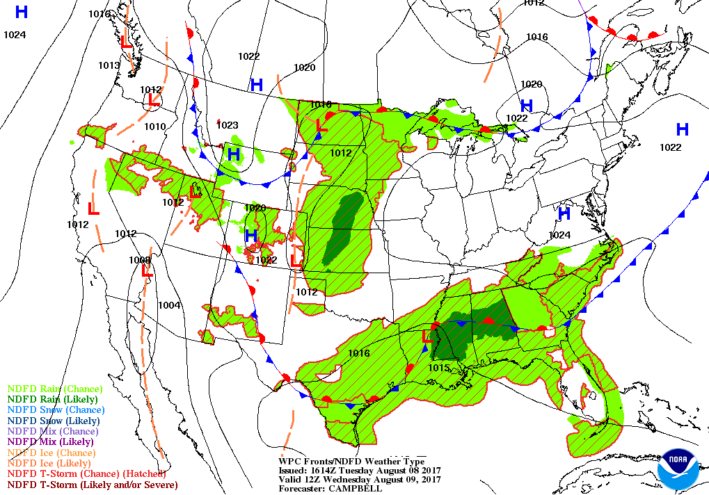
A cold front is currently situated over Central Alabama as we approach the midday hour. Along the front, we have a broken line of numerous showers and thunderstorms stretching from the Mississippi River in the east-central part of Mississippi through Central Alabama and into Central Georgia and up into the Carolinas.

As far as rainfall in Central Alabama, most of the activity is mainly lined up along the cold front, and this is allowing for these cells to train over the same locations with moderate to heavy rainfall. And with this being the case, the National Weather Service has much of Central Alabama in a Flash Flood Watch until 1PM Wednesday afternoon. All of these showers are pushing to the east with just a very slight movement southward.

Temperatures are mainly in the 70s throughout the area at this time with a few locations in the southern parts in the lower 80s. We can expect the temperatures the rise a few more degrees, but more rainfall will hold our temperatures back.
Could Birmingham Break A Record Today
The all time record for rainfall on this date was set back in 1912 at 2.85 inches. The airport is already sitting at 2.47 inches, and with another large batch of rain heading towards the Magic City, we could break it.
For The Rest Of Your Tuesday
We’ll continue to have an increased risk for scattered to numerous showers and thunderstorms throughout the remainder of the day and should be diminishing somewhat by the time we hit the 10:00 PM hour. At this point, we are not expecting any severe weather as the atmosphere is just was too saturated for that, but we could have some flash flooding issues due to the possibility of rain training over the same areas. Afternoon highs will range throughout the 70s today across the much of the area, with some locations making into the lower to mid 80s in the south. Lows will be in the lower to mid 70s.
Wednesday’s Forecast… Keep The Umbrellas Handy
We’ll still have an increased risk for showers and thunderstorms, but it appears that tomorrow’s rainfall will be more scattered in nature. The cold front will have stalled out in Central Alabama, and this will be the catalyst for the increased risk in activity. Heaviest amounts will be back over the same areas as affected by today’s rains, so some ponding and localized flash flooding may once again occur. Afternoon highs will be in the upper 70s to the upper 80s, thanks in part to the cloud cover and rain-cooled air.
Got Beach Plans?
A decent amount of sunshine each day, but with a good chance of a daily shower or thunderstorm this week. You can expect to see highs mainly in the middle to upper 80s and lows in the 70s. For a detailed look at the weather from Fort Morgan over to Panama City Beach, click here to see the AlabamaWx Beach Forecast Center page.
The Beach Forecast is partially underwritten by the support of Brett/Robinson Vacation Rentals in Gulf Shores and Orange Beach. Click here to see Brett/Robinson’s “Own Your Summer” specials now!
Taking A Peek At The Tropics
Stay up-to-date with “The Latest On The Tropics…” running post in the Tropical Weather category on the AlabamaWx Weather Blog home page.
Advertise With Us!
Now is the time to set your marketing campaign on AlabamaWX. The site has enjoyed a 71% jump in page views this year! The website has already enjoyed 10,157,915 page views this year. We can customize a creative, flexible and affordable package that will suit your organization’s needs. Contact Bill Murray at (205) 687-0782.
E-Forecast
Get the AlabamaWx seven-day forecast delivered directly to your inbox by email twice daily. It is the most detailed weather forecast available in Central Alabama. Click here to subscribe. It’s free!
Today In Weather History
August 8, 1987 – Thunderstorm rains in eastern Nebraska sent the Wahoo River and Ithica River above flood stage. Thunderstorm rains in western Iowa sent the Nishnabotna River over flood stage. Up to seven inches of rain deluged the Council Bluffs area Friday evening and Saturday morning. Thunderstorms produced 4.4 inches of rain in three hours Friday evening, along with golf ball size hail.
WeatherBrains
Check out the show at www.WeatherBrains.com. You can also subscribe on iTunes. You can watch the show live at live.bigbrainsmedia.com on Monday nights starting at 8:30 PM CDT. You will be able to see the show on the James Spann 24×7 weather channel on cable or directly over the air on the dot 2 feed.
Category: Alabama's Weather, ALL POSTS
About the Author (Author Profile)
Scott Martin is an operational meteorologist, professional graphic artist, musician, husband, and father. Not only is Scott a member of the National Weather Association, but he is also the Central Alabama Chapter of the NWA president. Scott is also the co-founder of Racecast Weather, which provides forecasts for many racing series across the USA. He also supplies forecasts for the BassMaster Elite Series events including the BassMaster Classic.Subscribe
If you enjoyed this article, subscribe to receive more just like it.


