Isolated Showers Today with More Monday
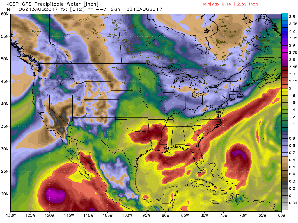
Alabamians waking up once again to some fog, however, visibilities were not nearly as low as we saw yesterday with many locations reporting visibilities in the 3 to 4 miles range. Satellite image revealed some middle and high clouds over the state, and surface observations confirmed temperature in the lower 70s for much of North and Central Alabama. A quick glance at the precipitable water chart showed values to be down a tad with values at mid-day projected to be around 1.5 inches. This should be just enough to lower the number and coverage of showers and thunderstorms today into the isolated category with highs coming close to the 90-degree mark.
The upper air pattern remains somewhat flat across the Southeast US on Monday as a parade of weak short waves traverse the flow. This will return Alabama to the moist air and bring shower chances back up with more numerous showers and thunderstorms covering more area. Highs should be in the upper 80s.
There is little change in the overall pattern for Tuesday, but the Bermuda high begins to raise its ugly head by Wednesday as it noses into the Southeast US from the east. With moisture still in place, scattered showers will continue but afternoon highs will come up slightly with readings in the lower 90s. Still not too shabby for August.
Thursday, Friday, and Saturday will see the upper ridge grow a bit strong, but with low level moisture well established the chances for showers and thunderstorms driven primarily by the heat of the day will continue along with highs dancing around the 90-degree mark.
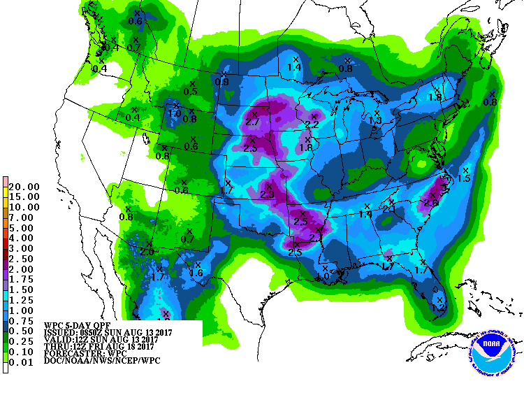
Overall, rainfall through Friday is likely to be in the 1 to 1.5 inch range. Because of the nature of showers, not everyone comes away with that total.
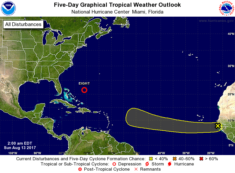
By Sunday, there is some weakening to the upper ridge – small though it may be – but by Sunday our attention is drawn to a tropical system – potentially the one that is just coming off the African coast – as both the GFS and the European bring what appears to be a strong system into the Bahamas. Now we’re verging into voodoo country, so this is interesting but not something we’ll make a forecast on just yet. There are pretty substantial differences between the European which brings the storm into the southern Bahamas and the GFS which brings it into the northern Bahamas.
Tropical Depression 8 was located just northeast of the Bahamas and is projected to become a tropical storm later today. When it does it will become Gert. An area of disturbed weather moved off the African coast earlier today. That system is projected to move west to west-northwest during the next several days where conditions could become increasingly favorable for gradual development of this system. This is most likely the system I’ve referred to above as it comes into the vicinity of the Bahamas.
At the beach, scattered showers are forecast each day for today and into next week with highs mainly in the upper 80s. Rip currents are forecast to be moderate today, so swimmers should use caution along the beaches. Click here to see the AlabamaWx Beach Forecast Center page. The Beach Forecast is partially underwritten by the support of Brett/Robinson Vacation Rentals in Gulf Shores and Orange Beach. Click here to see Brett/Robinson’s Own Your Summer specials now!
Looking out into voodoo country, the potential for a tropical system dominates the chart on the 24th of August. The GFS takes that system into the Ohio River Valley by the 26th of August as a very strong trough comes into the North Central US out of Canada. That trough digs into the eastern US as it carves out a trough over the eastern US by the 28th of August with the ridge pumping up across the western states.
Don’t forget you can listen to our weekly 90 minute netcast anytime on the web, or on iTunes. This is the show all about weather featuring many familiar voices, including our meteorologists here at ABC 33/40.
I appreciate you tuning into the Weather Xtreme Video today. James Spann will have the next edition bright and early Monday morning. Be sure to check back often for updates on Alabama’s weather. Have a great day and Godspeed.
-Brian-
Category: Alabama's Weather, ALL POSTS
About the Author (Author Profile)
Brian Peters is one of the television meteorologists at ABC3340 in Birmingham and a retired NWS Warning Coordination Meteorologist. He handles the weekend Weather Xtreme Videos and forecast discussion and is the Webmaster for the popular WeatherBrains podcast.Subscribe
If you enjoyed this article, subscribe to receive more just like it.


