Wind Advisories Issued for North and Central Alabama for Tonight and Friday
The center of post tropical cyclone Harvey is near Greenville, MS this afternoon, moving to the northeast.
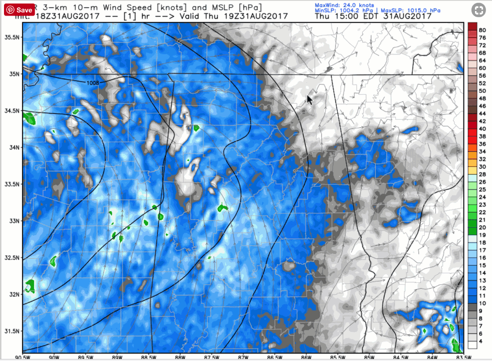
It is causing winds of 12-24 mph with occasional gusts to over 30 mph over parts of Mississippi into western Alabama.
These winds will continue to work their way eastward tonight. They will continue to be strong through the morning tomorrow.
Here is the HRRR depiction of the sustained winds that will average 12-24 mph at times and gust higher.
The NWS offices in Birmingham and Huntsville have both issued Wind Advisories for parts of the area. BMX counties include: Blount, Calhoun, Cherokee, Etowah, Fayette, Jefferson, Lamar, Marion, St. Clair, Walker and Winston. Huntsville counties in Alabama include Colbert, Cullman, De Kalb, Franklin, Jackson, Lauderdale, Lawrence, Limestone, Madison, Marshall and Morgan.
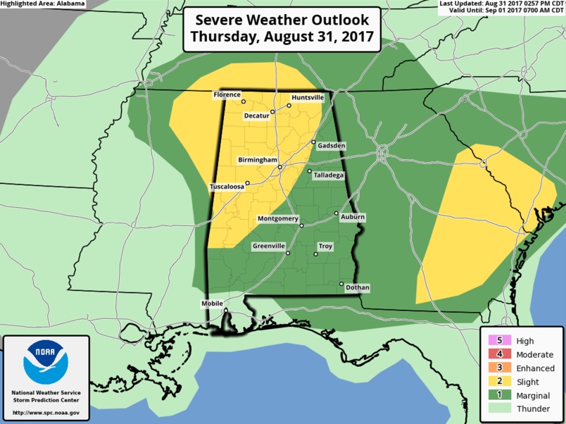
NEW SPC DAY ONE
The 3 p..m. edition of the SPC day one convective outlook is basically unchanged with a large part of the area in a slight risk (level 2 out of 5) severe weather risk for the possibility of quick hitting tornadoes.
Category: Alabama's Weather, ALL POSTS
About the Author (Author Profile)
Bill Murray is the President of The Weather Factory. He is the site's official weather historian and a weekend forecaster. He also anchors the site's severe weather coverage. Bill Murray is the proud holder of National Weather Association Digital Seal #0001 @wxhistorianSubscribe
If you enjoyed this article, subscribe to receive more just like it.


