The Midday Check Of Central Alabama’s Weather: Labor Day Edition
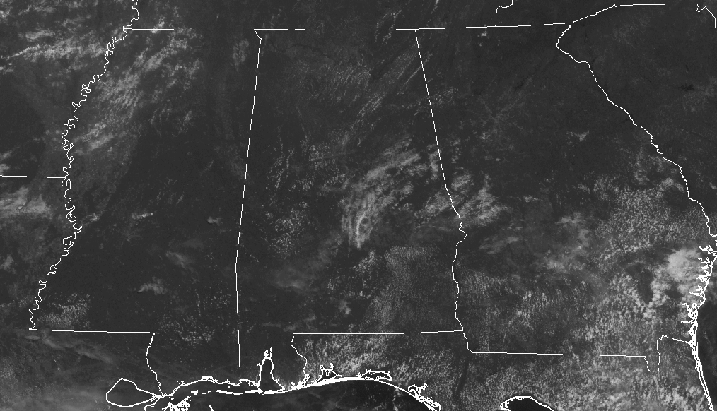
It’s a fine-looking day across Central Alabama as we are making our run up to the lunch-time hour, with only a few smaller clouds showing up on the latest visible satellite image. With that being said, there are no active showers showing up on radar as well. Temperatures are currently in the lower to mid 80s across the area, with the warm spot being Eufaula at 88 degrees.
We’ll have a few clouds form during the main heating of the day, but much of Central Alabama will be nice and dry throughout the remainder of the daylight hours. There is a very small chance of a few showers for the southeastern corner of the area, mainly south of I-85 and east of I-65. The odds for any one spot in that region getting rain will be less than 1-in-5 (less than 20% for the percentage people). Afternoon highs will make it up into the upper 80s to near 90 degrees throughout the area. Skies will be partly cloudy tonight, and any rain that is out there will be long gone. Overnight lows will be in the mid-60s to near 70 degrees.
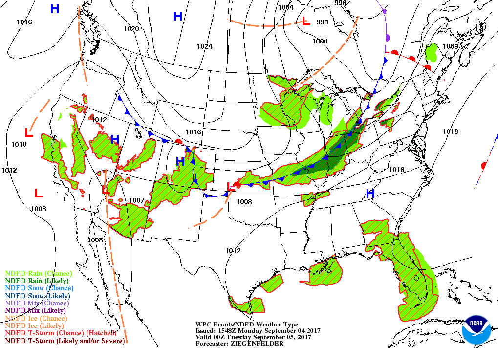
That’s right… rain wants to clock in and make a visit to the area. We’ll have a cold front that will be approaching from the northwest, which will bring an increased chance for showers and thunderstorms. The cold front will work into the area starting during the late morning to early afternoon hours and will slowly progress across the area through the day and into part of the day on Wednesday. Highest coverage of rain will be in the northern parts of the area to start with during much of the daylight hours, with better chances for the central parts of the state by the early evening through the overnight hours. Afternoon highs will be in the mid to upper 80s, but if the front is a little quicker moving in the northern parts of the area, highs up there may be held back a little. Overnight lows will range throughout the 60s to near 70 degrees.

Irma is currently a category 3 hurricane, with maximum sustained winds at 120 MPH, and is moving to the west-southwest at 14 MPH. Hurricane watches are now up for the U.S. and British Virgin Islands and Puerto Rico, and hurricane warnings are up for portions of the Leeward Islands. Latest NHC forecast track continues to keep Irma as a major hurricane throughout the next 5 days while moving very close to or over the Leeward Islands, Puerto Rick, Haiti, the Dominican Republic, and Cuba. It is still too early to tell where Irma will go after that, and I will not put up any model graphics because they will change with every run.
Stay up-to-date with the latest updates on Hurricane Irma and any other tropical systems out in the Atlantic Ocean, Caribbean Sea, or in the Gulf of Mexico with the latest post in our Tropical Weather section. Click here to see the latest.
Be sure to keep up to date with the detailed forecasts from Fort Morgan over to Panama City Beach with the AlabamaWx Weather Blog. Click here to see the AlabamaWx Beach Forecast Center page.
The Beach Forecast is partially underwritten by the support of Brett/Robinson Vacation Rentals in Gulf Shores and Orange Beach. Click here to see Brett/Robinson’s Hot Deals now!
Now is the time to set your marketing campaign on AlabamaWX. The site has enjoyed a 71% jump in page views this year! The website has already enjoyed over 11 MILLION page views this year. We can customize a creative, flexible and affordable package that will suit your organization’s needs. Contact Bill Murray at (205) 687-0782.
Get the AlabamaWx seven-day forecast delivered directly to your inbox by email twice daily. It is the most detailed weather forecast available in Central Alabama. Click here to subscribe. It’s free!
1986 – An unusually strong dust devil moved across the Flagstaff Pulliam Airport. The dust devil blew open the doors of the National Weather Service office scattering papers and bringing down a ceiling-mounted light fixture.
Check out the show at www.WeatherBrains.com. You can also subscribe on iTunes. You can watch the show live at live.bigbrainsmedia.com on Monday nights starting at 8:30 PM CDT. You will be able to see the show on the James Spann 24×7 weather channel on cable or directly over the air on the dot 2 feed.
Category: Alabama's Weather, ALL POSTS
About the Author (Author Profile)
Scott Martin is an operational meteorologist, professional graphic artist, musician, husband, and father. Not only is Scott a member of the National Weather Association, but he is also the Central Alabama Chapter of the NWA president. Scott is also the co-founder of Racecast Weather, which provides forecasts for many racing series across the USA. He also supplies forecasts for the BassMaster Elite Series events including the BassMaster Classic.Subscribe
If you enjoyed this article, subscribe to receive more just like it.


