Plenty Of Weather To Talk About At Midday
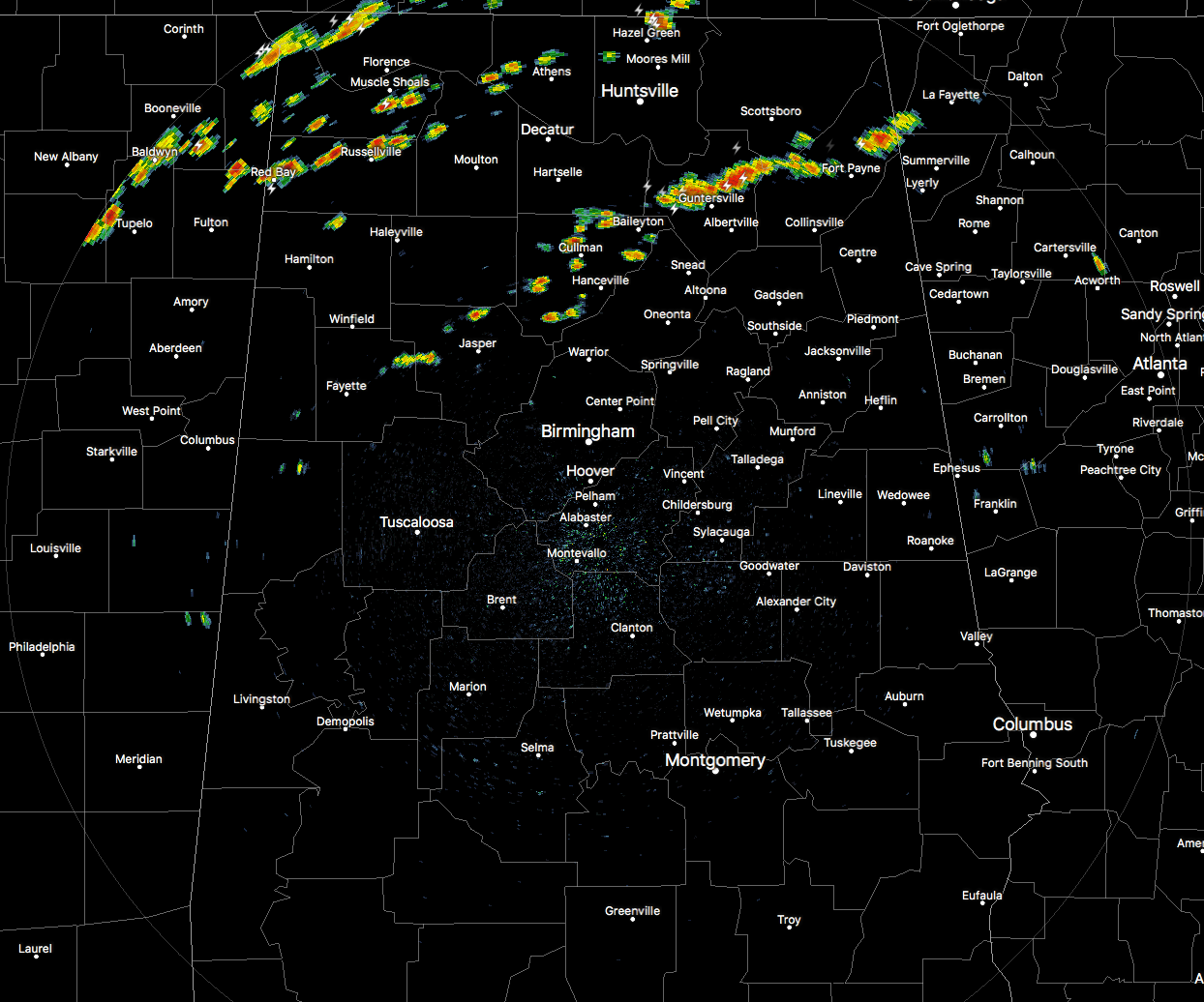
We have scattered showers that have developed out ahead of the cold front that will be moving into the northwestern corner of the state within the next hour or so. At this point, none of these storms in the Central Alabama county warning area have become at this point, but some in Tennessee have picked up in strength and will be pushing into the state later on.
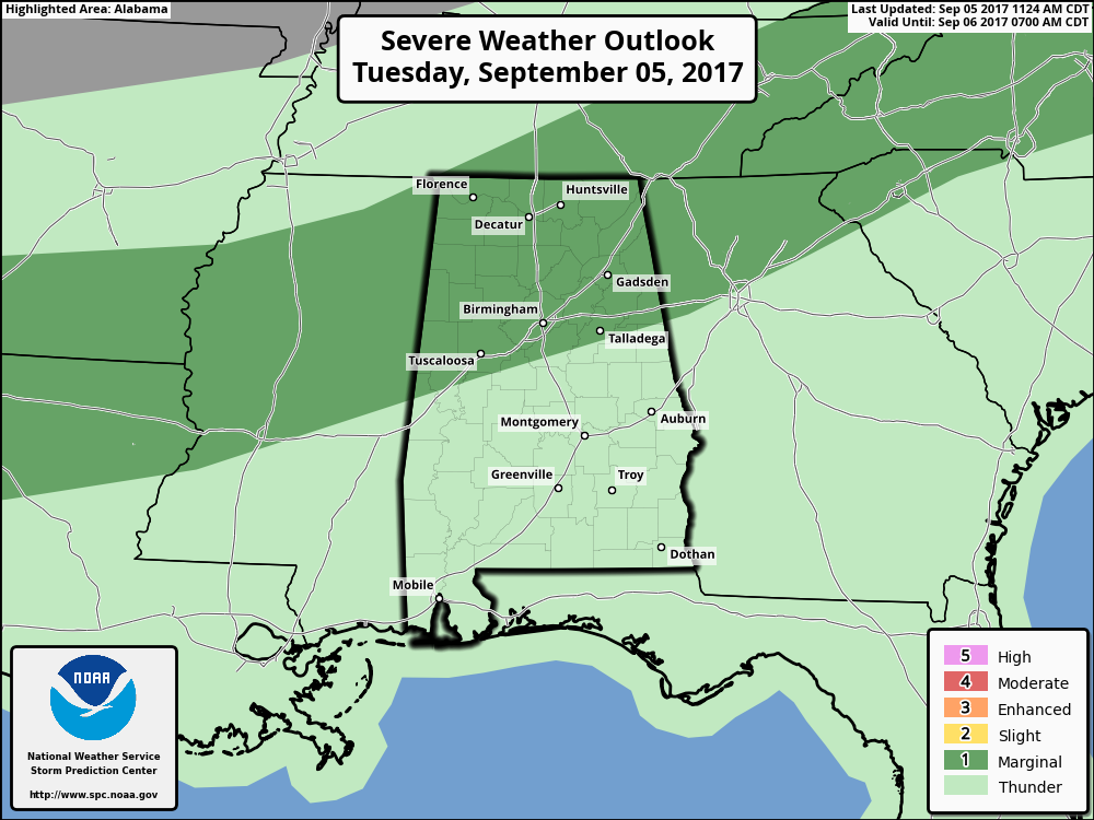
Roughly, the northern half of the state has been defined in a Marginal Risk for severe storms throughout the remainder of today, with the main threat being from isolated damaging downburst winds. Downdraft CAPE values will be at or near 1000 J/kg, and those numbers are well supportive of strong downdrafts.
Clouds will be on the increase from the north as the cold front slowly pushes its way southward. We’ll have showers and thunderstorms continuing to develop out ahead of the front, with the better risks coming over the northern half of the state during the daylight hours. Afternoon highs will be in the mid-80s in the north to the lower 90s to the south. Shower and thunderstorm chances will continue to increase southward throughout the evening and overnight hours, with the best chances north of a line from Demopolis to Clanton to Wedowee. Good news is that the severe threat will end as we lose the heating of the day, but a strong storm or two could be possible. Overnight lows will be in the 60s to near 70 degrees throughout the area.
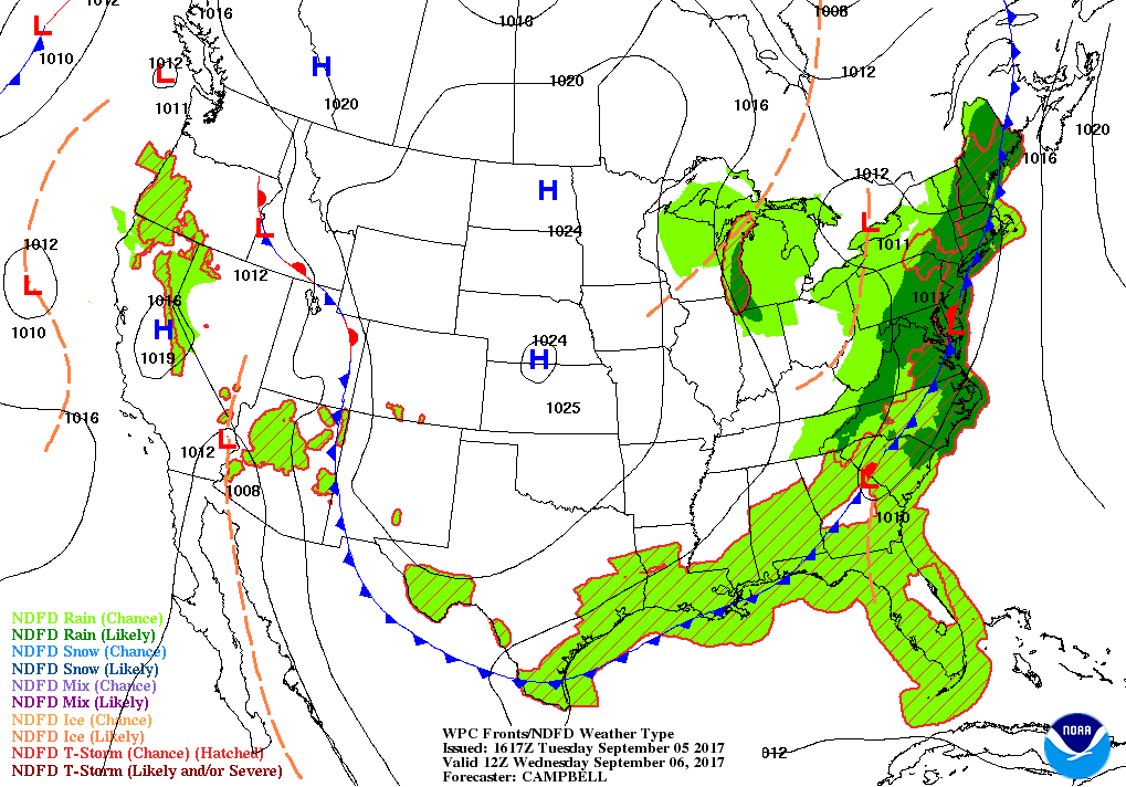
The cold front will slide through the southern half of Central Alabama during the day tomorrow, and rain will quickly end as the front passes. The best rain shower and thunderstorm chances will be south of a line from Demopolis to Alabaster to Anniston. You will definitely notice the change in temperatures, with daytime highs reaching the mid-70s to the lower 80s. The front will be completely out of the area tomorrow evening, and overnight lows will be in the 50s throughout the area.
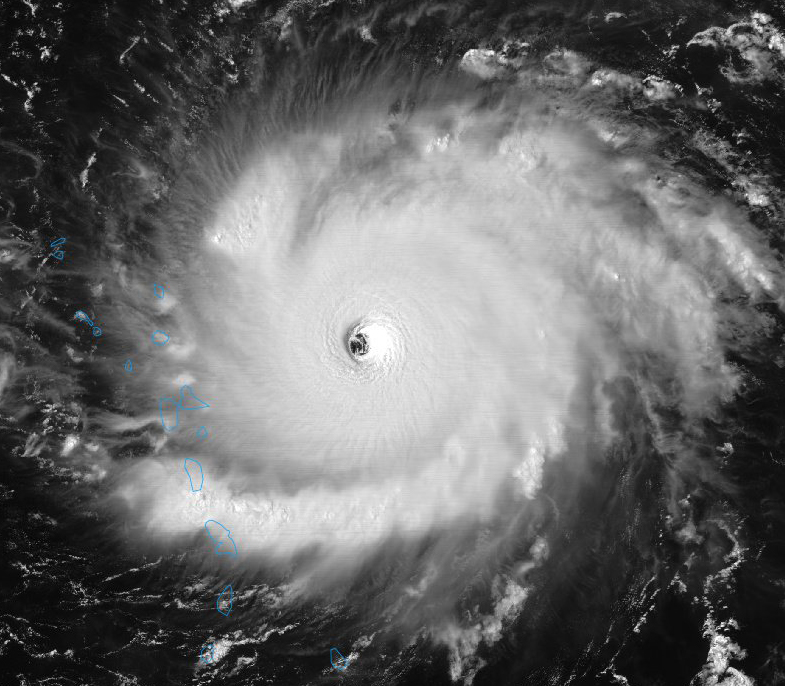
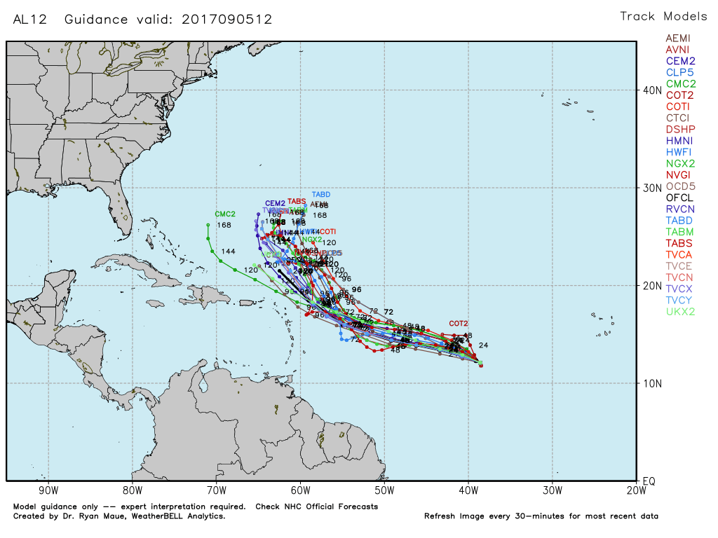
Hey wow!!! Category Irma has turned into a very dangerous category 5 storm, with maximum sustained winds at 185 MPH, tied as the 2nd strongest hurricane in recorded history. The latest forecast track continues to have the center on a west-northwest path throughout the next five days and will be entering the Gulf of Mexico by Sunday Morning. The northward turn is still not on the forecast map, so be prepared just in case the turn is later and the Gulf Coast could become the potential landfalling target. Irma is expected to move over the Leeward Island by tomorrow morning and much of Puerto Rico by tomorrow night, and weakening is not expected at this point, even though some fluctuations could occur.
Now we also have Tropical Storm Jose out in the open Atlantic as well, with maximum sustained winds at 40 MPH. Jose is expected to strengthen into a hurricane within the next couple of days, but should curve off to the north well away from the US mainland.
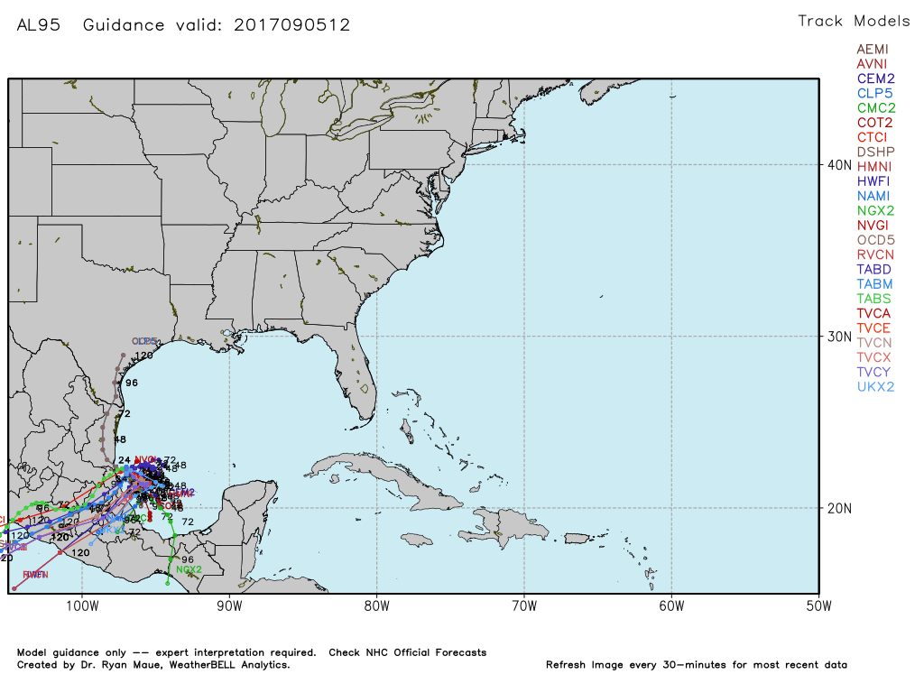
And if that wasn’t enough already, we have a disturbance in the southwestern Gulf of Mexico that is expected to become a tropical depression within the next few days. At this point, this disturbance is expected to meander around in the southwestern Gulf for a few days then move into Mexico. No threat to the United States.
Stay up-to-date with the latest updates on Hurricane Irma and any other tropical systems out in the Atlantic Ocean, Caribbean Sea, or in the Gulf of Mexico with the latest post in our Tropical Weather section. Click here to see the latest.
The Beach Forecast is partially underwritten by the support of Brett/Robinson Vacation Rentals in Gulf Shores and Orange Beach. Click here to see Brett/Robinson’s Hot Deals now!
Category: Alabama's Weather, ALL POSTS
About the Author (Author Profile)
Scott Martin is an operational meteorologist, professional graphic artist, musician, husband, and father. Not only is Scott a member of the National Weather Association, but he is also the Central Alabama Chapter of the NWA president. Scott is also the co-founder of Racecast Weather, which provides forecasts for many racing series across the USA. He also supplies forecasts for the BassMaster Elite Series events including the BassMaster Classic.Subscribe
If you enjoyed this article, subscribe to receive more just like it.


