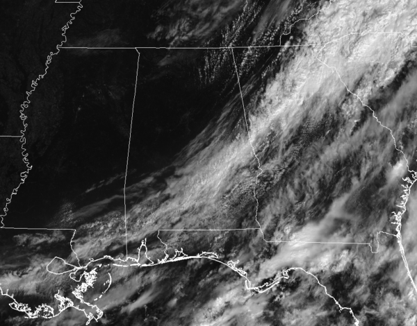
Rain Has Exited The State At Midday, Let’s Welcome In The Fall AirMost of Central Alabama can sit back and enjoy this fine weather that we are having as we are approaching the noon hour. We have clear skies for nearly all of the area at this point, with the only exception where clouds are pushing out of the area in the southeastern parts. Temperatures are currently ranging in the low to mid-70s throughout the area. Birmingham is currently at 75 degrees.
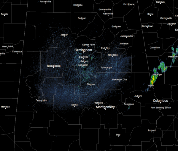
At 11:15 AM, radar for Central Alabama was showing mainly dry conditions for nearly everyone in the area, with a few left over showers near Valley and Tuskegee in the southeastern part. Radar will be clear of any rain activity for at least the next four or five day, according to what Hurricane Irma does.
Weather For The Remainder Of Your WednesdayVery comfortable temperatures and breezy conditions can be expected throughout the remainder of the day, along with clearing skies for the areas that currently have lingering clouds. Afternoon highs will top out in the mid 70s to near 80 degrees throughout the area. Winds will be out of the north at 10-15 MPH through the afternoon. Skies will be clear tonight and the winds will begin to slow down throughout the overnight hours. Lows will be in the 50s throughout the area, with a few of the colder spots hitting the 40s.
Has Fall Arrived Early In Central Alabama?Of course the answer is no, but the only reason that you will have to complain about Thursday’s weather will be because of work keeping you from enjoying it. High pressure will be off to our northwest and bringing in drier air from the north into Central Alabama. Dewpoint values will be in the lower 50s and that will allow the day feel really comfortable. Afternoon highs will be in the mid-70s to the lower 80s throughout the area.
Rinse & Repeat Forecast Through The Weekend For Central AlabamaThese really nice conditions will persist on Friday and throughout the weekend… Mainly sunny skies and lower dewpoints, with no rain at all in the forecast. Afternoon highs will be in the upper 70s to the mid-80s throughout the area each day.
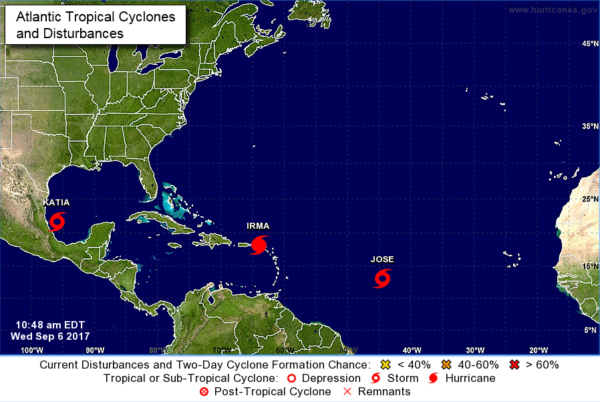
Very Active TropicsCategory 5 Hurricane Irma
As of the latest update, Irma continues to have maximum sustained winds at 185 MPH, and is moving to the west-northwest at 16 MPH. The eye is nearing the Virgin Islands, and will pass very near Puerto Rico this afternoon and into tonight. Latest forecast track from the NHC has Irma continuing to the west-northwest through Friday and starts to make the turn to the north on Saturday. Now the question is where exactly does Irma make landfall. There are still several scenarios possible, but the cone has anywhere from the southern part of South Carolina over to the Big Bend in Florida.
Tropical Storm Jose
More than likely when the next update comes out, Jose should become a hurricane. Maximum sustained winds are currently at 70 MPH, and is moving to the west-northwest at 17 MPH. It looks like for now that Jose will recurve well before reaching the US Mainland, but the island of Bermuda could be in the path. We’ll know more about its path in the next few days. As of now, NHC keeps Jose below a major hurricane.
Tropical Storm Katia
Katia currently has maximum sustained winds at 45 MPH, and is moving to the east-southeast at 5 MPH. Katia is expected to meander around close to the same location where she is currently through Friday morning before moving onshore in Mexico on Saturday morning. Strengthening is expected and Katia could become a hurricane before making landfall. No threat to Central Alabama or the United States at all.
Stay up-to-date with the latest updates on all of the tropical systems out in the Atlantic Ocean, Caribbean Sea, or in the Gulf of Mexico with the latest posts in our Tropical Weather section. Click here to see the latest.
Got Beach Plans? Check Out Our Beach Forecast CenterBe sure to keep up to date with the detailed forecasts from Fort Morgan over to Panama City Beach with the AlabamaWx Weather Blog.
Click here to see the AlabamaWx Beach Forecast Center page.
The Beach Forecast is partially underwritten by the support of Brett/Robinson Vacation Rentals in Gulf Shores and Orange Beach.
Click here to see Brett/Robinson’s Hot Deals now!
Would You Like To See Your Company’s Name Advertised On AlabamaWx?Now is the time to set your marketing campaign on AlabamaWX. The site has enjoyed a 71% jump in page views this year! The website has already enjoyed over 11 MILLION page views this year. We can customize a creative, flexible and affordable package that will suit your organization’s needs. Contact Bill Murray at (205) 687-0782.
E-ForecastGet the AlabamaWx seven-day forecast delivered directly to your inbox by email twice daily. It is the most detailed weather forecast available in Central Alabama.
Click here to subscribe. It’s free!
On This Day In Weather History1989 – An early afternoon thunderstorm produced wind gusts to 104 mph at Winterhaven, FL, flipping over four airplanes, and damaging five others. The high winds also damaged a hangar and three other buildings. A cold front produced strong winds and blowing dust in the Northern High Plains, with gusts to 54 mph reported at Buffalo SD. Powerful Hurricane Gabrielle and strong easterly winds combined to create waves up to ten feet high along the southern half of the Atlantic coast.
WeatherBrainsCheck out the show at
www.WeatherBrains.com. You can also subscribe on iTunes. You can watch the show live at
live.bigbrainsmedia.com on Monday nights starting at 8:30 PM CDT. You will be able to see the show on the James Spann 24×7 weather channel on cable or directly over the air on the dot 2 feed.
Tags: ANC, midday
Category: Alabama's Weather, ALL POSTS


