Tropical Storm Watch Posted for Southeast Alabama
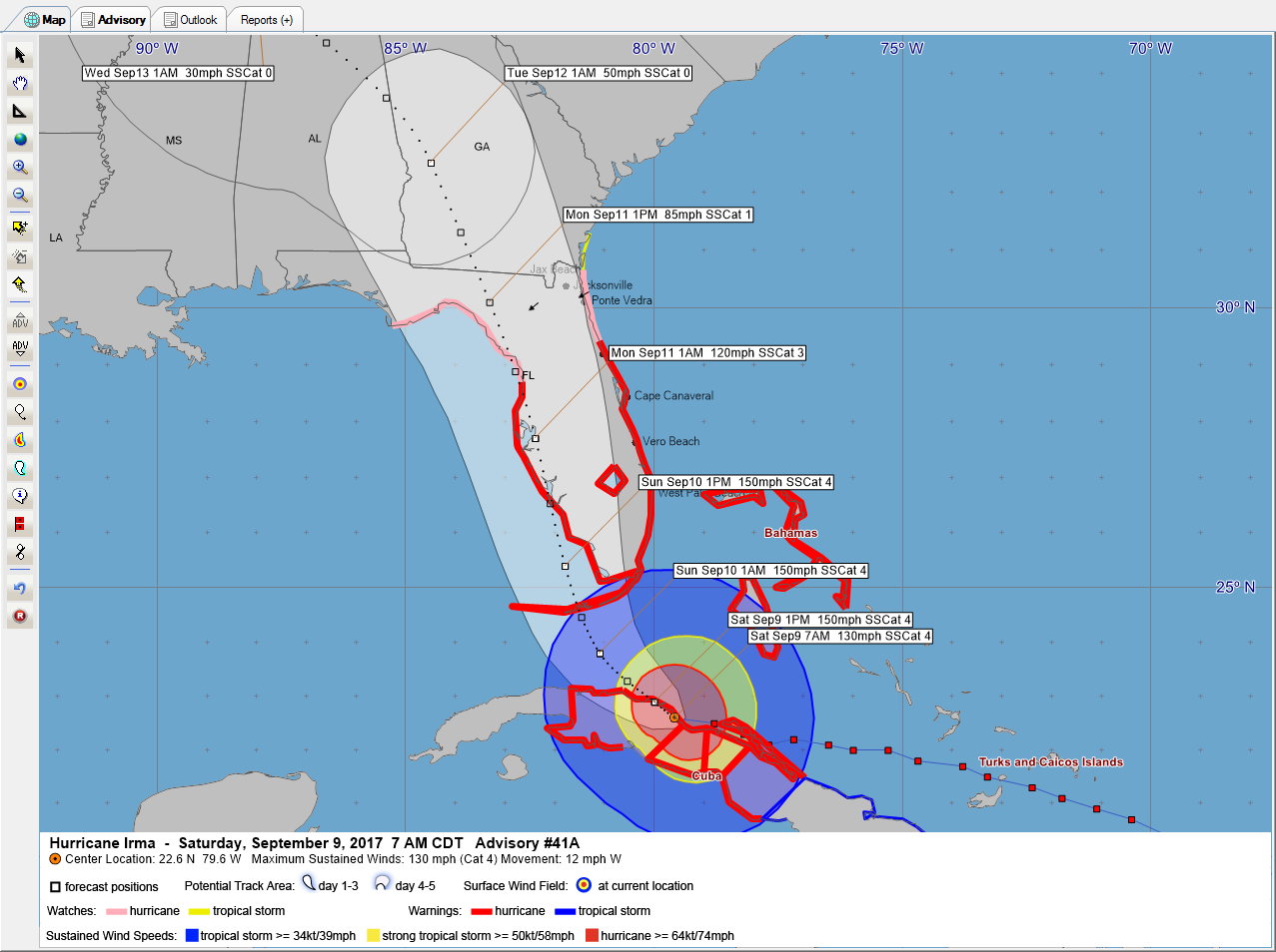
Hurricane Irma continues to weaken along the coast of Cuba this morning. Winds are officially down to 125 mph but the plane was unable to find surface winds higher than 114 mph or flight level winds higher than 121 mph. The terrain of Cuba has impacted the hurricane tremendously.
Can you imagine what the hurricane history of the United States might have looked like without the islands of the Greater Antilles there to slow down hurricanes coming through the Caribbean and western Atlantic?
The official forecast starts turning Irma northwestward in response to an upper-level disturbance over the Arklatex that will carve out the trough over the Gulf of Mexico over the next 24 hours. If Irma misses that trough, she would wander into the southern Gulf and be steered westward by the developing upper ridge to the north. That is not even being discussed at the moment as a possibility.
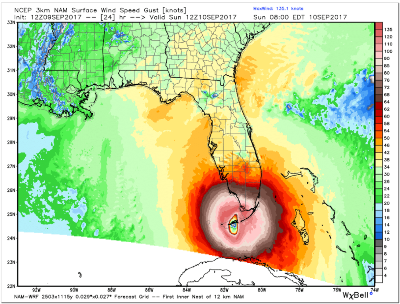
All the models move it generally northwestward to the Lower/Middle Keys as a strengthening hurricane by early Sunday morning. Here is the 3 km NAM for tomorrow morning, showing a 924 mb hurricane near Marathon in the Keys with top winds of 155 mph.
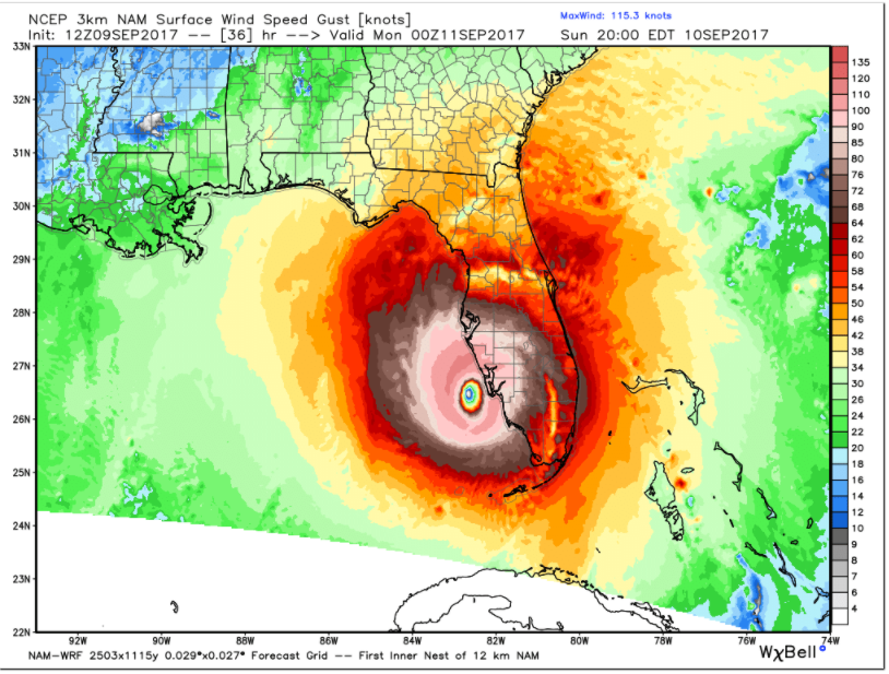
It is offshore of Fort Myers by tomorrow evening as a 928 mb hurricane with winds of 125 mph.
This could produce a devastating storm surge along the southwest coast of Florida in places like Naples, Port Charlotte, Punta Gorda and Fort Myers.
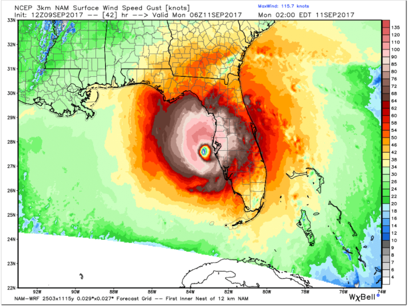
By midnight tomorrow night, it could be offshore of Tampa as a 936 mb hurricane with winds of 125 mph. Storm surge would be inundating the Tampa Bay.
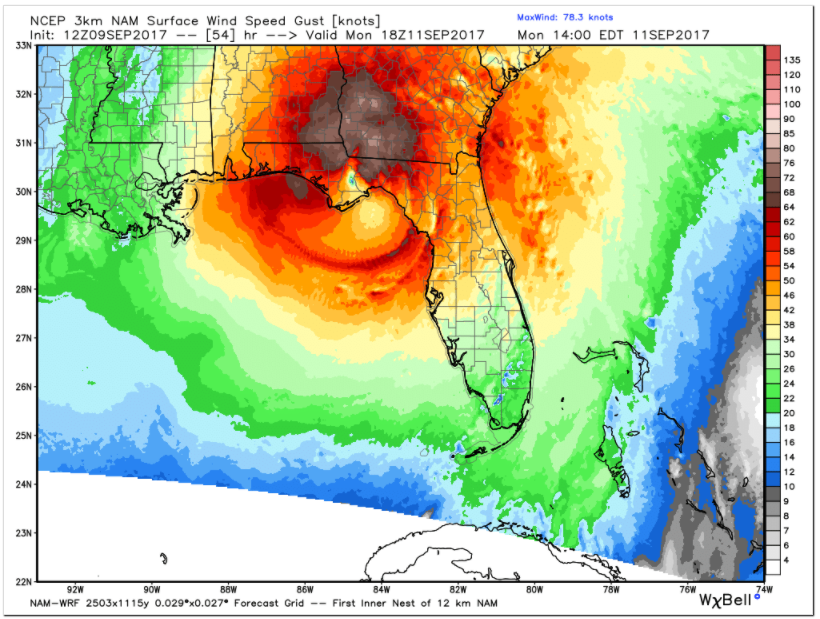
The model brings it to near Apalachicola by late morning Monday as a 951 mb hurricane with winds of 110. The Florida Big Bend would experience a devastating storm surge. Winds would be strong over Southeast Alabama, the Florida Panhandle, and southern Georgia by then, reaching 40-50 mph in places like Tallahasse, Dothan, Albany and Valdosta. Gusts could reach hurricane force (75-85 mph).
Tropical storm watches are already in effect for Southeast Alabama, South Georgia, and Northwest Florida, including Walton, Holmes, Washington, Bay, Gulf, Franklin, Calhoun, Liberty and Jackson Counties.
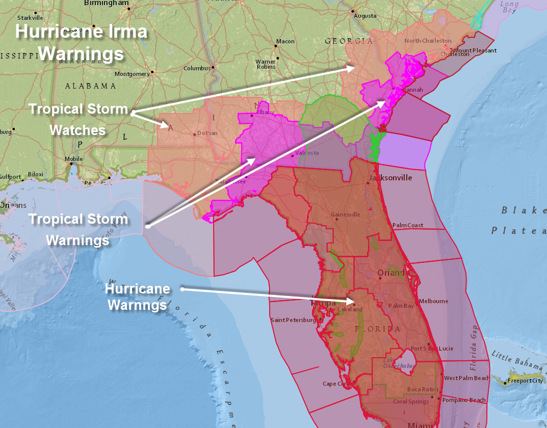
It includes places like Enterprise, Dothan, Panama City and communities along 30A. It is for northerly winds that will be on the western side of the storm, so storm surge will not be a problem along the coast. It should be mainly dry and tornadoes will not be an issue.
This is one model scenario. The official forecast is still further east, closer to the European and not as far east as the GFS, which is closer to I-75.
This is still an unfolding story for the West Coast of Florida, the Panhandle and Southeast Alabama and Southwest Georgia.
On a side note, a tornado watch has now been issued for southern Florida from Lake Okeechobee to the south.
Category: Alabama's Weather, ALL POSTS
About the Author (Author Profile)
Bill Murray is the President of The Weather Factory. He is the site's official weather historian and a weekend forecaster. He also anchors the site's severe weather coverage. Bill Murray is the proud holder of National Weather Association Digital Seal #0001 @wxhistorianSubscribe
If you enjoyed this article, subscribe to receive more just like it.


