Late Morning Forecast Notes
A quick peek at the 12Z model runs shows no major change in thinking for the rest of the week. The coldest air arrives Thursday and Friday; we will below freezing much of the day Thursday with wind chill index values in the single digits, maybe even below zero at times. Friday morning will see lows between 10 and 15 for most places, with single digits for the colder valleys across North Alabama.
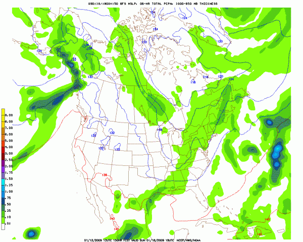
WEEKEND: The GFS continues the idea of a strong short wave impacting Alabama Sunday, but with limited moisture. The model projecting of low level thickness (1000 to 850 mb) suggests it could be cold enough for snow flakes. But, precipitation should be light if the moisture fields are correct. Here is the output for 12:00 noon local time Sunday:

Still, this no forecast, just model output. Let’s look at the ECMWF and the GEM, and we can some final conclusions for a preliminary forecast.
The most important event we need to stress now, no doubt, is the brutally cold air moving in here Thursday and Friday. I will have a full discussion and the afternoon Weather Xtreme video posted by 3:30. Stay tuned!
Category: Uncategorized


