The Midday Look At Central Alabama’s Weather On this Cool & Cloudy Tuesday
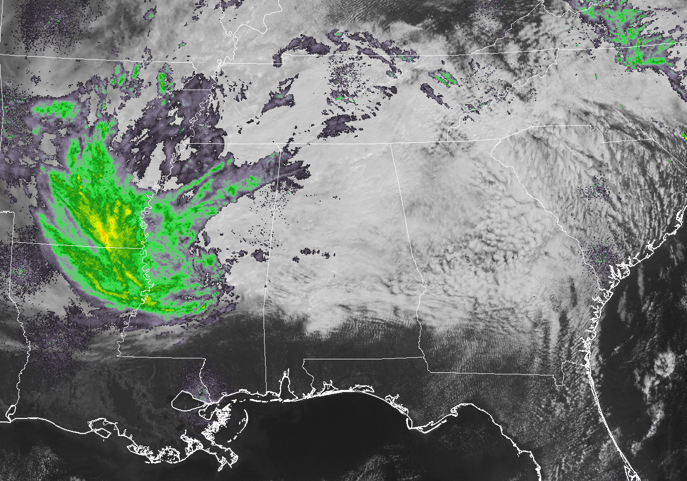
Radar at 12:08 PM shows a few sprinkles to very light rain falling over parts of Central Alabama, some of which may not even be reaching the ground. All of the area at this point is still under cloud cover from the remnants of Irma, but the good news is all of her winds and heavier rains have left. Moderate to heavy rain from Irma is falling over parts of the lower Mississippi Valley, the Tennessee Valley north of Alabama, and the southern Mid-Atlantic states.
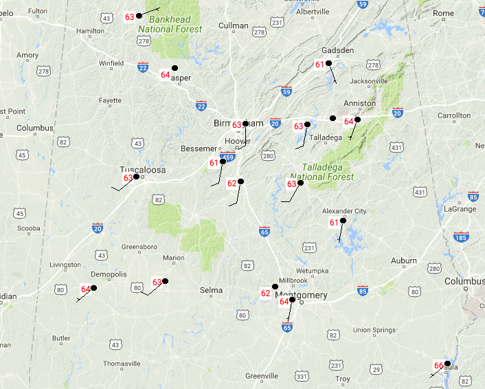
Temperatures are still well below normal today, currently in the lower to mid-60s throughout the area. Eufaula is the warm spot at this time, at 66 degrees. For most of the area, we are already pretty close to what our highs will be for the day, but some sun could break out to our south and make it into the lower to mid-70s. The rest of the area will range throughout the 60s. We may have a few scattered showers move across the area this afternoon and throughout the evening, with the higher chances to the north and west. Overnight lows will be in the mid to upper 50s throughout the area.
We’ll have more clouds than sun, but the sun will peek through the clouds at times throughout the day on Wednesday. Scattered showers will be possible for mainly the northern half of Central Alabama. Afternoon highs will be well below normal once again, with a wide range from the upper 60s to the lower 80s throughout the area from north to south. Amounts will be less than 0.10 inches for those who receive rain, while the rest of the area remains dry. The odds of any one location getting rain will be less than 1-in-3.
The rest of the work week looks fantastic, and temperatures will be warming back up to near normal levels. Skies will be mostly sunny with highs in the lower to mid-80s for most on Thursday, and warming into the mid to upper 80s for Friday. There will be a very slight risk of an isolated shower or two on both days, but the risk is so small that it is almost not worth mentioning at this point.
OUR TROPICAL WEATHER CATEGORY HAS THE LATEST ON ALL ACTIVE STORMS
Stay up-to-date with the latest updates on all of the tropical systems out in the Atlantic Ocean, Caribbean Sea, or in the Gulf of Mexico with the latest posts in our Tropical Weather section. Click here to see the latest.
GOT BEACH PLANS?
Be sure to keep up to date with the detailed forecasts from Fort Morgan over to Panama City Beach with the AlabamaWx Weather Blog. Click here to see the AlabamaWx Beach Forecast Center page.
The Beach Forecast is partially underwritten by the support of Brett/Robinson Vacation Rentals in Gulf Shores and Orange Beach. Click here to see Brett/Robinson’s Hot Deals now!
ADVERTISE WITH ALABAMAWX
Now is the time to set your marketing campaign on AlabamaWX. The site has enjoyed a 71% jump in page views this year! The website has already enjoyed over 12 MILLION page views this year. We can customize a creative, flexible and affordable package that will suit your organization’s needs. Contact Bill Murray at (205) 687-0782.
E-FORECAST
Get the AlabamaWx seven-day forecast delivered directly to your inbox by email twice daily. It is the most detailed weather forecast available in Central Alabama. Click here to subscribe. It’s free!
ON THIS DAY IN WEATHER HISTORY
1988 – An afternoon tornado spawned a tornado which skipped across northern sections of Indianapolis IN damaging roofs and automobiles. It was the first tornado in central Indiana in September in nearly forty years of records. Hurricane Gilbert plowed across the island of Jamaica, and by the end of the day was headed for the Cayman Islands, packing winds of 125 mph.
WEATHERBRAINS
Check out the show at www.WeatherBrains.com. You can also subscribe on iTunes. You can watch the show live at live.bigbrainsmedia.com on Monday nights starting at 8:30 PM CDT. You will be able to see the show on the James Spann 24×7 weather channel on cable or directly over the air on the dot 2 feed.
Category: Alabama's Weather, ALL POSTS
About the Author (Author Profile)
Scott Martin is an operational meteorologist, professional graphic artist, musician, husband, and father. Not only is Scott a member of the National Weather Association, but he is also the Central Alabama Chapter of the NWA president. Scott is also the co-founder of Racecast Weather, which provides forecasts for many racing series across the USA. He also supplies forecasts for the BassMaster Elite Series events including the BassMaster Classic.Subscribe
If you enjoyed this article, subscribe to receive more just like it.


