Mostly Sunny, Hot, & Humid For Most At Midday, While Some Are Getting Rain
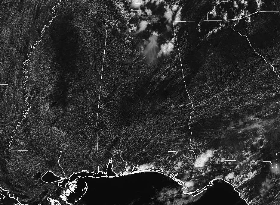
We have mostly sunny skies and pretty warm temperatures across Central Alabama at the noon hour, and dewpoint values are making the atmosphere feel rather muggy as well. We have convective cloud development firing up in the northeastern parts of the area and up into the Tennessee Valley as well. Wonder what could be under some of those clouds…
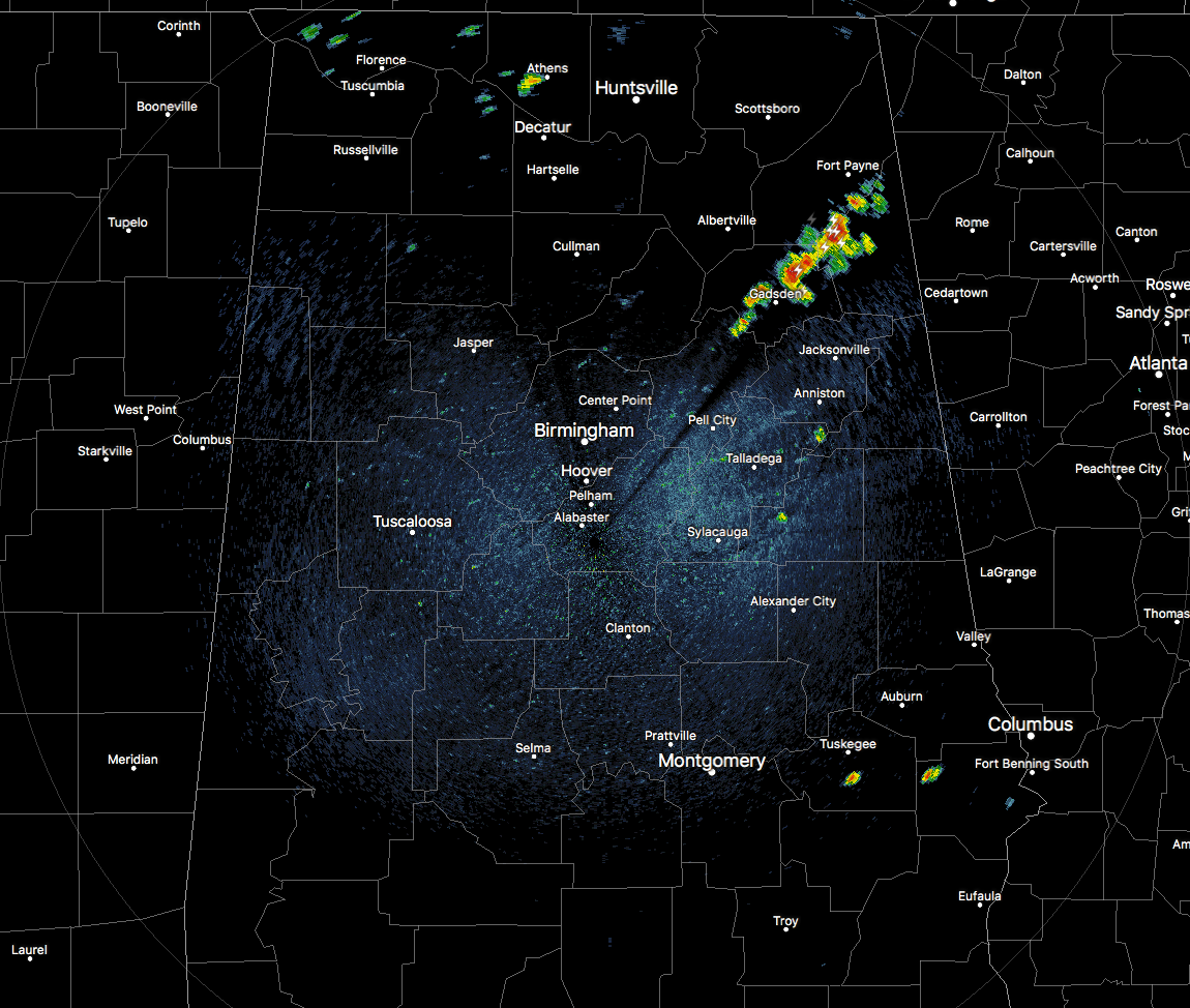
As we look at the radar image from 12:35 PM, most of Central Alabama is dry at this point, but there are thunderstorms that have fired up over in the northeastern part of the area where those clouds were located. These showers and storms are stretching from Ashville to the northeast through Reece City and to Sand Rock. This activity is moving to the south-southwest, and the cell approaching Glencoe and Gadsden is putting down very heavy rainfall at the moment.
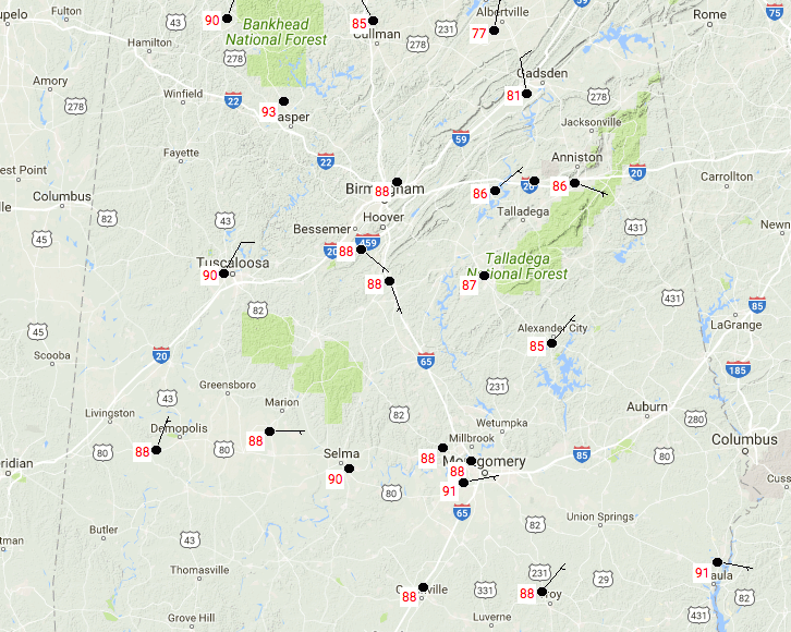
Temperatures at the 12:35 PM are ranging in the lower 80s with rain cooled air approaching, to the lower 90s with nearly full sunshine. Demopolis and Montgomery are the warm spots currently at 91 degrees, while Gadsden is the cool spot in the area at 81 degrees. The Birmingham Airport is currently reading a temperature of 88 degrees.
FOR THE REST OF TODAY
Convective clouds will continue to form during the remainder of the hottest part of the afternoon, and we’ll have a chance of scattered showers and thunderstorms across much of the northern and southern parts of Central Alabama, while there is a wedge of slighty drier air caught in between across the central parts of the area, where only isolated showers are possible. It will continue to be hot and muggy out there today even in the drier air, with highs reaching the upper 80s to the lower 90s and dewpoint values in the lower 70s.
Some showers may linger for an hour or two after we lose the sunlight, but patchy fog may develop in areas where it had previously rained during the day and near some bodies of water. Overnight lows will be in the mid-60s to the lower 70s.
HOT, HUMID, AND SHOWERS EXPECTED FOR FRIDAY
We’ll continue to have muggy conditions throughout Central Alabama on Friday, and we can expect isolated to scattered afternoon showers and thunderstorms to form. You are less likely to see rain in the northwestern quarter of the area (mainly west of I-65 and north of I-20/59), with chances higher for the rest. Otherwise, we’ll have a mix of sun and clouds and highs will be back up in the upper 80s to the lower 90s.
OUR TROPICAL WEATHER CATEGORY HAS THE LATEST ON ALL ACTIVE STORMS
Stay up-to-date with the latest updates on all of the tropical systems out in the Atlantic Ocean, Caribbean Sea, or in the Gulf of Mexico with the latest posts in our Tropical Weather section. Click here to see the latest.
GOT BEACH PLANS?
Be sure to keep up to date with the detailed forecasts from Fort Morgan over to Panama City Beach with the AlabamaWx Weather Blog. Click here to see the AlabamaWx Beach Forecast Center page.
The Beach Forecast is partially underwritten by the support of Brett/Robinson Vacation Rentals in Gulf Shores and Orange Beach. Click here to see Brett/Robinson’s Hot Deals now!
ON THIS DAY IN WEATHER HISTORY
1989 – Hurricane Hugo slammed into the South Carolina coast about 11 PM, making landfall near Sullivans Island. Hurricane Hugo was directly responsible for thirteen deaths, and indirectly responsible for twenty-two others. A total of 420 persons were injured in the hurricane, and damage was estimated at eight billion dollars, including two billion dollars damage to crops. Sustained winds reached 85 mph at Folly Beach SC, with wind gusts as high was 138 mph. Wind gusts reached 98 mph at Charleston, and 1S09 mph at Shaw AFB. The biggest storm surge occurred in the McClellanville and Bulls Bay area of Charleston County, with a storm surge of 20.2 feet reported at Seewee Bay. Shrimp boats were found one half mile inland at McClellanville.
WEATHERBRAINS
Check out the show at www.WeatherBrains.com. You can also subscribe on iTunes. You can watch the show live at live.bigbrainsmedia.com on Monday nights starting at 8:30 PM CDT. You will be able to see the show on the James Spann 24×7 weather channel on cable or directly over the air on the dot 2 feed.
Category: Alabama's Weather, ALL POSTS
About the Author (Author Profile)
Scott Martin is an operational meteorologist, professional graphic artist, musician, husband, and father. Not only is Scott a member of the National Weather Association, but he is also the Central Alabama Chapter of the NWA president. Scott is also the co-founder of Racecast Weather, which provides forecasts for many racing series across the USA. He also supplies forecasts for the BassMaster Elite Series events including the BassMaster Classic.Subscribe
If you enjoyed this article, subscribe to receive more just like it.


