The Last Hot Midday of 2017? It’s Possible
THE CENTRAL ALABAMA WEATHER CHECK AT 12:00 PM

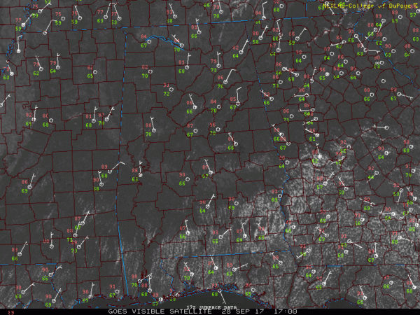
We currently have mainly sunny skies with very warm to hot temperatures at the midday hour in the middle and southern portions of Central Alabama, with cooler temperatures in the northern part of the area. Birmingham is currently at 86 degrees, while Eufaula is the current warm spot at 91 degrees. Looking to the north, Cullman is only at 81 degrees, and Haleyville is at 82 degrees. A cold front is currently making its way through Central Alabama, but the big temperature difference will not be felt until tomorrow.
We will continue to have plenty of sunshine throughout the remainder of this afternoon and early evening hours with only a few clouds dotting the sky. No rain is expected with this cold front, and like I said earlier, the big temperature difference will start to be felt on Friday. Afternoon highs will be in the mid-80s to the lower 90s throughout the area, with the warmer temperatures in the southern portions. We’ll have a wider range of temperatures for the overnight lows due to the cold front and with cooler are starting to work into the area. We’ll have lower to mid-60s for the northern half of Central Alabama, with mid-60s to the lower 70s in the south. A few of the colder locations in the northern parts may hit the 50s tonight.
A FANTASTIC FRIDAY FOR CENTRAL ALABAMA

Cooler air will have worked into the northern half of the state by tomorrow afternoon, and our highs will reflect that. We’ll have mainly clear skies throughout Central Alabama, with highs ranging from the lower 80s in the northern half of the area, to the mid-80s to the lower 90s in the southern half. We will start to cool off nicely for high school football games, with mid-70s to the lower 80s expected around 6:00 PM, and cooling off into the mid-60s to the mid-70s by 10:00 PM. Skies will be clear throughout the evening and overnight hours, and lows will be in the upper 50s tot he upper 60s.
OUR TROPICAL WEATHER CATEGORY HAS THE LATEST ON ALL ACTIVE STORMS

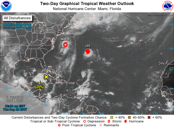
Stay up-to-date with the latest updates on all of the tropical systems out in the Atlantic Ocean, Caribbean Sea, or in the Gulf of Mexico with the latest posts in our Tropical Weather section. Click here to see the latest.
GOT BEACH PLANS?
Be sure to keep up to date with the detailed forecasts from Fort Morgan over to Panama City Beach with the AlabamaWx Weather Blog. Click here to see the AlabamaWx Beach Forecast Center page.
The Beach Forecast is partially underwritten by the support of Brett/Robinson Vacation Rentals in Gulf Shores and Orange Beach. Click here to see Brett/Robinson’s Hot Deals now!
ON THIS DAY IN WEATHER HISTORY
1917 – A hurricane hit Pensacola, FL. Winds gusted to 95 mph, and the barometric pressure dipped to 28.50 inches. Winds at Mobile AL gusted to 75 mph.
WEATHERBRAINS
Check out the show at www.WeatherBrains.com. You can also subscribe on iTunes. You can watch the show live at live.bigbrainsmedia.com on Monday nights starting at 8:30 PM CDT. You will be able to see the show on the James Spann 24×7 weather channel on cable or directly over the air on the dot 2 feed.
Category: Alabama's Weather, ALL POSTS


