A Nice Midday in Central Alabama, Great Weather For Trick-Or-Treating Tonight
Conditions Across Central Alabama at 12:20 PM
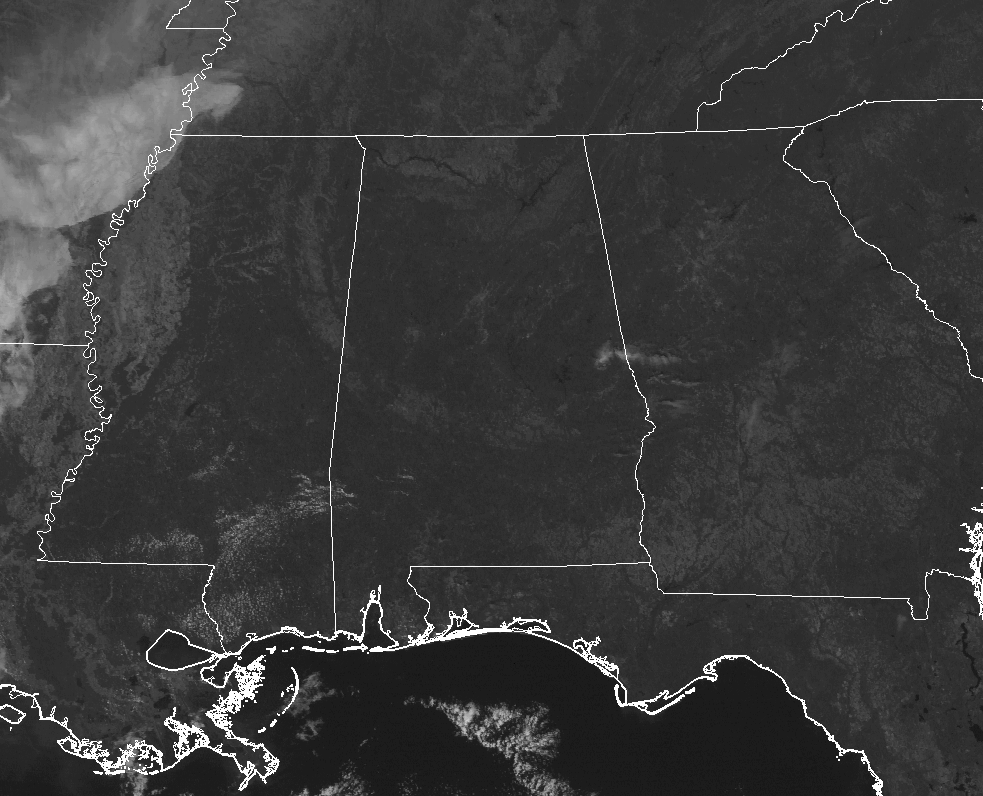
It’s pretty hard to find any clouds over Central Alabama at this point of the day, but if you look closely in eastern Alabama near Dadeville, there are just a few. Those clouds are moving quickly to the east-northeast and will be out of the state shortly.
A cold front is currently pushing southward through Central Alabama at this point, but it will soon stall and start to move northward as a warm front later today. That cold front is keeping temperatures cooler in the northern half of the area, with readings coming in lower to mid-60s, while the southern half of the area enjoys upper 60s to the lower 70s. It’s 66 degrees currently in Birmingham.
Weather For The Rest Of Trick-Or-Treat Day
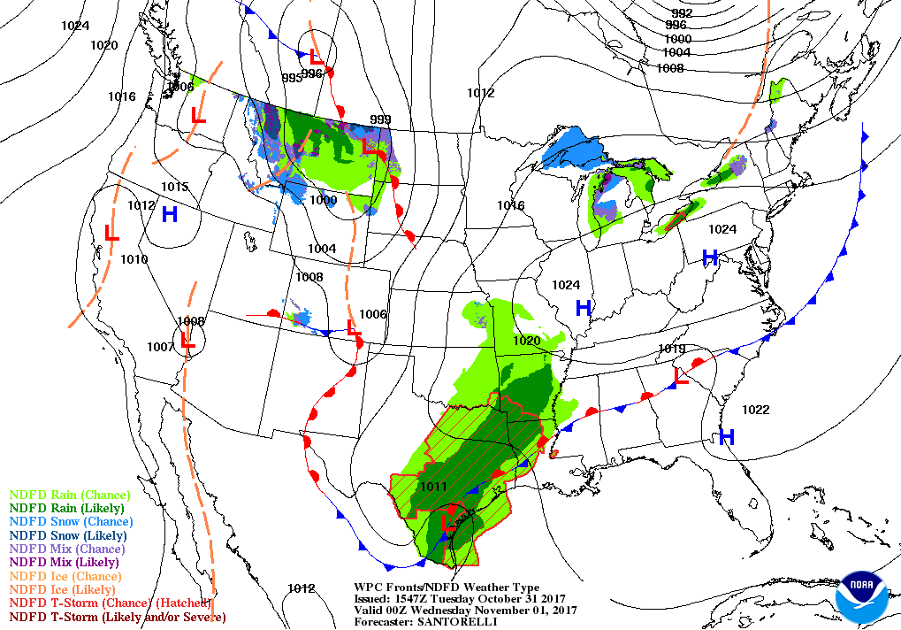
A stationary front will be draped over Central Alabama this evening but it will start to move northward as a warm front through the late night and overnight hours. The good news is that our temperatures throughout the evening will remain warmer than what we felt for the past couple of evenings, making Trick-or-Treating rather comfortable. Skies will be mostly clear but clouds will be on the increase across the northern parts of the area. Afternoon highs will top out in the mid-60s to the mid-70s throughout Central Alabama from north to south, dropping into the lower 60s to lower 70s by 5PM, and into the mid to upper 50s by 8PM. For the overnight hours, clouds will continue to increase from the north and the extreme northwestern tip of Central Alabama could see a shower or two. Overnight lows will be in the mid-40s to the lower 50s.
Rain For Parts Of The Area On Wednesday
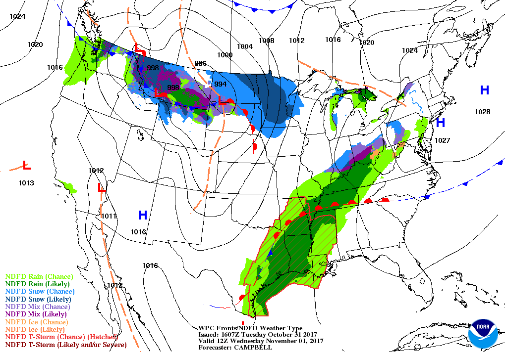
The warm front will have moved just north of the state, but a disturbance will be working eastward bringing clouds and showers to a good bit of the northern half of Central Alabama. A very small chance for showers extends just south and east of the I-59 corridor throughout the day, but the better chances will be along and west of I-59. Those rain chances will slowly push eastward during the latter parts of the day, but coverage will dissipate some as we lose sunlight. When it’s not raining, skies will be mainly cloudy. Afternoon highs will be in the mid-60s to the mid-70s from north to south throughout the area. Lows will be in the mid-50s to at or near 60 degrees.
Gulf Coast Weather
Be sure to keep up to date with the detailed forecasts from Fort Morgan over to Panama City Beach with the AlabamaWx Weather Blog. Click here to see the AlabamaWx Beach Forecast Center page.
The Beach Forecast is partially underwritten by the support of Brett/Robinson Vacation Rentals in Gulf Shores and Orange Beach. Click here to see Brett/Robinson’s Off Season Deals now!
The Tropics
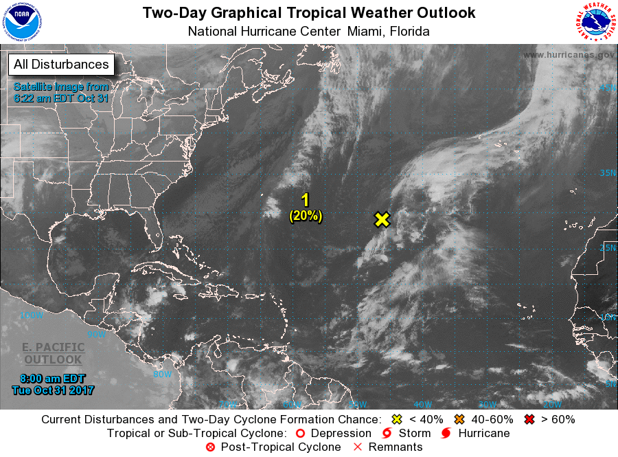
A weak disturbance is located about 1000 miles east-southeast of Bermuda producing showers and thunderstorms, mainly well to the northeast and southeast of the center. Strong upper-level winds and dry air are expected to limit any development during the next couple of days while it meanders between Bermuda and the Azores. Formation chance is very low during the next 5 days, only at 20%. At this point, it does not appear to be a threat to the US mainland.
Stay up-to-date with the latest updates on all of the tropical systems out in the Atlantic Ocean, Caribbean Sea, or in the Gulf of Mexico with the latest posts in our Tropical Weather category. Click here to see the latest.
On This Day In Weather History
1989 – Halloween night was a soggy one in New England. Showers in the northeastern U.S. produced more than an inch and a half of rain in six hours at some locations. An invasion of cold arctic air brought an abrupt end to a week of “Indian Summer” type weather in the Great Lakes Region, and brought snow and subzero wind chill readings to the Northern Plains. In Colorado, Alamosa was the cold spot in the nation with a record low of two degrees above zero, and a Halloween night storm brought 3 to 6 inches of snow to the Front Range, and 5 to 10 inches to the nearby foothills. Icy streets around Denver the next morning made for a rather spooky commute.
WeatherBrains
Check out the show at www.WeatherBrains.com. You can also subscribe on iTunes. You can watch the show live at live.bigbrainsmedia.com on Monday nights starting at 8:30 PM CDT. You will be able to see the show on the James Spann 24×7 weather channel on cable or directly over the air on the dot 2 feed.
Category: Alabama's Weather, ALL POSTS
About the Author (Author Profile)
Scott Martin is an operational meteorologist, professional graphic artist, musician, husband, and father. Not only is Scott a member of the National Weather Association, but he is also the Central Alabama Chapter of the NWA president. Scott is also the co-founder of Racecast Weather, which provides forecasts for many racing series across the USA. He also supplies forecasts for the BassMaster Elite Series events including the BassMaster Classic.Subscribe
If you enjoyed this article, subscribe to receive more just like it.


