A Few Sprinkles Out There At Midday, Few Strong Storms Later Today
Radar Check At 1:20 PM
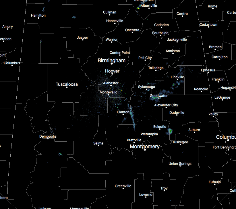
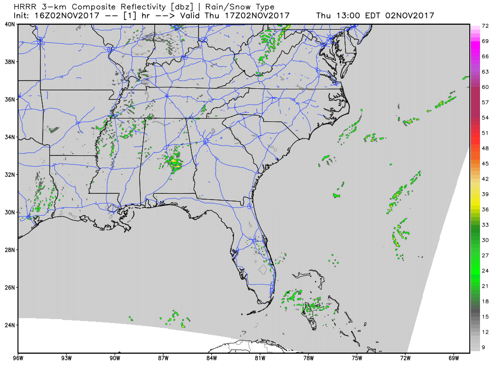
Not much going on in Central Alabama during the 1 o’clock hour, but I have a feeling that we could see some active weather in the northwestern parts of the area by the late afternoon into the early evening hours. Only a few sprinkles and very light showers are showing up mainly in the east and southeastern parts of the area, but these are dissipating as they move to the northeast.
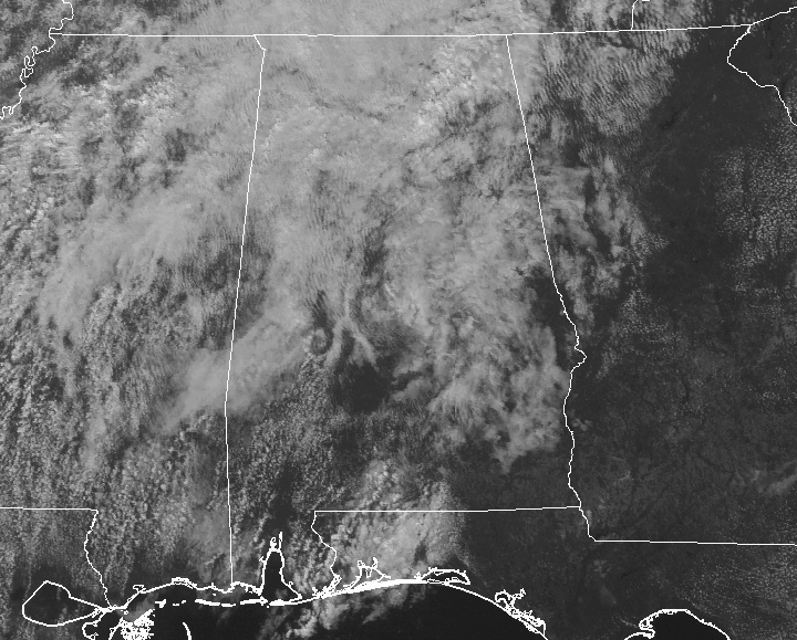
Much of Central Alabama is covered in clouds, but there are a few breaks in there letting the sun warm the surface. Temperatures at 1:20 PM are running in the mid-60s to the lower 70s in the north, with lower 70s to near 80 degrees in the south. Dewpoints are running in the mid to upper 60s throughout the area.
A Few Severe Storms Possible In Northwestern Central Alabama
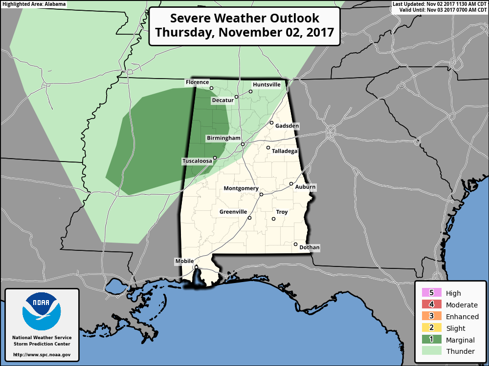
The Storm Prediction Center has defined a Marginal Risk for severe storms for mainly the northwestern parts of Central Alabama, including the communities of Eutaw, Tuscaloosa, Jasper, Double Springs, Haleyville, and Hamilton. All modes of severe weather is possible: damaging thunderstorm wind gusts, large hail, and an isolated tornado or two.
An impulse will be moving into the area later this afternoon that will provide the lift for thunderstorm development. That, along with surface instabilities rising into the 1000-2000 J/kg range, low-level helicity numbers approaching the 150-200 m2/s2 range, bulk shear values reaching 35-40 kt, and surface dewpoints in the mid to upper 60s, will be sufficient enough to support supercellular type thunderstorm development.
Timing for the best chance of severe weather in the northwestern parts of the area will be from 5PM-10PM, but scattered shower activity will form earlier than that, and will last throughout the overnight hours.
For the rest of Central Alabama, the best chance for shower activity will be north of a line from Livingston to Jemison to Wedowee, while any measurable rainfall will be hard to come by south of that line. Afternoon highs will be in the 70s to 80 degrees. We could have a few breaks in the clouds throughout the day, but expect skies to remain cloudy. Rain chances will drop some for the overnight hours, and lows will be in the upper 50s to mid-60s.
Could Be A Repeat Performance On Friday
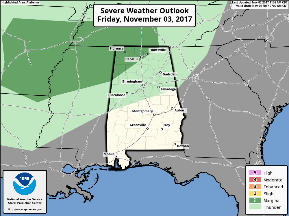
SPC has the northwestern corner of the area defined in a Marginal Risk for severe storms on their day 2 outlook for Friday. A couple of shortwaves will move through bringing a couple of rounds of scattered shower activity, which could include a few stronger to severe storms in the marginal risk area. At this point, the main risk appears to be from large hail and damaging wind gusts, with a much lower tornado risk. As with thunderstorms in the south always “expect the unexpected.” Go ahead and have your safe place and supplies ready, just in case.
Much of the rest of Central Alabama will see a chance of scattered showers and maybe a few claps of thunder, while the southeastern corner of the area remains dry. Afternoon highs will be in the mid-70s to the lower 80s. Those rain chances will persists throughout the evening hours, and actually increase in the extreme northwestern corner. So take your umbrella to those high school football games just in case a scattered shower passes over. Of course, if thunder roars, go indoors. If you can hear thunder, you are close enough to the storm to be struck by lightning. Temperatures at kickoff will be in the lower to mid-70s, and dropping into the mid to upper 60s by the final whistle.
Gulf Coast Weather
Be sure to keep up to date with the detailed forecasts from Fort Morgan over to Panama City Beach with the AlabamaWx Weather Blog. Click here to see the AlabamaWx Beach Forecast Center page.
The Beach Forecast is partially underwritten by the support of Brett/Robinson Vacation Rentals in Gulf Shores and Orange Beach. Click here to see Brett/Robinson’s Off Season Deals now!
The Tropics
Stay up-to-date with the latest updates on all of the tropical systems out in the Atlantic Ocean, Caribbean Sea, or in the Gulf of Mexico with the latest posts in our Tropical Weather category. Click here to see the latest.
On This Day In Weather History
1988 – A very intense low pressure system brought heavy rain, snow, and high winds, to parts of the northeastern U.S. Portland ME established a record for November with 4.52 inches of rain in 24 hours, and winds along the coast of Maine gusted to 74 mph at Southwest Harbor. Heavy snow blanketed parts of northern Vermont and upstate New York, with 15 inches reported at Spruce Hill NY.
WeatherBrains
Check out the show at www.WeatherBrains.com. You can also subscribe on iTunes. You can watch the show live at live.bigbrainsmedia.com on Monday nights starting at 8:30 PM CDT. You will be able to see the show on the James Spann 24×7 weather channel on cable or directly over the air on the dot 2 feed.
Category: Alabama's Weather, ALL POSTS
About the Author (Author Profile)
Scott Martin is an operational meteorologist, professional graphic artist, musician, husband, and father. Not only is Scott a member of the National Weather Association, but he is also the Central Alabama Chapter of the NWA president. Scott is also the co-founder of Racecast Weather, which provides forecasts for many racing series across the USA. He also supplies forecasts for the BassMaster Elite Series events including the BassMaster Classic.Subscribe
If you enjoyed this article, subscribe to receive more just like it.


