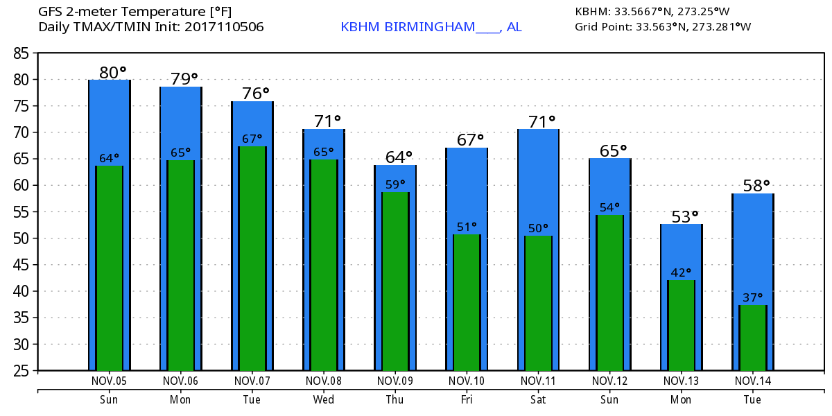
Warm with Rain at Midweek
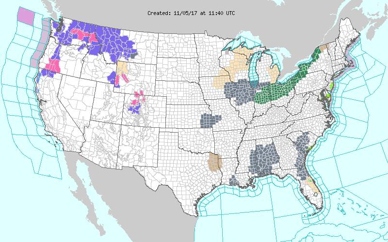
Another warm morning along with a dense fog advisory covering much of Alabama, Northwest Florida, and eastern Mississippi to start your day. The dense fog should burn off or lift into a cloud deck with improved visibility by 9 am or so. Otherwise partly cloudy skies this morning with the early morning temperatures running in the middle 50s to lower 60s. We should see some sunshine today with the afternoon highs reaching near 80 degrees. The potential for showers is very low though not quite zero.
The upper flow is expected to remain fairly zonal for the next couple of days, so a frontal zone is forecast to sag into the Tennessee River Valley on Monday and remain there on Tuesday. This should bring increased cloud cover that will help to hold the afternoon highs in the upper 70s for Monday and Tuesday. Showers will be possible primarily north and northwest of Central Alabama.
A small but somewhat potent short wave trough moves into the southern Plains on Wednesday which will generate a surface in the vicinity of western Oklahoma while increasing the rain chances across the area. Highs at midweek will most likely be held in the 60s.
The upper trough moves due east into Middle Tennessee on Thursday with the surface low tracking into northern Georgia. This should produce our best chances for rain come Wednesday evening into Thursday morning. It’s a little too far out to be specific about the severe weather threat, but the GFS forecasts CAPE values into the 500 to 600 range for Wednesday afternoon/evening especially for the eastern half of Central and South Alabama and Florida Panhandle. We’ll have to keep a close eye on this prospect in future runs. SPC notes that the features forecast in the models do support the potential for severe storms should a definitive warm sector develop with the surface low. Definitely a “stay tuned” situation.
Rainfall amounts will likely come in around 1 inch for most with the potential for some spots seeing between 1 and 2 inches.
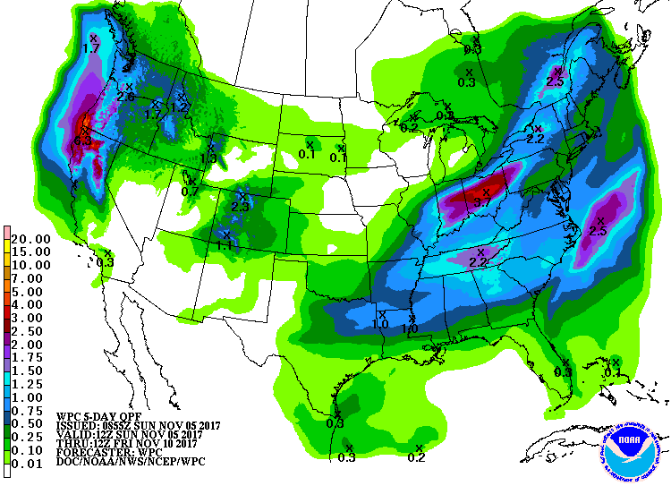
The upper trough moves off the Carolina Coast on Friday paving the way for good weather for Friday and Saturday. Highs both days will reach near 70 degrees. But don’t get too happy with the good weather as another potent short wave is forecast to move across the Middle Mississippi River Valley on Sunday which would set the stage for another surface low in the Ohio River Valley. The current forecast scenario is a little shy on moisture, so the chances for any showers or storms could be somewhat restricted.
In the tropics, there is a weak disturbance about 875 miles southeast of Bermuda. It has a small chance of developing into a tropical cyclone as it moves northeastward over the open Atlantic during the next couple of days.
For beachgoers, it is looking nice for the week ahead along the beaches of Alabama and Northwest Florida. It should be mainly dry, except for a few showers on Wednesday as that surface low passes. Highs will be in the 70s through Tuesday dropping back a few degrees for the end of the week. Lows will be in the 60s until the front passes on Wednesday dropping them back into the 50s by the weekend.
Click here to see the Beach Forecast Center page. Check out hot deals on the Alabama Gulf Coast with Brett/Robinson! The Beach Forecast is partially underwritten by the support of Brett/Robinson Vacation Rentals in Gulf Shores and Orange Beach. Click here to see Brett/Robinson’s best beach offers now!.
WEATHERBRAINS: Check out the weekly netcast that’s all about the weather at www.WeatherBrains.com. You can also subscribe on iTunes. You can watch the show live at live.bigbrainsmedia.com You will be able to see the show on the James Spann 24×7 weather channel on cable or directly over the air on the dot 2 feed.
Special thanks to Bill Murray for filling in for me over portions of the last two weekends. My wife and I took in a storytelling festival in Selma and then cruised into the Gulf of Mexico for five days. Hard to get back in the saddle after such a wonderful week. James Spann will have the next Weather Xtreme Video here bright and early on Monday morning. If you haven’t set your clocks back, do so soon since we reverted to standard time this morning. Have a great day and Godspeed.
-Brian-
Category: Alabama's Weather, ALL POSTS
About the Author (Author Profile)
Brian Peters is one of the television meteorologists at ABC3340 in Birmingham and a retired NWS Warning Coordination Meteorologist. He handles the weekend Weather Xtreme Videos and forecast discussion and is the Webmaster for the popular WeatherBrains podcast.Subscribe
If you enjoyed this article, subscribe to receive more just like it.


