

Cold Front Moving Through Northern Parts of Central Alabama At Midday

RADAR CHECK AT 12:15 PM: A broken line of showers and a couple of embedded thunderstorms are currently pushing its way east-southeastward through the northwestern parts of Central Alabama and the eastern half of North Alabama. The line currently stretches from near Macedonia in Pickens County, through Fayette and just north of Jasper, through South Vinemont and Union Grove, to just north of Valley Head in Dekalb County. A few indications of lightning is showing up in the part of the line near Section and approaching Guntersville.
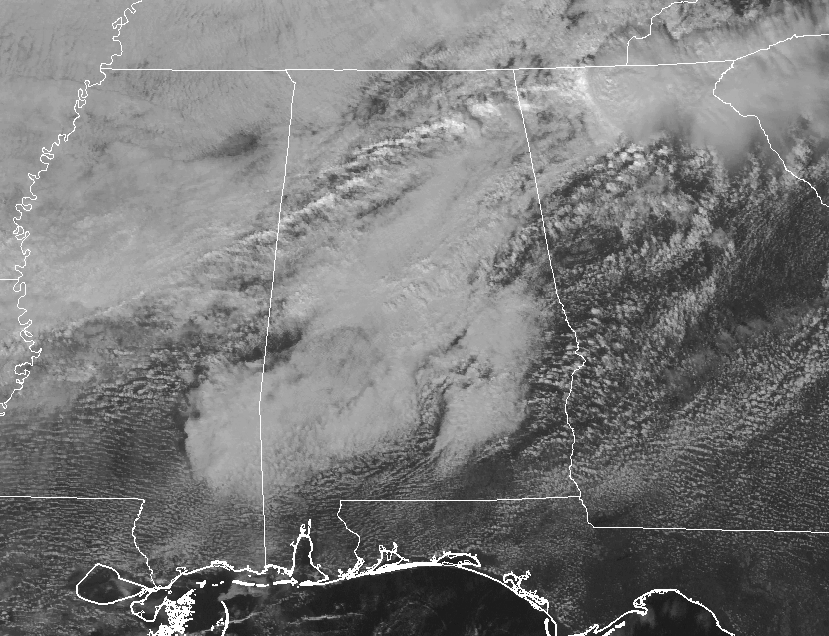
VISIBLE SATELLITE: Nearly all of the rest of Central Alabama is blanketed in clouds at the midday hour, with some breaks along and just west of the Georgia state line. Temperatures are currently in the upper 60s to the lower 70s in the northern half of the area, with lower 70s to the lower 80s in the south. Birmingham is currently at 70 degrees, but that is well behind the warm spot of Eufaula at 83 degrees.

TODAY AND TONIGHT: Scattered showers and maybe a few claps of thunder will be moving through the area today, mainly along the cold front. Otherwise, maybe a few isolated showers possible out ahead of the front. Skies will be mainly mostly cloudy to cloudy, and afternoon highs will be in the lower 70s to the lower 80s from north to south throughout the area.
For tonight, we’ll have a quiet period before more showers move in during the overnight hours. Much of the heavier activity should stay north of Central Alabama, but widely scattered light to moderate showers are possible west of I-65. Overnight lows will be in the lower 50s to the mid-60s. Some patchy fog could develop over portions of the area, and advisories may be needed.
WEDNESDAY: Looking at the latest run of the hi-res NAM, showers will be spotty to start the day, but light to moderate rain will become likely for the afternoon hours through daybreak on Thursday. When it’s not raining, don’t expect much sunshine as clouds will be dominating the skies. You’ll notice a difference in the temperatures, especially in the northern half of Central Alabama, where highs will be in the upper 50s to the lower 60s. Mid-60s to the mid-70s can be expected in the southern half.
RAINFALL: Rainfall amounts through the next couple of days will range from 1/4 inch to 1 inch, with the heavier amounts in the southern parts of the area. This QPF image from the NWS WPC ends on Friday evening at 6PM.
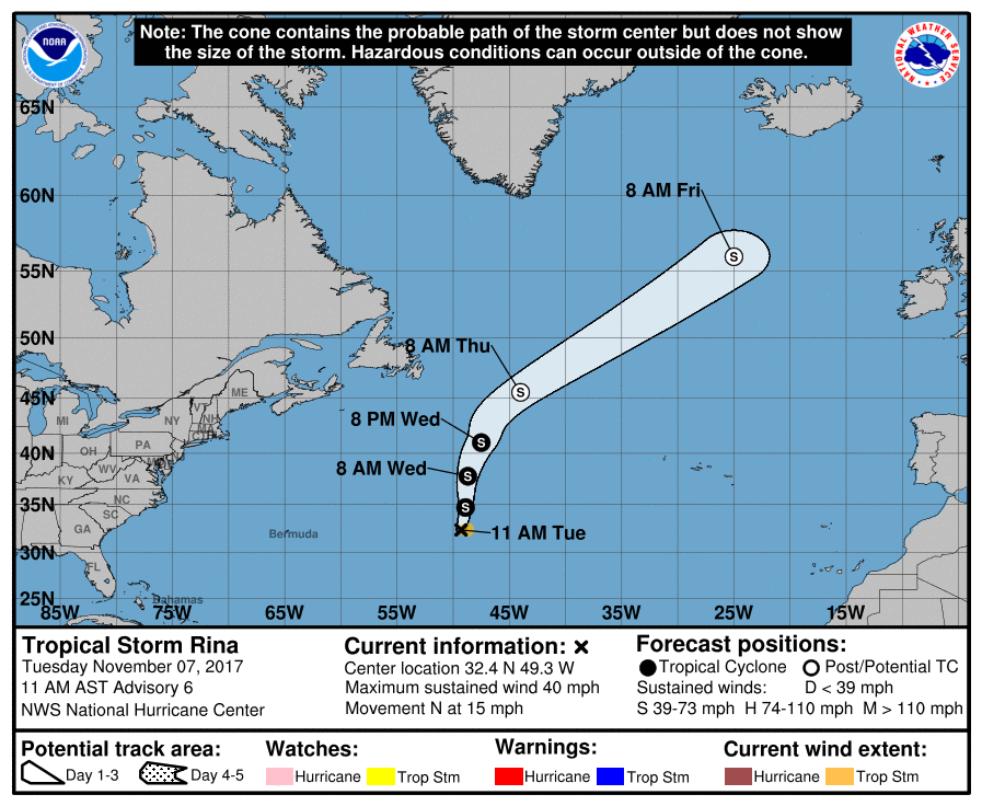
THE TROPICS: All is quiet close to home, but Tropical Storm Rina is churning up the Central Atlantic Ocean with maximum sustained winds of 40 MPH. No threat to land as she will move northward until making a northeastwardly turn on Thursday and should become post-tropical.
Stay up-to-date with the latest updates on all of the tropical systems out in the Atlantic Ocean, Caribbean Sea, or in the Gulf of Mexico with the latest posts in our Tropical Weather category. Click here to see the latest.
BEACH FORECAST CENTER: Be sure to keep up to date with the detailed forecasts from Fort Morgan over to Panama City Beach with the AlabamaWx Weather Blog. Click here to see the AlabamaWx Beach Forecast Center page. The Beach Forecast is partially underwritten by the support of Brett/Robinson Vacation Rentals in Gulf Shores and Orange Beach. Click here to see Brett/Robinson’s Off Season Deals now!
THIS DAY IN WEATHER HISTORY: 1940 – The Galloping Gertie bridge at Tacoma, WA, collapsed in strong winds resulting in a six million dollar loss, just four months after the grand opening of the new bridge. The winds caused the evenly sized spans of the bridge to begin to vibrate until the central one finally collapsed. From that point on bridges were constructed with spans of varying size.
WEATHERBRAINS: Check out the show at www.WeatherBrains.com. You can also subscribe on iTunes. You can watch the show live at live.bigbrainsmedia.com on Monday nights starting at 8:30 PM CDT. You will be able to see the show on the James Spann 24×7 weather channel on cable or directly over the air on the dot 2 feed.
Category: Alabama's Weather, ALL POSTS
About the Author (Author Profile)
Scott Martin is an operational meteorologist, professional graphic artist, musician, husband, and father. Not only is Scott a member of the National Weather Association, but he is also the Central Alabama Chapter of the NWA president. Scott is also the co-founder of Racecast Weather, which provides forecasts for many racing series across the USA. He also supplies forecasts for the BassMaster Elite Series events including the BassMaster Classic.Subscribe
If you enjoyed this article, subscribe to receive more just like it.


