Clouds In The East But Mainly Really Nice Out There At Midday
CONDITIONS RIGHT BEFORE 1:00 PM
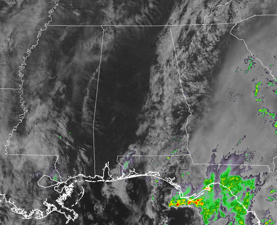
So far as we approach the 1:00 PM hour in Central Alabama, a good bit of the central and western parts of the area are experiencing maximum sunshine, while the eastern parts have partly to mostly cloudy skies. No organized showers showing up on radar at this point over the east and southeastern Central Alabama, but a few are possible throughout the remainder of the day.
TEMPERATURES AT 12:55 PM
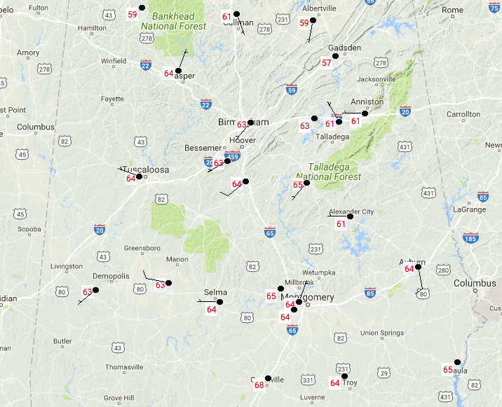
We have a nice spread of temperatures out there across the area at this time, with upper 50s to the mid-60s showing up on our readings. Birmingham was at 63º, while a few spots are tied at 65º for the warm spot. At this point, Haleyville is the only location still in the 50s, at 59º.
YOUR WEATHER FOR THE REMAINDER OF TODAY
For much of Central Alabama throughout the remainder of the daylight hours and into the early evening, we will continue to have mostly sunny and dry conditions. The extreme east and southeastern parts of the area will experience partly to mostly cloudy conditions with a very small chance of a showers. Those rain chances will drop steadily after 4PM and should be entirely diminished by bedtime tonight. Today’s highs will top out in the lower to mid-60s from north to south. Skies will be mostly clear tonight and through the overnight hours for most, with a few more clouds hanging around for a little while longer in the southeast. Lows will dip down into the upper 30s to the upper 40s, with the warmer temperatures occurring where there is more clouds to trap in the radiational heating from the daylight hours.
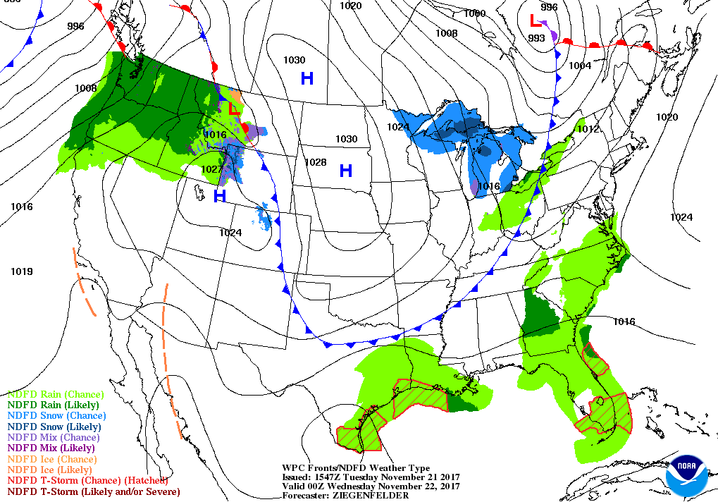
CALM AND COOL WEATHER FROM WEDNESDAY THROUGH THE WEEKEND
It is an unusual weather pattern that has set up for Central Alabama for this time of the year, as we are accustomed to seeing a system with storms pass through here every few days or so. Looks like we’ll have mostly sunny and pleasant days with fair and chilly nights starting on Wednesday and lasting all of the way through the weekend. Afternoon highs will generally be in the upper 60s to the lower 60s, with lows ranging in the 30s to the lower 40s.
FORECAST FOR SOME BOWL MADE OF IRON… WHAT’S THAT? (HA HA HA)
Jackets may be required for and pre-game tailgating as temperatures will be starting of in the upper 40s down on the Plains in Auburn at 8:00 AM. By the time kickoff arrives at 2:30 PM, skies will be mostly sunny and the temperatures will be at its warmest in the mid 60s. By the end of the game, the temperatures will be down in the mid-50s, and steadily dropping into the upper 40s by 10:00 PM. Winds will be out of the west at 5-10 MPH throughout the day.
THE TROPICS
The end of the 2017 Atlantic Hurricane Season will be here in just 9 days, and at this point we have nothing to report on in the Gulf of Mexico, Caribbean Sea, or the tropical Atlantic Ocean. Stay up-to-date with the latest updates on all of the tropical systems out in the Atlantic Ocean, Caribbean Sea, or in the Gulf of Mexico with the latest posts in our Tropical Weather category. Click here to see the latest.
THE BEACH FORECAST
Be sure to keep up to date with the detailed forecasts from Fort Morgan over to Panama City Beach with the AlabamaWx Weather Blog. Click here to see the AlabamaWx Beach Forecast Center page. The Beach Forecast is partially underwritten by the support of Brett/Robinson Vacation Rentals in Gulf Shores and Orange Beach. Click here to see Brett/Robinson’s Off Season Deals now!
ON THIS DAY IN WEATHER HISTORY

1985 – Hurricane Kate made landfall during the evening hours near Mexico Beach, FL. Wind gusts to 100 mph were reported at Cape San Blas FL. It was the latest known hurricane to hit the U.S. so far north.
WEATHERBRAINS
Check out the show at www.WeatherBrains.com. You can also subscribe on iTunes. You can watch the show live at live.bigbrainsmedia.com. You will be able to see the show on the James Spann 24×7 weather channel on cable or directly over the air on the dot 2 feed.
E-FORECAST
Get the Seven-Day Forecast delivered directly to your inbox by email twice daily. It is the most detailed weather forecast available in Central Alabama. Subscribe here. It’s free!
ADVERTISE WITH US
Deliver your message to a highly engaged audience by advertising on the AlabamaWX.com website. The site has enjoyed 15.4 MILLION page views in the past 12 months. Don’t miss out! We can customize a creative, flexible and affordable package that will suit your organization’s needs. Contact Bill Murray at (205) 687-0782.
Category: Alabama's Weather, ALL POSTS
About the Author (Author Profile)
Scott Martin is an operational meteorologist, professional graphic artist, musician, husband, and father. Not only is Scott a member of the National Weather Association, but he is also the Central Alabama Chapter of the NWA president. Scott is also the co-founder of Racecast Weather, which provides forecasts for many racing series across the USA. He also supplies forecasts for the BassMaster Elite Series events including the BassMaster Classic.Subscribe
If you enjoyed this article, subscribe to receive more just like it.


