

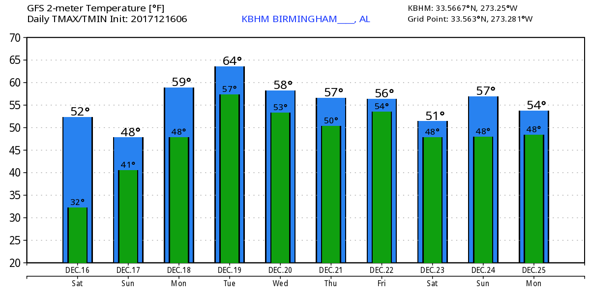
Turning Cloudy, Wet After Today
High cirrus clouds were streaming across the Alabama sky this morning as we start the day out on a very chilly note. High pressure had settled into the Southeast US with the center of the high right over Auburn, AL, and morning readings were in the 20s all the way down to extreme southern Alabama. We should see a good deal of sunshine today though it will be filtered through high cirrus clouds. High temperatures will reach the upper 40s and lower 50s.
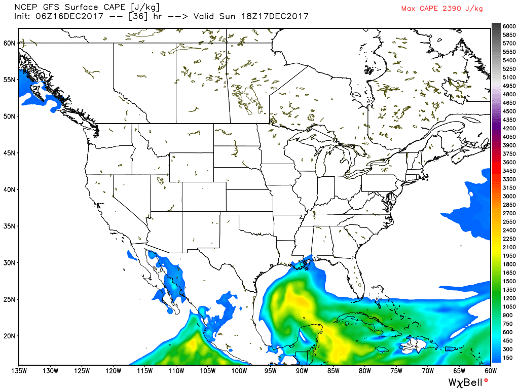
After today, the pattern turns wet. Just how wet depends on which model you choose to make the forecast from. The ECMWF is much drier than the NAM or the GFS, but even with the drier ECMWF, it will be cloudy for most of the first half of the week. The upper air pattern starts out with two short waves in the Southwest US, one over extreme West Texas, and another over southern California. The first one ejects out quickly reaching the Ohio River Valley by midday on Sunday. Rain should push eastward with this system, be the strong ridge in place over Cuba and the Bahamas will slow the eastward progression of rain on Sunday. West Alabama will see rain Sunday morning, while East Alabama may not see rain at all with much drier air in place there along with the substantial ridge. We should see some warming with southwesterly flow aloft along with a return to southerly flow at the surface. I expect to see highs in the lower to middle 50s. There does not appear to be enough instability to have concerns for severe weather except along the immediate coast.
The second short wave comes across northern Mexico on Monday keeping us in a moist southwesterly flow aloft. Rain will still be an issue though the pattern suggests greater rain amounts across South Alabama. Highs Monday should climb a bit more as the atmosphere continues to warm slightly with highs in the lower 60s.
Tuesday and Wednesday the short wave over West Texas moves eastward as it weakens, so the weather remains wet. The short wave exits our area by Thursday as the overall pattern resets into a weak upper ridge in response to another upper low digging into the Four Corners area. This should also bring an end to precipitation for Thursday Friday. High temperatures will be in the upper half of the 50s and lower half of the 60s.
Rainfall for the five days ending on Thursday morning will likely have an east to west gradient in amounts with higher amounts of 2 to 3 inches across West Alabama and 1 to 2 inches in East Alabama. See the chart below.

The “dry spell” is short lived, though, as the closed low over the Southwest US detaches from the trough over the North Central US. With southwesterly flow aloft packing in the moisture along with a surface front coming at us from the northwest, we’ll have to ramp up rain chances for the latter part of Friday and into Saturday. At this point in the forecast it looks like there could be a concern for wintery precipitation across the southern US. Thicknesses along with the upper ridge holding tough across the Southeast US, it would appear that the better chances for wintery weather will be well west of Alabama. This is verging on voodoo country, so I’m not stepping into a forecast that obviously will see many changes before we reach that time period.
Looking out into voodoo country, the pattern is suggestive of a wet Christmas without the chance for a white Christmas in the Southeast US thanks mainly to an upper air pattern that does no indicate much cold. In fact the pattern remains very flat for much of the last few days of December and 2017, a pattern that just seems somewhat unlikely after all the changes we’ve seen over the last couple of weeks. I suspect strongly that the pattern in voodoo country tomorrow will look dramatically different.
Beach Forecast: Click here to see the AlabamaWx Beach Forecast Center page. The Beach Forecast is partially underwritten by the support of Brett/Robinson Vacation Rentals in Gulf Shores and Orange Beach. Click here to see Brett/Robinson’s Hot Deals now!
WeatherBrains: Don’t forget you can listen to our weekly 90 minute netcast anytime on the web, or on iTunes. This is the show all about weather featuring many familiar voices, including our meteorologists here at ABC 33/40.
I expect to have the next edition of the Weather Xtreme Video posted here by 7 am or so on Sunday. Have a great day and Godspeed.
-Brian-
Category: Alabama's Weather, ALL POSTS
About the Author (Author Profile)
Brian Peters is one of the television meteorologists at ABC3340 in Birmingham and a retired NWS Warning Coordination Meteorologist. He handles the weekend Weather Xtreme Videos and forecast discussion and is the Webmaster for the popular WeatherBrains podcast.Subscribe
If you enjoyed this article, subscribe to receive more just like it.


