A Brief Look At Central Alabama’s Weather Situation At Midday
RADAR CHECK AT 11:15 AM
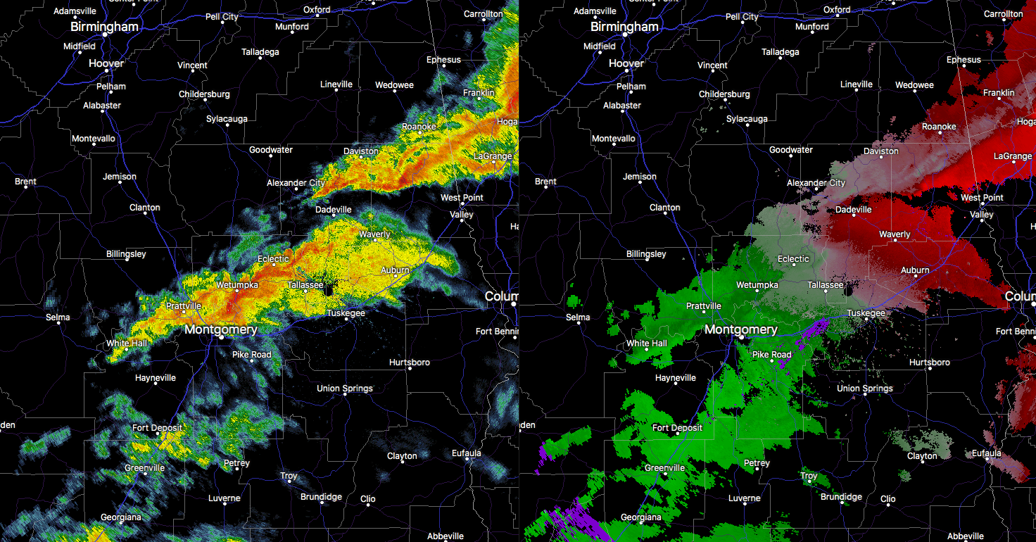
The good news is that the severe weather threat for much of Central Alabama is over. The bad news is that there is a broken line of intense rainfall that has the potential for isolated damaging wind gusts and a brief spin-up tornado or two that is stretching from Roanoke to Alexander City to Eclectic to Montgomery to White Hall. None of these have any lightning associated with them, but we are watching for any signs of rotation with these.
So for the next two hours, the threat of any severe weather will be along and north of I-85 in the east and southeastern parts of Central Alabama, until this activity moves into Georgia.
For the rest of Central Alabama throughout the remainder of the day, there may be a few light showers or sprinkles that develop throughout the daylight hours, but the nearly everyone will be able to dry out. Afternoon highs will be in the mid-60s to the lower 70s. For tonight, there will be a very small risk of some leftover light showers or sprinkles in the extreme eastern parts of the area, while everyone else will have the potential for patchy dense fog development. Overnight lows will be in the upper 40s to the mid-50s.
Category: Alabama's Weather, ALL POSTS
About the Author (Author Profile)
Scott Martin is an operational meteorologist, professional graphic artist, musician, husband, and father. Not only is Scott a member of the National Weather Association, but he is also the Central Alabama Chapter of the NWA president. Scott is also the co-founder of Racecast Weather, which provides forecasts for many racing series across the USA. He also supplies forecasts for the BassMaster Elite Series events including the BassMaster Classic.Subscribe
If you enjoyed this article, subscribe to receive more just like it.


