

Mostly Cloudy And Not That Bad Outside At 2:30 PM
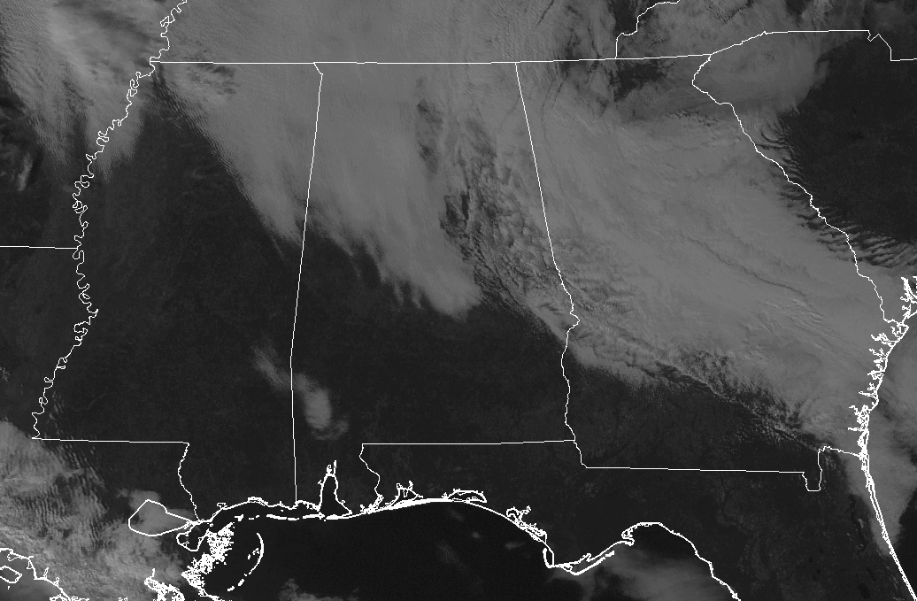
At this point on this mostly gray Thursday afternoon, radar is clear and temperatures are ranging from the lower 50s to the mid-60s in the north to the upper 50s to the upper 60s in the south. The temperatures are clearly showing where the cloud cover is less or a good amount of sunshine is making it to the surface… sure doesn’t feel like the first day of winter outside. For the remainder of the afternoon and early evening hours, skies will remain mostly cloudy with highs ranging from the mid-50s to the upper 60s from north to south. Skies will be mostly cloudy for tonight with fog developing before midnight, then a chance of showers start to creep in after midnight for the western 2/3rds of the area. Lows will be in the lower to mid-50s.
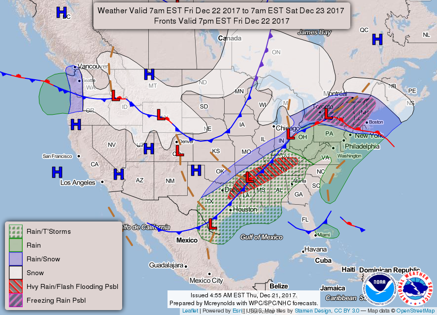
Tomorrow’s weather will continue to be mild with mainly cloudy skies, but we’ll add a chance of scattered showers for a good part of the day. Some of those showers may have a few rumbles of thunder, but severe storms are not expected. Afternoon highs will be in the mid-60s to the lower 70s throughout Central Alabama. Tomorrow night, the chances for scattered showers will diminish somewhat, but there is a very small chance throughout the late night and overnight hours before a line of showers and storms associated with a cold front starts to move in before daybreak on Saturday. Lows will be in the upper 50s to the lower 60s.
Category: Alabama's Weather, ALL POSTS
About the Author (Author Profile)
Scott Martin is an operational meteorologist, professional graphic artist, musician, husband, and father. Not only is Scott a member of the National Weather Association, but he is also the Central Alabama Chapter of the NWA president. Scott is also the co-founder of Racecast Weather, which provides forecasts for many racing series across the USA. He also supplies forecasts for the BassMaster Elite Series events including the BassMaster Classic.Subscribe
If you enjoyed this article, subscribe to receive more just like it.


