

A Brief Check On Our Weather At 9:45 PM
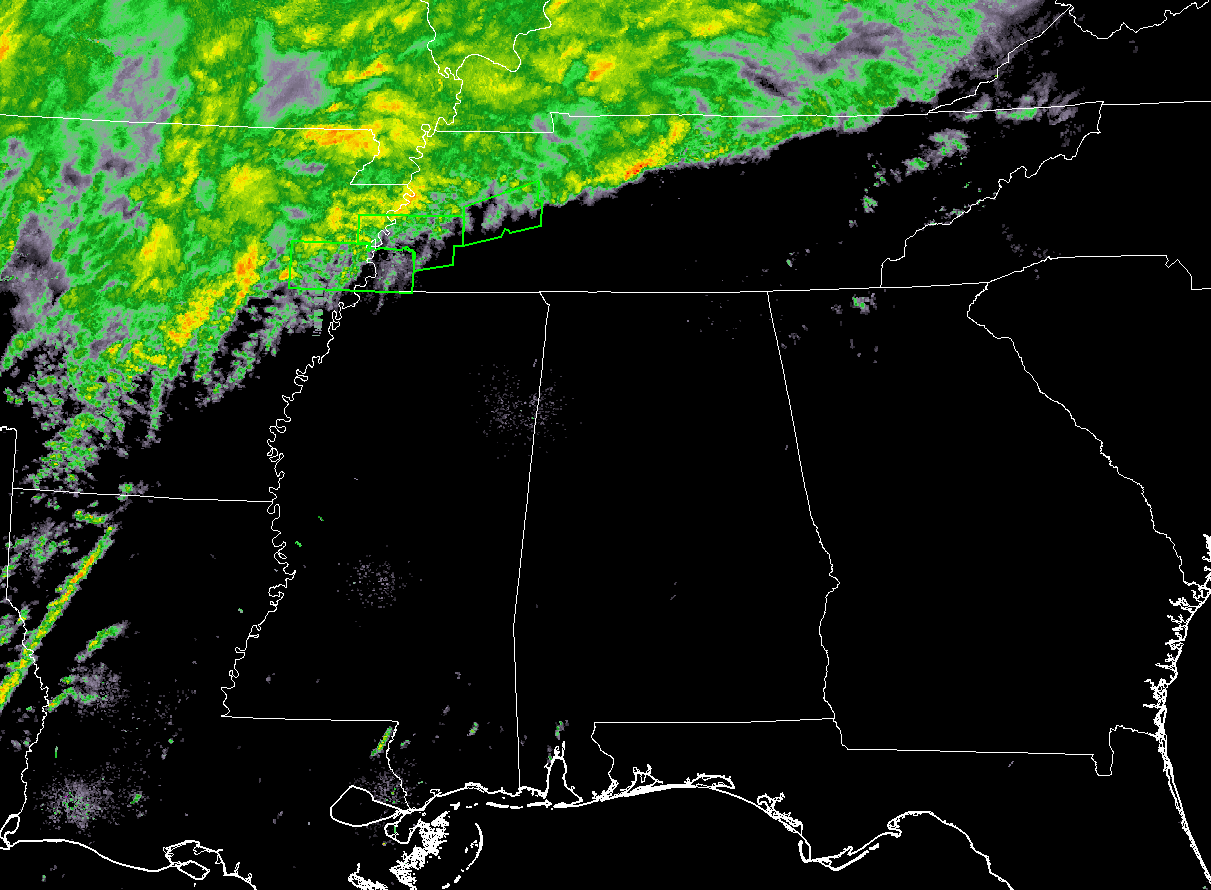
At this point of the night (9:30 PM), there are no issues at all for Alabama. Radar is relatively quiet with the exception of a lone shower located over the central part of Lowndes County. All of the rain and thunderstorm activity is located well back to our west over Arkansas and Louisiana and up to the north in Tennessee and Kentucky, with a few Flash Flood Warnings in effect for parts of southwestern Tennessee. No convective watches or warnings are currently in effect.
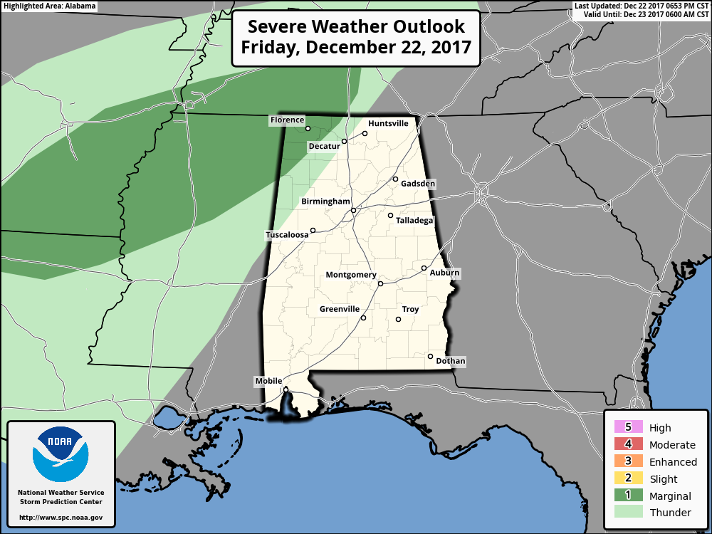
The Storm Prediction Center continues to have the northwestern part of the state in a Marginal Risk for severe storms throughout the remainder of tonight and the pre-dawn hours of Saturday. Showers and thunderstorms will enter that part of the state during the 2AM-4AM time frame on Saturday morning before dawn. These embedded storms will be capable of producing locally damaging wind gusts and the possibility of a brief tornado or two.
Dewpoints in that part of the state are already in the lower 60s, and with an 850mb jet max developing over Kentucky and Tennessee during the overnight hours, we could definitely see a few storms becoming strong to severe in nature that will be capable of producing damaging winds and a brief tornado.
All of these will stay in the northwestern parts of the state until daybreak, before moving into Central Alabama and into the rest of North Alabama during the morning.

SPC continues to have nearly all of North Alabama and a good bit of the northern half of Central Alabama in a Marginal Risk of severe storms throughout the day on Saturday. With the higher dewpoints in the risk area, and some instability values ranging from 250-350 J/kg, a few storms could reach strong to severe in intensity with damaging thunderstorm wind gusts up to 60 MPH being the main risk. I can’t rule out a brief tornado or two, but the threat of those will be mighty low.
The way it looks as of now, much of the instability will have dissipated by late morning and the severe threat should be over for the marginal risk area no later than noon Saturday. Much of the shower and storm activity will be out of the northern half of the area by 2:00 PM and will mainly be confined east of I-65 along and south of the I-85 corridor in the southeastern parts of the area.
Category: Alabama's Weather, ALL POSTS
About the Author (Author Profile)
Scott Martin is an operational meteorologist, professional graphic artist, musician, husband, and father. Not only is Scott a member of the National Weather Association, but he is also the Central Alabama Chapter of the NWA president. Scott is also the co-founder of Racecast Weather, which provides forecasts for many racing series across the USA. He also supplies forecasts for the BassMaster Elite Series events including the BassMaster Classic.Subscribe
If you enjoyed this article, subscribe to receive more just like it.


