

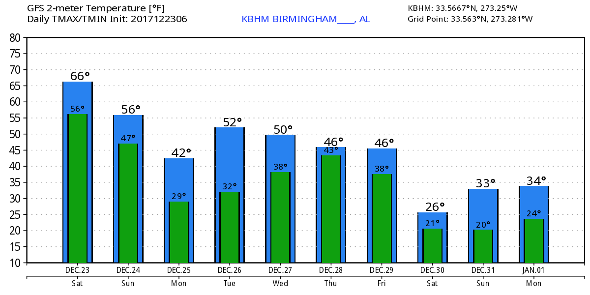
Wet and Warm Goes Dry and Cold
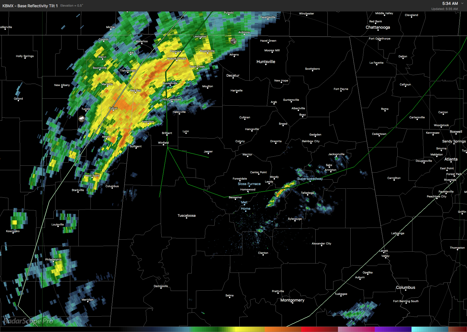
The surface pattern this morning features a surface low near Muscle Shoals with a cold front making its way across Alabama coming out of eastern Mississippi. Much of Central Alabama is cloudy but radar showed the rain stretching from just west of Huntsville southwestward to just west of Columbus, MS. A few scattered showers were is southern St. Clair and eastern Shelby counties. Temperatures were mild with readings ahead of the front in the 60s, but temperatures plunged into the 40s behind the front in West Tennessee. The highs for today across much of Central Alabama will be in the upper 60s, maybe even lower 70s, but once the front passes a location, temperatures will drop into and through the 50s reaching the 40s shortly after sunset.
Birmingham Bowl: The annual Birmingham Bowl is today; Texas Tech vs South Florida. The game kicks off at 11:00 am at Legion Field. Rain is likely during the game with a decent chance the second half will see the rain dimishing. Temperatures will be in the middle 60s at kickoff, falling into the middle 50s by the final whistle as the wind comes around to the north.
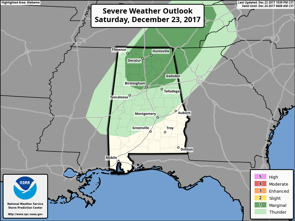
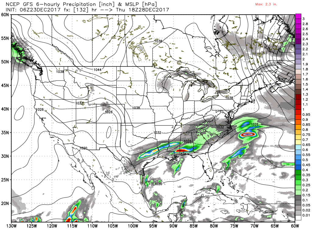
Rainfall today and then again Wednesday and Thursday should result in amounts of one half to three-quarters of an inch. There is a marginal severe weather risk across the northern third of Alabama as defined by SPC. The NWS in Huntsville has issued a couple of warnings this morning. While an isolated marginally severe thunderstorm is possible, I think SPC has the right idea with their outlook.
The strong upper trough will move across the eastern US very quickly exiting the East Coast by early Sunday. A second strong trough is moving southward in the flow right behind that first one, and this one will bring some cold air into the Southeast US for Christmas Day. Temperatures Sunday will not likely get out of the 50s, but on Christmas Day we should see the highs struggle to reach the middle 40s – upper 40s for some south of Birmingham. It will be dry on Christmas Day, but we’re likely to see some clouds as the upper short wave moves through the base of the broad trough over the eastern US. GFS suggests some light snow north of Alabama as that short wave moves briskly by early Christmas morning.
There is no rest for weather forecasters. We stay dry into Tuesday as the upper flow becomes nearly zonal for the eastern two-thirds of the country. Tuesday morning will see lows in the middle 20s while afternoon highs will reach near 50, so overall pretty chilly. Then we see a subtle split in the flow pattern as southwesterly flow begins to tap into Pacific moisture bringing the Southeast US into an overrunning situation. The main threat for much of the Southeast US will be rain chances from Wednesday into Friday, however, we’ll have to watch the development of the overrunning carefully with cold air sitting across Tennessee.
This split flow pattern sticks around until Friday when another strong short wave comes into the western Great Lakes region and digs southeastward into the East Coast on Saturday. This promises to bring dry weather once again along with another round of very cold weather for the eastern US as a strong surface high of 1047 millibars develops in South Central Canada opening up the freezer door once again for us with lows Saturday potentially near 20 degrees with highs only in the lower 40s.
Looking out further into voodoo country, there is one thing that is abundantly clear – and that is that the pattern is going to remain very active. A strong short wave comes out of the Rockies around the 1st of January with two more troughs coming into the eastern US by the 2nd of January. This sets up a potential winter weather threat for the Southeast US around the 2nd. We’re not going to jump on a forecast of ice and snow out in voodoo country, but this is something we will need to watch. Did I say the pattern was active? Another very strong trough with the potential of a cut-off low over northern Mexico is projected around the 4th of January. By the 7th of January we come under upper ridging which brings the promise of a warm and wet pattern across the Southeast US as more Pacific moisture is picked up and traverses Mexico into the Southeast US. But remember, all of this is voodoo with no real skill, but definitely something to watch.
Beach Forecast: Click here to see the AlabamaWx Beach Forecast Center page. The Beach Forecast is partially underwritten by the support of Brett/Robinson Vacation Rentals in Gulf Shores and Orange Beach. Click here to see Brett/Robinson’s Hot Deals now!
WeatherBrains: Don’t forget you can listen to our weekly 90 minute netcast anytime on the web, or on iTunes. This is the show all about weather featuring many familiar voices, including our meteorologists here at ABC 33/40.
James Spann is on vacation for the next week, so we will be on the typical one-a-day cycle with the Weather Xtreme Videos until he returns on January 1st. I will also be filling in for Charles Daniel on ABC 3340 news at 6 and 10 pm this evening. Have a great day and get ready for some cold weather.
-Brian-
Category: Alabama's Weather, ALL POSTS
About the Author (Author Profile)
Brian Peters is one of the television meteorologists at ABC3340 in Birmingham and a retired NWS Warning Coordination Meteorologist. He handles the weekend Weather Xtreme Videos and forecast discussion and is the Webmaster for the popular WeatherBrains podcast.Subscribe
If you enjoyed this article, subscribe to receive more just like it.


