Latest Model Runs Are In For New Year’s… Looking Like A Turnip Green Soup Day
My wife says that with Monday looking as cold as the models are painting, it will be a great day to stay indoors and enjoy a helping of hot turnip green soup and black-eyed peas. The latest 12z model runs are in and we are still getting a mixed bag of solutions from the GFS and the European. It’s safe to say that our confidence level in the forecast for New Year’s Eve and New Year’s Day is still rather low. We’ll have to wait until the event gets closer, but at this point, we know that the precipitation will quickly come to an end just after the midnight hour on Monday, the beginning of 2018. Monday will be very cold as well… so here are the latest trends.
Latest Run Of The GFS (12z)
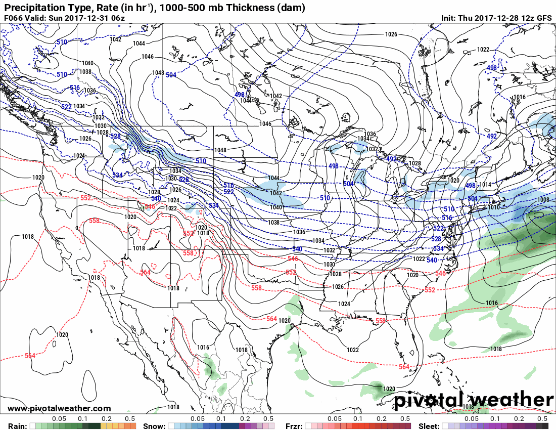
So with this run of the model, it is painting a mainly dry two day period for Central Alabama to end 2017 and to start 2018. Moisture does develop over Louisiana and Texas early on Sunday morning, but as it progresses eastward throughout the day, it stays over the southern parts of Mississippi and Alabama with only a small tongue of sleet on the northern periphery of the moisture. The precipitation dissipates for nearly all of Alabama with the exception of a few showers for the Gulf Coast and up into northern Mobile and Baldwin counties. The 540 line on this chart, also known as the freezing line, stays well north of the precipitation and doesn’t make it into the Birmingham metropolitan area until after midnight and the start of 2018.
For those heading to New Orleans for the Sugar Bowl on Sunday, you will encounter some shower activity with the possibility of a few sleet pellets hitting your windshield during the late morning to the early afternoon hours. A few scattered light showers or sprinkles may persist into the evening and late night hours on Sunday, but after midnight all of the remaining moisture will be out over the Gulf of Mexico and Monday will be a dry day. The high for Birmingham is forecast to be around 30 degrees.
For those heading to Atlanta for the Peach Bowl, your trip will be dry no matter what time you leave on Sunday or Monday.
Latest Run Of The European (12z)
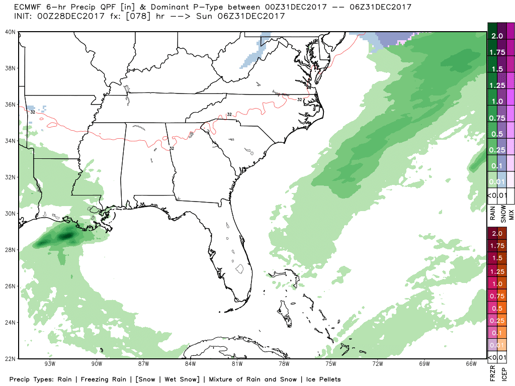
Now the European is totally painting a different picture for the same time frame on Sunday and Monday, with moisture already developing back to our west during the pre-dawn hours on Sunday and moving into the western parts of the state by daybreak. When we get to noon, we see that a wintry mix and snow will be moving into the northwestern parts of the state, while rain is in the west and southwestern parts. The good news at this point is that the activity appears to be light in nature, so major accumulations at this point are unlikely.
As we move forward to 6:00 PM Sunday, All of the northern half of Central Alabama will be seeing snow flurries to light snow showers with a very small transition zone just south of Birmingham where sleet will be mixed with rain before becoming all rain south of that. By the time we ring in the New Year at midnight, all of the snow activity has dissipated and the southern half of the state will be seeing showers at that point.
By sunrise on Monday morning, All rain has ended for Central Alabama and the cold air starts to invade the state from the north. This run of the European is only painting a high temperature for Birmingham at 30 degrees and will no be above freezing again until around noon on Tuesday.

Looking at the accumulations map valid at midnight Tuesday, a light dusting of snow is possible for much of the northern half of the state, with the possibility of a few spots seeing some small ice accumulation from freezing rain. With this solution, there could be some travel issues from the I-20 corridor to the north in Alabama on Sunday afternoon and evening. It may be best if you could leave on Saturday if you are heading to the Sugar Bowl or the Peach Bowl with this solution.
Category: ALL POSTS, Winter Weather
About the Author (Author Profile)
Scott Martin is an operational meteorologist, professional graphic artist, musician, husband, and father. Not only is Scott a member of the National Weather Association, but he is also the Central Alabama Chapter of the NWA president. Scott is also the co-founder of Racecast Weather, which provides forecasts for many racing series across the USA. He also supplies forecasts for the BassMaster Elite Series events including the BassMaster Classic.Subscribe
If you enjoyed this article, subscribe to receive more just like it.


