

Midday Report: We’ll Be Above Freezing Today But Back In The Deep Freeze For Tomorrow
HOW’S THE WEATHER OUT THERE AT MIDDAY
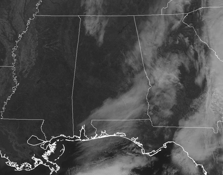
Other than a few high clouds wrapping around the backside of a low-pressure system that is nailing the southern Atlantic coast with ice and snow, North and Central Alabama is mainly clear at this point on your Wednesday. Nearly every reporting station in the area is above freezing at 12:08 PM, but Muscle Shoals, Decatur, and Albertville are still coming in at or just below freezing. Temperatures are ranging from the lower 30s in the north to the lower 40s in the south.
WEATHER FOR THE REST OF YOUR WEDNESDAY

Believe it or not, nearly all locations in North/Central Alabama will get above freezing this afternoon, as highs should top out in the mid-30s in the north to the mid-40s in the south. A cold front moves through the area during the late night and overnight hours, bringing a reinforcing shot of cold air. Overnight lows will bottom out in the lower teens in the north to the lower 20s in the south.
CURRENT WATCHES, WARNINGS, & ADVISORIES
NWS Huntsville has issued a Wind Chill Advisory for Dekalb, Jackson, Madison, and Marshall counties starting at 12:00 AM Thursday and ending at 9:00 AM Thursday. Skies will become clear throughout the area with the exceptions of a cloud or two in the northeastern parts of North Alabama.
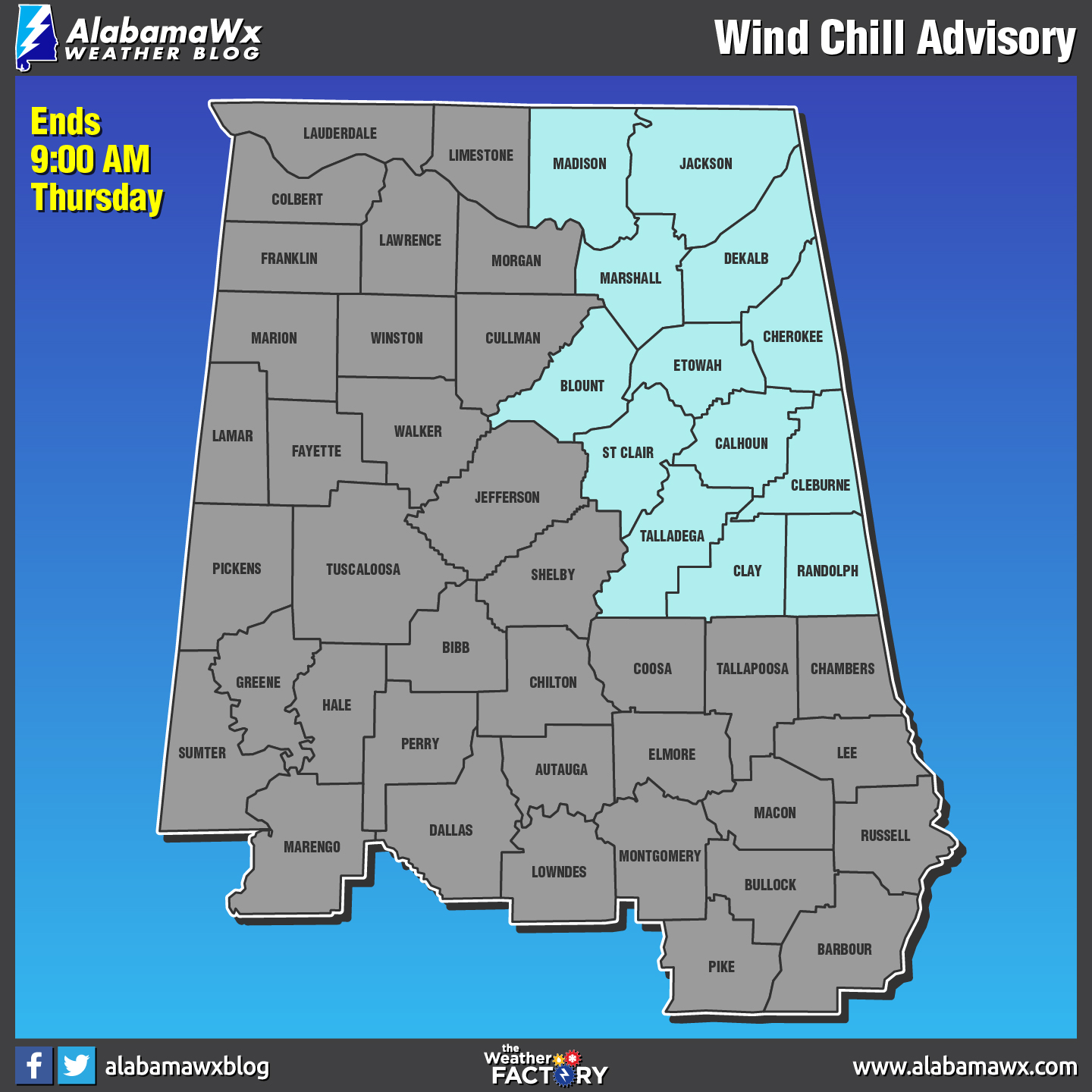
NWS Birmingham has issued a Wind Chill Advisory for Blount, Calhoun, Cherokee, Clay, Cleburne, Etowah, Randolph, St. Clair, and Talladega counties starting at 2:00 AM Thursday and ending at 9:00 AM Thursday.
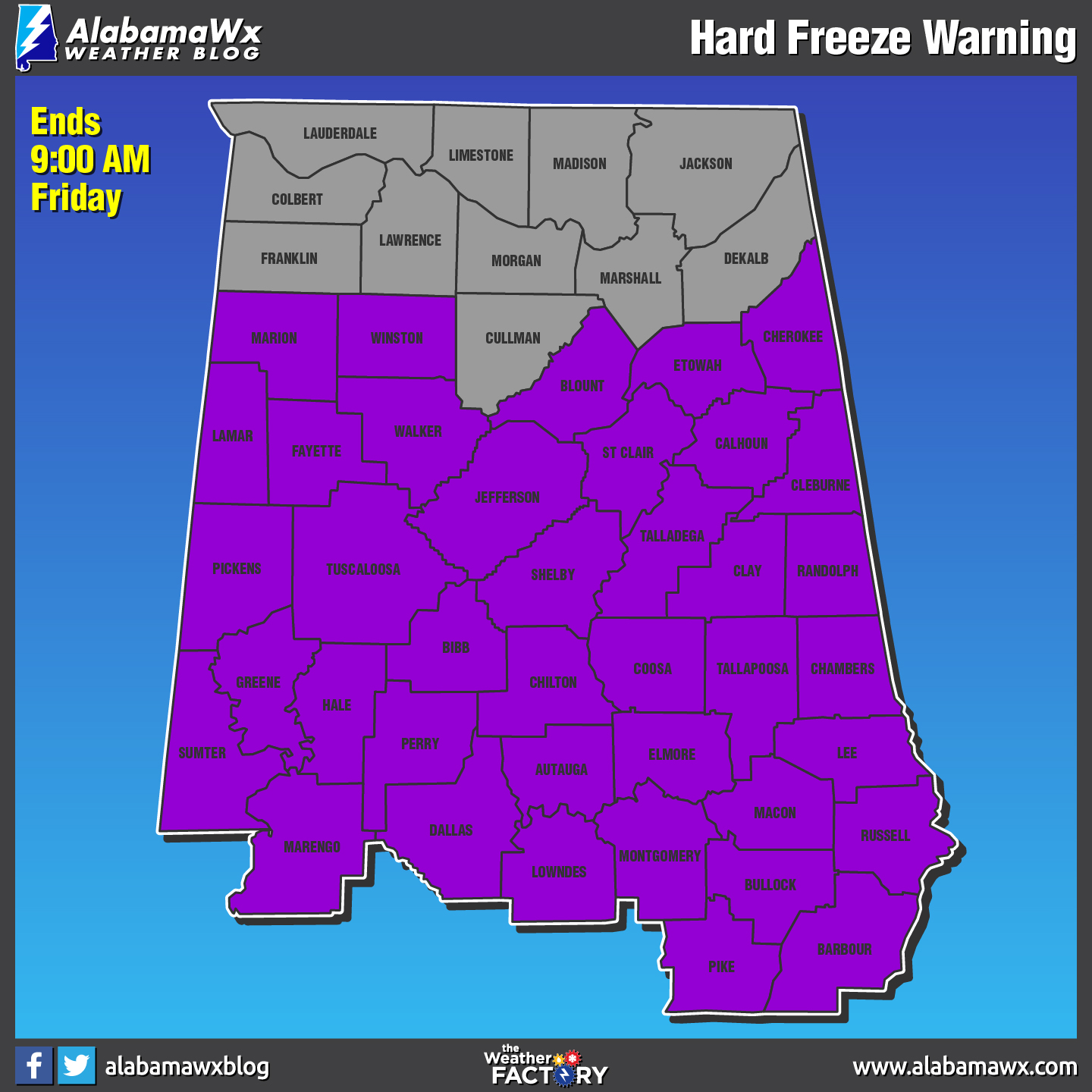
NWS Birmingham continues a Hard Freeze Warning for all of their counties until 9:00 AM Friday.
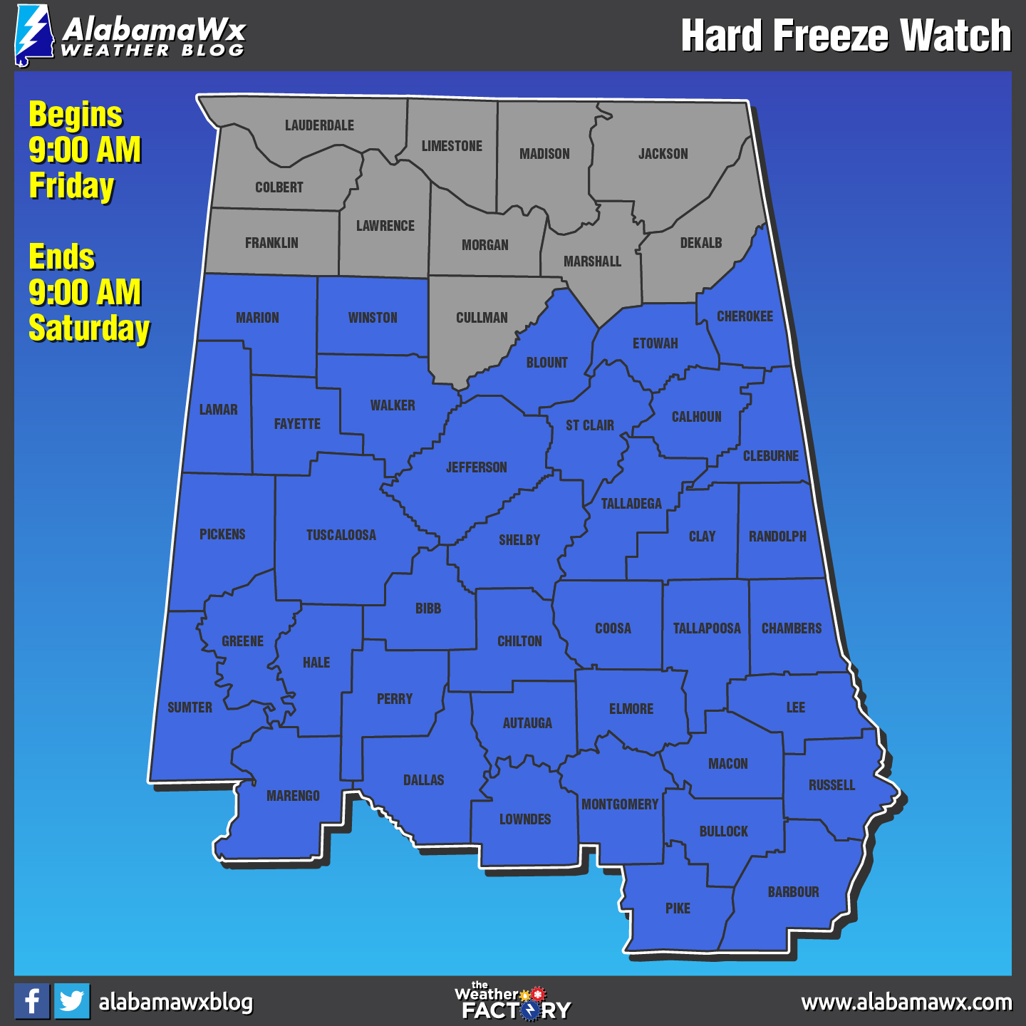
NWS Birmingham has issued a Hard Freeze Watch for all of their counties starting at 9:00 AM Friday and ending at 9:00 AM Saturday.
SHIVER ME TIMBERS… IT’S NASTY COLD AGAIN FOR THURSDAY

All of North Alabama and the northern parts of Central Alabama will stay below freezing throughout the day after the passage of the cold front that moved through the area earlier during the pre-dawn hours. Even with mainly sunny skies, afternoon highs will only top out in the mid-20s in the north to the upper 30s to near 40 in the south. Tomorrow night will once again be bitterly cold, with lows dropping into the lower teens in the north to the upper teens in the south.
ON THIS DAY IN WEATHER HISTORY
1777 – An overnight freeze enabled George Washington and his troops to flank the British at Trenton, cross their lines at Princeton, and seek security in the hills of northern New Jersey.
THE BEACH FORECAST
Click here to see the AlabamaWx Beach Forecast Center page. The Beach Forecast is partially underwritten by the support of Brett/Robinson Vacation Rentals in Gulf Shores and Orange Beach. Click here to see Brett/Robinson’s Off-Season Deals now!
WEATHERBRAINS
Check out the show at www.WeatherBrains.com. You can also subscribe on iTunes. You can watch the show live at live.bigbrainsmedia.com. You will be able to see the show on the James Spann 24×7 weather channel on cable or directly over the air on the dot 2 feed.
E-FORECAST
Get the Seven-Day Forecast delivered directly to your inbox by email twice daily. It is the most detailed weather forecast available in Central Alabama. Subscribe here. It’s free!
ADVERTISE WITH US
Don’t miss out! We can customize a creative, flexible and affordable package that will suit your organization’s needs. Contact Bill Murray at (205) 687-0782.
Category: Alabama's Weather, ALL POSTS
About the Author (Author Profile)
Scott Martin is an operational meteorologist, professional graphic artist, musician, husband, and father. Not only is Scott a member of the National Weather Association, but he is also the Central Alabama Chapter of the NWA president. Scott is also the co-founder of Racecast Weather, which provides forecasts for many racing series across the USA. He also supplies forecasts for the BassMaster Elite Series events including the BassMaster Classic.Subscribe
If you enjoyed this article, subscribe to receive more just like it.


