A Brief Check On Our Weather At 5:40 AM
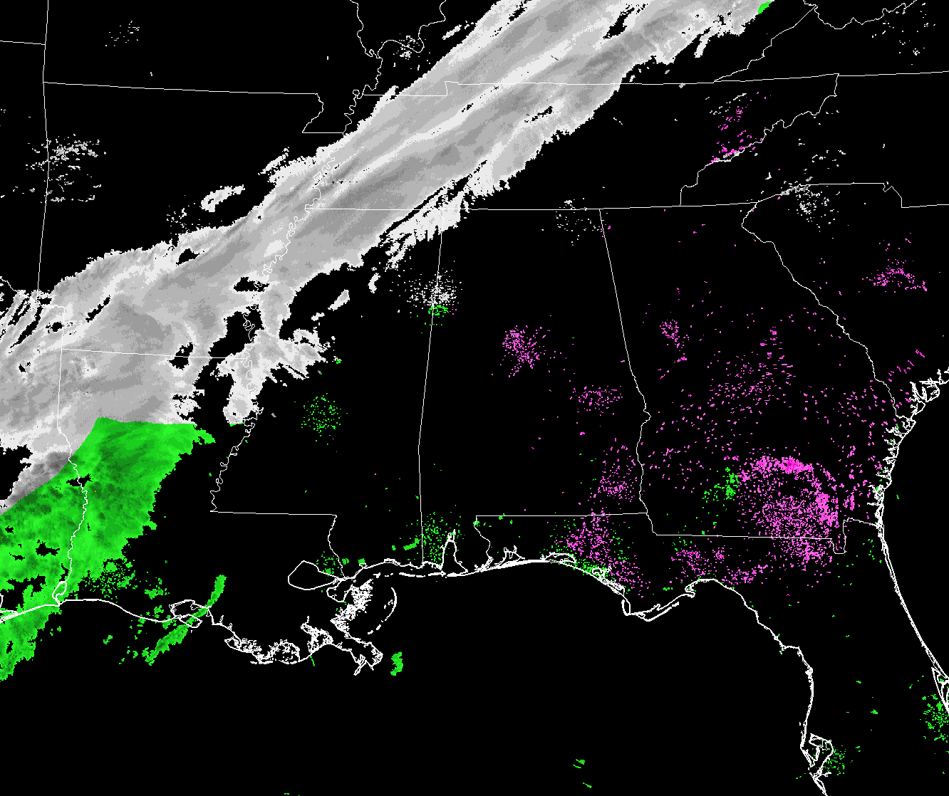
Taking a look at the radar composite of the southeastern United States at 5:34 AM, the band of snow has started to enter the northwestern corner of the state. Temperatures at this point are ranging from the mid-20s in the northern parts of North Alabama to the lower 30s in the southernt part of Central Alabama. Birmingham was at 30 degrees.
The forecast for today’s winter weather event is still on track that could lead to significant icing issues soon after the snow starts in your location. The cold front has already moved into the northwestern corner of Central Alabama at this point, and once it passes your location, the temperature will begin to fall and will do so until sunrise on Wednesday morning.
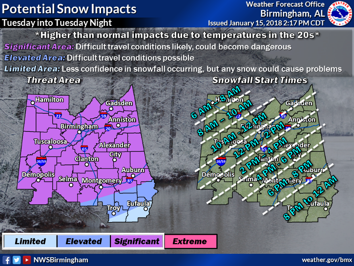
The latest coming in from our northwest is showing that the system is overperforming a little, so the snowfall accumulations across the area could now range from 1.0 to 1.5 inches with some locally heavier amounts. There may be a possibility of an increase in accumulations due to an approaching vorticity maximum which could enhance the snowfall this afternoon and into tonight. A Winter Storm Warning may be needed if this situation looks more evident throughout the day. If this occurs, accumulations may reach up to 4 inches in locations along and east of I-59.
Along with the snow threat comes a major cooldown, as very frigid arctic air will invade the state behind the cold front. A Wind Chill Advisory has been issued for all of North and Central Alabama, along with a Hard Freeze Watch for all of Central Alabama, both until 9:00 AM Wednesday. Low temperatures are expected to bottom out in the 5 to 15-degree range from the Tennessee state line down to Troy and Eufaula. Combine those temperatures with winds out of the north up to 15 MPH, wind chills will be in the -5 to 5-degree range. Frostbite and hypothermia can occur very quickly if precautions are not taken. Make sure you wear a hat and gloves.
Please remember the 4-Ps… People, Pets, Plants, and Pipes. The cold air that will be in place can cause damage to plants and property, so be sure you take the proper steps to protect those. Be sure to check on the elderly and make sure they have proper and safe ways of staying warm. Bring those pets indoors as this cold will be harmful or even deadly.
Keep checking back with us on the blog throughout the day for the latest updates, and follow us on Twitter and Facebook (@AlabamaWxBlog).
Category: Alabama's Weather, ALL POSTS
About the Author (Author Profile)
Scott Martin is an operational meteorologist, professional graphic artist, musician, husband, and father. Not only is Scott a member of the National Weather Association, but he is also the Central Alabama Chapter of the NWA president. Scott is also the co-founder of Racecast Weather, which provides forecasts for many racing series across the USA. He also supplies forecasts for the BassMaster Elite Series events including the BassMaster Classic.Subscribe
If you enjoyed this article, subscribe to receive more just like it.


