Just A Brief Check On Our Conditions at 9:30 AM
SATELLITE & TEMPERATURE CHECK
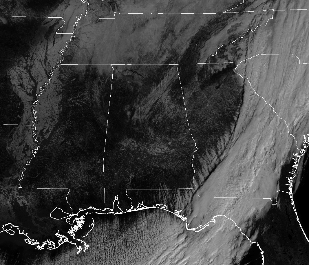
All of the snowfall and cloud cover in association with the system that brought light snow and icy conditions to the state has now pushed well off to our east into the Carolinas and Georgia. We are left with a few small clouds overhead that are blocking some of the sunlight at this point, and that will not help our temperatures at all. Looking at the latest visible satellite image, you can clearly see snowfall covering the ground along and around the Mississippi River from Missouri all of the way down to Louisiana. Some of the white you see in South Alabama is snowfall as well.
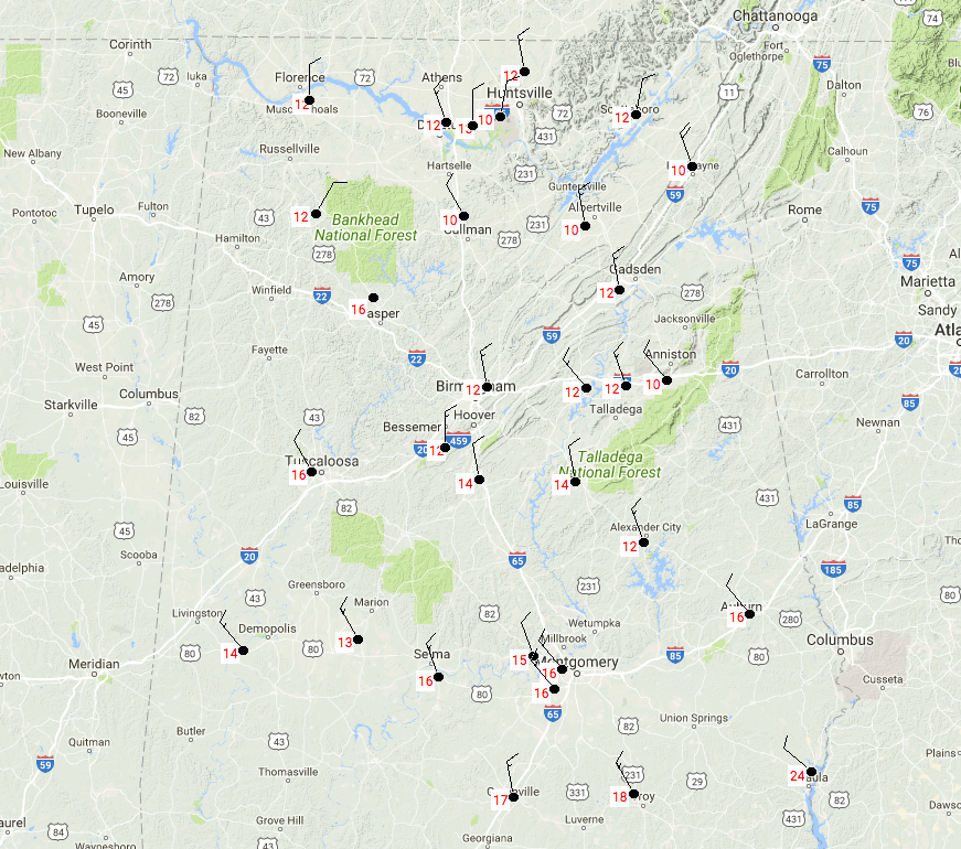
At 9:11 AM, temperatures have finally made into the teens throughout North and Central Alabama, with lower to mid-20s in the extreme southeastern parts. It was 10 degrees in Cullman, Albertville, Oxford, Fort Payne, and Huntsville International Airport… all of these tied as the cool spots. Eufaula is the “warm spot” at 24 degrees. Birmingham International Airport is only at 12 degrees at this point. With winds gusting to over 15 MPH out of the north, wind chills are running anywhere from 7 to 12 degrees colder than the actual temperature. As you will see, Wind Chill Advisories continue for all of North and Central Alabama.
WATCHES, ADVISORIES, & WARNINGS CURRENTLY IN EFFECT
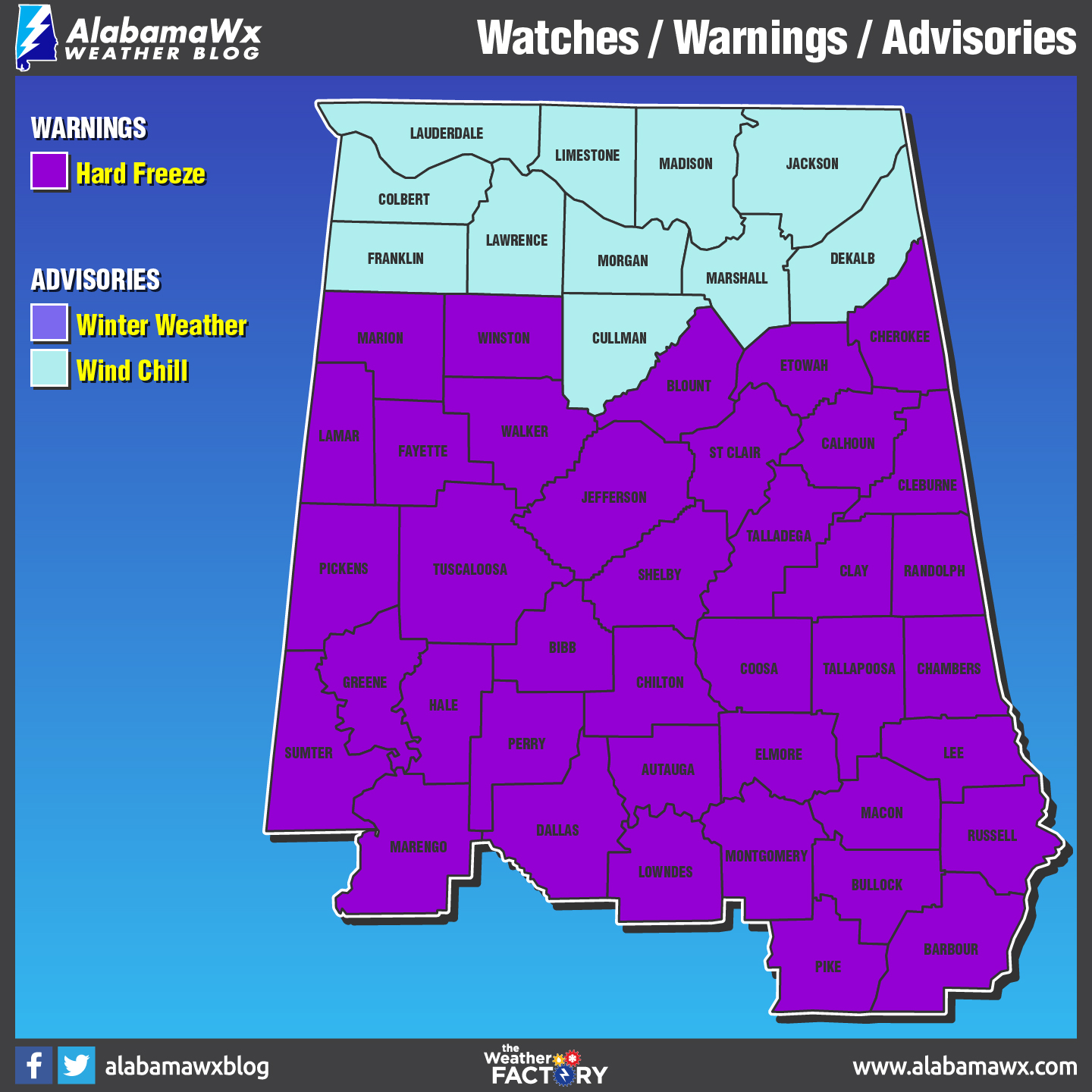
A Wind Chill Advisory is in effect for all counties in North Alabama until 12:00 PM today.
A Wind Chill Advisory has been extended for all counties in Central Alabama until 12:00 PM today (not seen on the map due to the Hard Freeze Warning).
A Hard Freeze Warning is in effect for all counties in Central Alabama until 9:00 AM Wednesday.
The Winter Weather Advisory that was in effect until 8:00 AM today has expired.
The Wind Chill Warning that was in effect for Jackson County in North Alabama until 9:00 AM today has expired.
REST OF TODAY
We’ll continue to have a few clouds overhead throughout the morning and afternoon hours, and a few flurries may be possible. It will feel much colder out there due to winds possibly gusting up to 15-25 MPH out of the north. Afternoon highs will continue to stay below freezing throughout the area, ranging from the lower 20s in the north to the lower 30s in the south. Skies will clear out by the time we reach sunset and temperatures will fall rapidly once again. Overnight lows will range from the lower teens in the north to the upper teens in the south.
ROAD CONDITIONS
Hazardous travel conditions will persist through much of Wednesday morning as temperatures will remain below freezing. Travel is strongly discouraged through this morning. If you must travel, use extreme caution, especially on bridges, overpasses, and elevated highways. Reduce travel speed as appropriate and leave extra room for vehicles in front of you. Do not assume that a well-traveled road will be totally free of ice. Dress warmly and keep a winter travel kit in your vehicle. For the latest on road closures in your location, please visit the ALGO Traffic website.
Category: Alabama's Weather, ALL POSTS
About the Author (Author Profile)
Scott Martin is an operational meteorologist, professional graphic artist, musician, husband, and father. Not only is Scott a member of the National Weather Association, but he is also the Central Alabama Chapter of the NWA president. Scott is also the co-founder of Racecast Weather, which provides forecasts for many racing series across the USA. He also supplies forecasts for the BassMaster Elite Series events including the BassMaster Classic.Subscribe
If you enjoyed this article, subscribe to receive more just like it.


