Skies Have Cleared But Some Roadways Continue To Be An Issue
CONDITIONS AT 1:50 PM
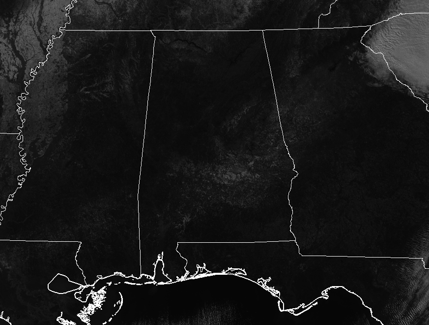
It has turned out to be a beautiful afternoon across North and Central Alabama as all cloud cover has moved out of the state and we’re receiving maximum sunshine. The good news is that the direct sunshine is melting some of the ice on the roadways, but the very cold temperatures is making that process very slow. Winds out of the north gusting up to 20 MPH at times are making it feel much, much colder than the actual temperature.
TEMPERATURES AT 1:50 PM
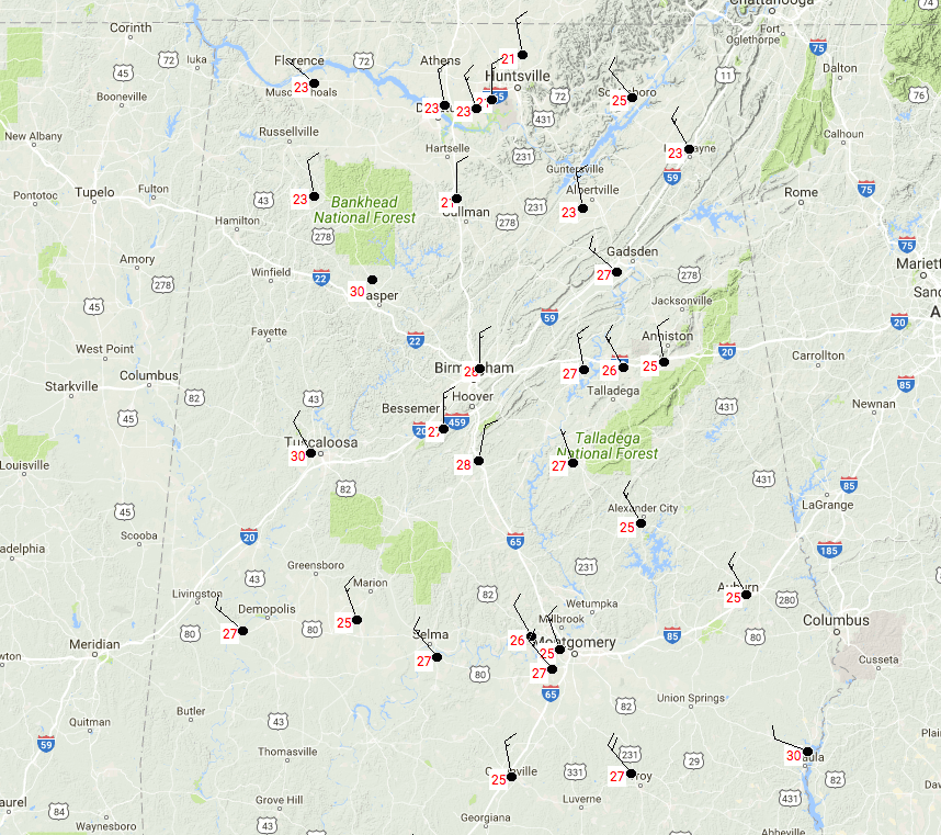
Believe it or not, all locations in North and Central Alabama have made it into the 20s, considering that most were in the single digits at daybreak. Only one reporting station was at 30 degrees and that was Eufaula. Wind chills are still running as much as 8 to 13 degrees cooler than the actual temperature. So Birmingham was at 28 degrees with a wind chill of 15 degrees at 1:50 PM.
CURRENT WATCHES, WARNINGS, & ADVISORIES IN EFFECT
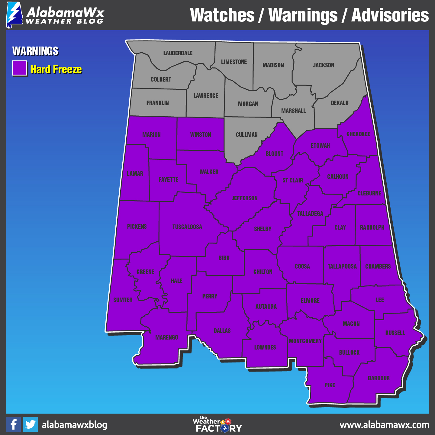
A Hard Freeze Warning is in effect for all counties in Central Alabama until 9:00 AM Thursday.
All other advisories and warnings were allowed to expire at their proper times.
CIVIL EMERGENCY MESSAGE
The county emergency management agencies for Autauga, Bibb, Chambers, Clay, Dallas, Elmore, Greene, Lowndes, Montgomery, Perry, Randolph, Shelby, Sumter and Tallapoosa counties and law enforcement officials for each county are requesting that residents remain off roadways through at least 8 am Thursday morning. Portions of the county and city roads, primary highways, and interstates in these counties are impassable.
Although some improvement has been observed, temperatures will remain below freezing and drop into the teens overnight. This will allow roadways to refreeze and cause the roadways to be extremely hazardous. Please limit unnecessary travel and use extreme caution if you must travel.
ROAD CONDITIONS
Hazardous travel conditions will persist through much of Wednesday afternoon as temperatures will remain below freezing. Travel is strongly discouraged through this afternoon. If you must travel, use extreme caution, especially on bridges, overpasses, and elevated highways. Reduce travel speed as appropriate and leave extra room for vehicles in front of you. Do not assume that a well-traveled road will be totally free of ice. Dress warmly and keep a winter travel kit in your vehicle. For the latest on road closures in your location, please visit the ALGO Traffic website.
FOR THE REST OF TODAY
We’ll continue to have clear skies overhead throughout the rest of the afternoon hours, but it will feel much colder out there due to winds possibly gusting up to 10-25 MPH at times out of the north. Afternoon highs will continue to stay below freezing throughout the area, ranging from the lower 20s in the north to the lower 30s in the south. Skies will clear out by the time we reach sunset and temperatures will fall rapidly once again. Overnight lows will range from the lower teens in the north to the upper teens in the south.
Category: Alabama's Weather, ALL POSTS
About the Author (Author Profile)
Scott Martin is an operational meteorologist, professional graphic artist, musician, husband, and father. Not only is Scott a member of the National Weather Association, but he is also the Central Alabama Chapter of the NWA president. Scott is also the co-founder of Racecast Weather, which provides forecasts for many racing series across the USA. He also supplies forecasts for the BassMaster Elite Series events including the BassMaster Classic.Subscribe
If you enjoyed this article, subscribe to receive more just like it.


