Strong Storms Affecting Parts of Elmore, Macon, & Montgomery Counties
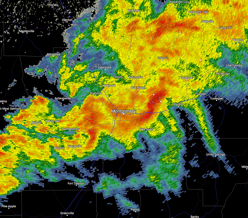
At 3:21 PM CST, Doppler radar was tracking a strong thunderstorm over Mount Meigs, or 10 miles east of Montgomery, moving northeast at 45 mph. Pea size hail and winds in excess of 40 mph will be possible with this storm.
NWS Birmingham has issued a Significant Weather Advisory until 3:45 PM for southeastern Elmore, central Macon, and northeastern Montgomery counties.
Locations impacted include…
Northeastern Montgomery, Tallassee, Milstead, Shorter, Franklin, Auburn University In Montgomery, Emerald Mountain, Mount Meigs, Tysonville, Victoryland, Waugh, Mitylene, Brassell, Ware, Tallapoosa Water Plant and Yates Dam.
Category: ALL POSTS, Archived Warnings
About the Author (Author Profile)
Scott Martin is an operational meteorologist, professional graphic artist, musician, husband, and father. Not only is Scott a member of the National Weather Association, but he is also the Central Alabama Chapter of the NWA president. Scott is also the co-founder of Racecast Weather, which provides forecasts for many racing series across the USA. He also supplies forecasts for the BassMaster Elite Series events including the BassMaster Classic.Subscribe
If you enjoyed this article, subscribe to receive more just like it.


