Weather Calming Down At The Midday Hour In Central Alabama
RADAR CHECK AT 11:45 AM
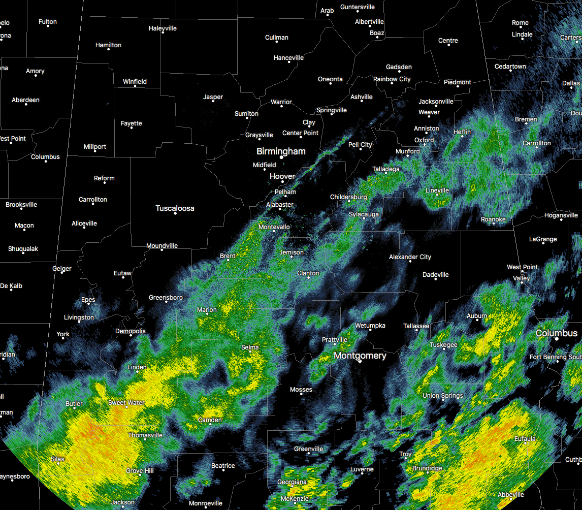
The severe weather threat for Central Alabama has come to an end, and all that will be left will be light to moderate showers moving through ahead of a cold front, which is now located from the northeastern corner of the state to the southwestern corner of Central Alabama. Temperatures are already reflecting the passage of the cold front, with upper 30s to the mid-40s in the northwestern quarter of the state, while the rest of the state is ranging from the lower 50s to the upper 70s. Temperatures in Central Alabama are ranging from the lower 40s in the northwest to the mid-60s in the southeast. Birmingham was at 52 degrees.
DAMAGE REPORTS SO FAR THIS MORNING
Chilton County
- Jemison… Debris in roadway near intersection of AL-191 and US-31.
- Jemison… Report of uprooted trees.
- Jemison… Tree across railroad tracks.
- Jemison… Damage to at least two structures at the intersection of Church Street and 25th Street; multiple trees down in surrounding area.
Sumter County
- Cuba… Tree reported down.
- Boyd… Shingles reported off of a home; report of a store that lost its roof.
- York… Roof blown off of service station near the intersection of US-80 and AL-17 in Siloam; portions of roof and awning of the BBQ Pit area were ripped off, and 2 homes west of the store received damage.
Hale County
- Gallion… Damage to a barn and mobile home, along with some timber damage.
WEATHER FOR THE REST OF YOUR WEDNESDAY
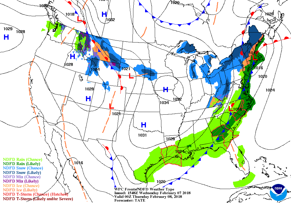
The cold front that is currently stretched across the state from the northeast corner down to the southwest through Tuscaloosa and Cuba will continue to move through the remainder of the state and will make its exit from Alabama around or just after 6:00 PM tonight. Rainfall has mostly come to an end for everyone along and north of I-20/59 in the western parts of the area, and along and north of I-59 in the east. That trend should continue through the rest of the evening, especially for the northern 1/3rd of Central Alabama. Rain will continue to move across the southern half of the area before starting to taper off in the west by 7PM, and completely out of the area at or around midnight. Temperatures will be dropping behind the cold front, and daytime highs will be in the lower 50s to the upper 60s to near 70 degrees in the southeast. That colder air will continue to move in during the overnight hours, and lows will range from the upper 20s in the northwest to the lower 40s in the southeast.
A NICE REBOUND FOR THURSDAY
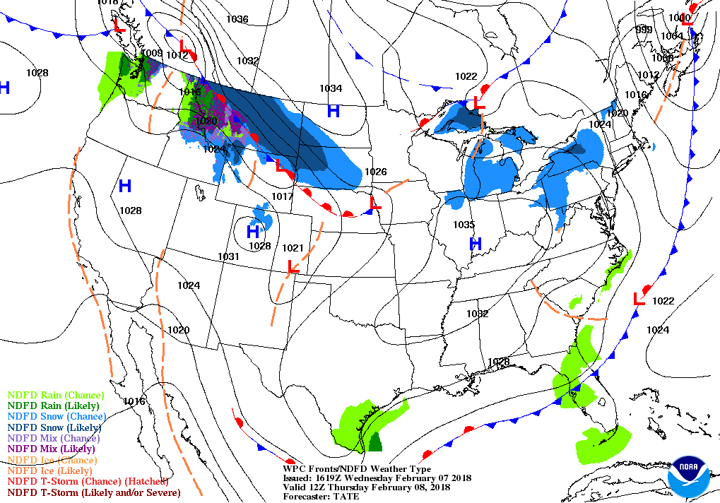
We’ll get a day to dry out before rain chances move back in on Friday and last through the weekend. Skies will be mainly clear for much of Central Alabama, with some clouds lingering in the southeast during the morning hours. Everyone will be dry from sun-up to sun-down, and afternoon highs will be in the mid-50s to the lower 60s… Not that bad, considering it is the beginning of February. A fair and cold night ahead on Thursday night, with mainly clear skies, and lows in the lower 30s to the lower 40s.
Category: Alabama's Weather, ALL POSTS
About the Author (Author Profile)
Scott Martin is an operational meteorologist, professional graphic artist, musician, husband, and father. Not only is Scott a member of the National Weather Association, but he is also the Central Alabama Chapter of the NWA president. Scott is also the co-founder of Racecast Weather, which provides forecasts for many racing series across the USA. He also supplies forecasts for the BassMaster Elite Series events including the BassMaster Classic.Subscribe
If you enjoyed this article, subscribe to receive more just like it.


