At Midday, No Strong Storms So Far For Us… A Tornado Warning In South Alabama
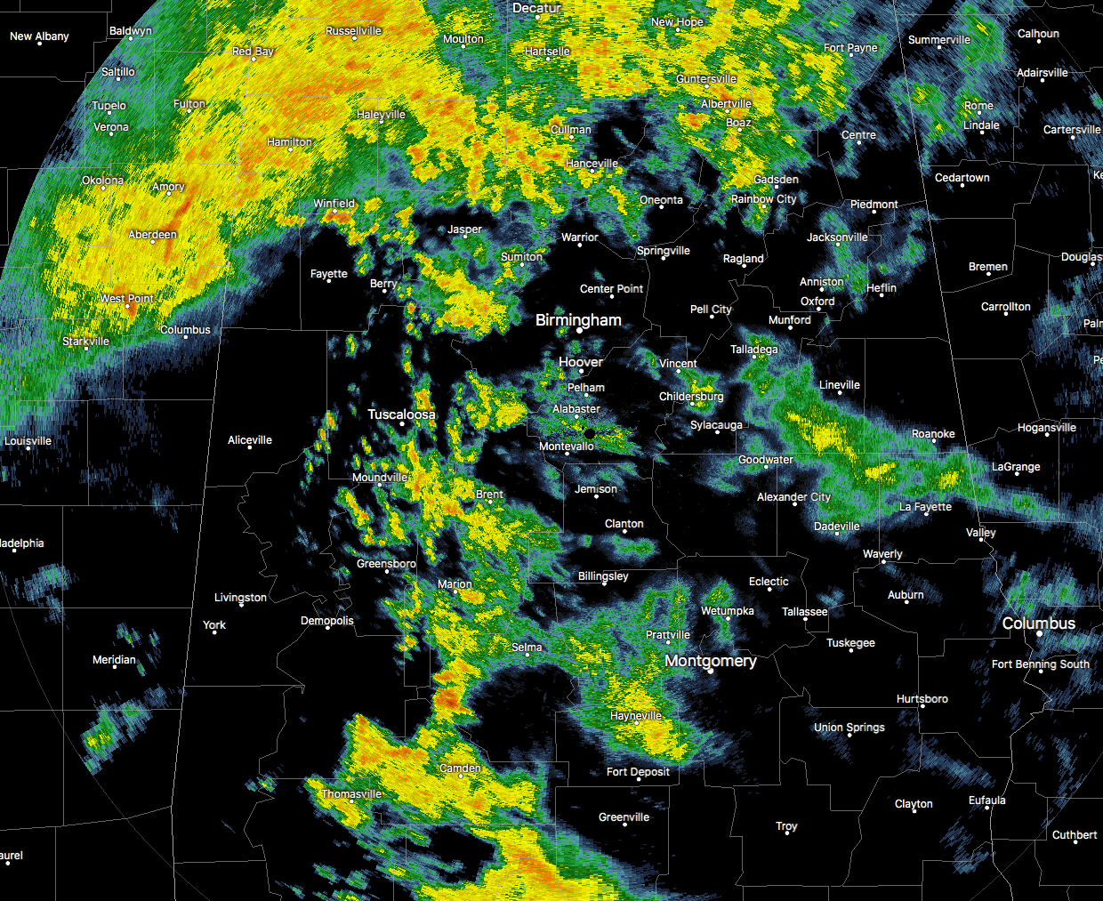
Radar check at 1:15 PM shows a mass of showers across the northern parts of Central Alabama, with scattered to numerous showers in the central and southern parts of the area. The good news is that there have been no strong to severe storms at this point, but it looks like that the main threat will be from heavier rainfall that may lead to flooding issues. Temperatures at this time are ranging from the mid-50s to the upper 60s throughout the area.
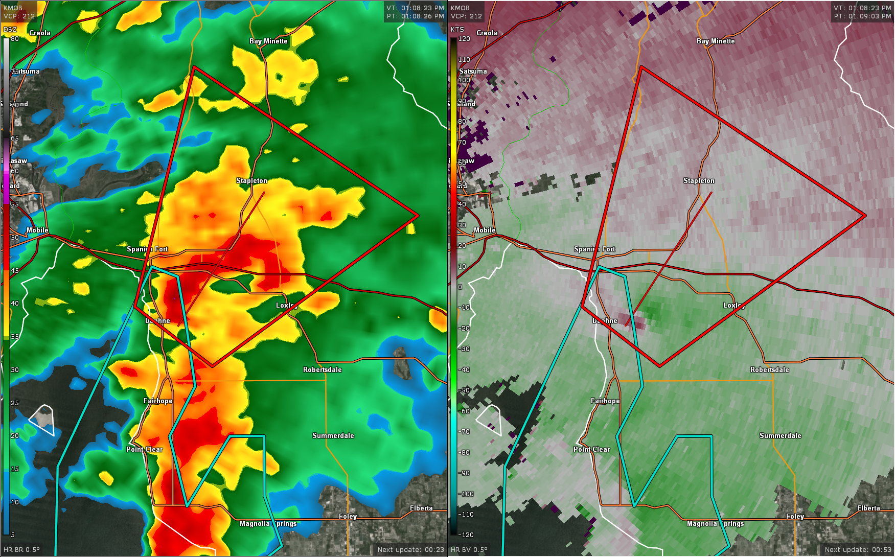
More active weather is occurring in the southern parts of the state, as a Tornado Warning is in effect for Baldwain County for a possible tornado that is currently located just east of Daphne and moving to the northeast towards Stapleton at 20 MPH. The warning is expected to expire at 1:45 PM.
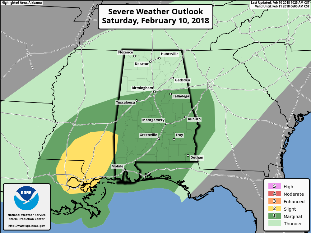
The SPC continues to have much of Central Alabama in a Marginal Risk for severe storms throughout the remainder of the day, but we have noticed that parts of southeastern Mississippi and into the western parts of Choctaw and Washington counties in southwestern Alabama have been upgraded to a Slight Risk. The main risks continue to be from damaging straight-line thunderstorm wind gusts, and a brief isolated tornado or two.
Scattered showers and a few thunderstorms will continue to move into Central Alabama throughout the remainder of the day, and there is still a possibility for a few isolated strong to severe storms through the afternoon. The good news is that the cloud cover and rainfall is keeping surface temperatures from rising, and this will help keep the destabilization of the atmosphere from occurring. There may be a few spots in the southern parts of the area that could see a few breaks in the clouds, allowing for more warmth to build at the surface and increasing instability. Highs today will top out in the mid-60s to the mid-70s from northwest to southeast, with overnight lows in the upper 50s to the lower 60s.
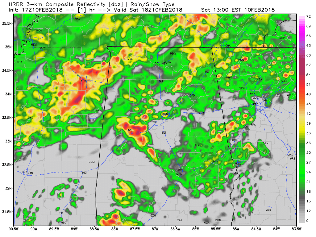
Latest HRRR Simulated Radar model valid from now through 5AM Sunday.
The larger threat with today’s weather will be from flooding, especially with the prolonged nature of the increased rain chances across the area. Rainfall amounts through 12:00 AM Sunday are ranging from 1.5 inches to 2.5 inches throughout most of the area, with lower amounts around 0.75 to 1.25 inches in the southeastern parts of the area.
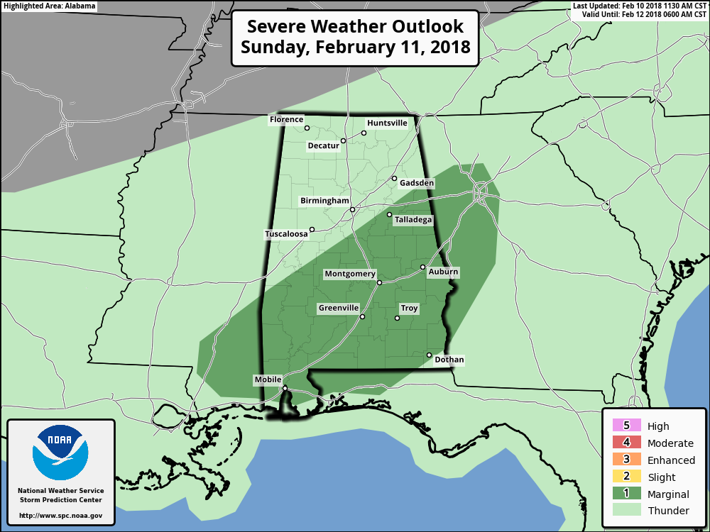
The SPC has introduced the southeastern half of the state in a Marginal Risk for severe storms during the day on Sunday as well. Main risks will be from damaging straight-line thunderstorm wind gusts and a brief isolated tornado or two. Conditions will be pretty much the same as today… periods of rain and thunderstorms, some of which could be strong to marginally severe. Afternoon highs will be in the lower 60s to the lower 70s from northwest to southeast.
Category: Alabama's Weather, ALL POSTS
About the Author (Author Profile)
Scott Martin is an operational meteorologist, professional graphic artist, musician, husband, and father. Not only is Scott a member of the National Weather Association, but he is also the Central Alabama Chapter of the NWA president. Scott is also the co-founder of Racecast Weather, which provides forecasts for many racing series across the USA. He also supplies forecasts for the BassMaster Elite Series events including the BassMaster Classic.Subscribe
If you enjoyed this article, subscribe to receive more just like it.


