A Quick Check On Our Weather At 12:30 AM Sunday
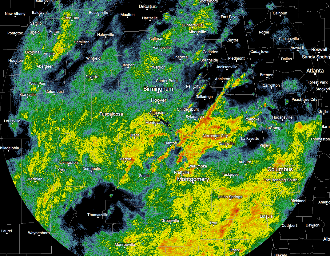
Waves of showers and thunderstorms continue to move northeastward over much of Central Alabama. At this point, the heaviest activity is located over the southern half of the area while the northern half is getting a little break from the heavier showers and storms. No severe storms out there at the moment, but we do notice that lightning is starting to pick up in the southeastern portions of the area, mainly around the Troy area.
Rainfall amounts, for the most part, have been held back a little today with most areas getting around or just over 1/2-inch. The heavier activity for much of the day has been located over the northwestern parts of the state, where as much as 1 to 2 inches have fallen. The good news is that all of that rainfall has been spread out in time today, so no major flooding issues have risen. We could still see amounts up to 1.5 to 3 inches by the time the cold front moves through on Sunday.
The cold front that will move through during the evening on Sunday has entered the northwest corner of Mississippi and is beginning its slow approach to Central Alabama. With it getting closer, and still plenty of gulf moisture advecting into the area, we could still see pockets of heavier rain away from the thunderstorms that could move through and may cause some flooding issues in poor drainage areas.
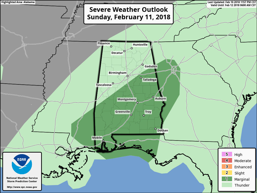
The SPC just released their latest updated outlook graphics for Sunday, and the area defined in the Marginal Risk for severe storms has been pushed a little farther south than earlier. Areas included in the Marginal Risk for severe storms are south of a line from Demopolis to Alabaster to Jacksonville. Strong to marginally severe storms are possible through Sunday evening when the cold front moves through the area. There is enough shear in place to give some storm organization, but overall instability is limited due to the cloud cover and rain in place. The dynamics associated with the upper-level system may aid in storm strength overnight and a few breaks in clouds tomorrow may also aide somewhat. If the storms gain enough strength, a damaging wind gust or short-lived tornado may become possible.
Continue to keep up with the latest on AlabamaWx.com, and be sure to follow us on our Facebook page and on our Twitter feed. Have a great night.
Category: Alabama's Weather, ALL POSTS
About the Author (Author Profile)
Scott Martin is an operational meteorologist, professional graphic artist, musician, husband, and father. Not only is Scott a member of the National Weather Association, but he is also the Central Alabama Chapter of the NWA president. Scott is also the co-founder of Racecast Weather, which provides forecasts for many racing series across the USA. He also supplies forecasts for the BassMaster Elite Series events including the BassMaster Classic.Subscribe
If you enjoyed this article, subscribe to receive more just like it.


