Areal Flood Advisory Issued For Parts of Tuscaloosa, Shelby, Bibb, & Jefferson Counties Until 7:00 PM
Flood Advisory
National Weather Service Birmingham AL
501 PM CST SUN FEB 11 2018
ALC007-073-117-125-120100-
/O.NEW.KBMX.FA.Y.0007.180211T2301Z-180212T0100Z/
/00000.N.ER.000000T0000Z.000000T0000Z.000000T0000Z.OO/
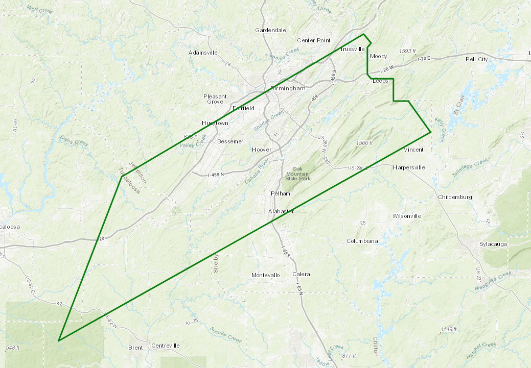
Tuscaloosa AL-Shelby AL-Bibb AL-Jefferson AL-
501 PM CST SUN FEB 11 2018
The National Weather Service in Birmingham has issued a
* Urban and Small Stream Flood Advisory for Poor Drainage Areas
for…
Southeastern Tuscaloosa County in west central Alabama…
Central Shelby County in central Alabama…
Northern Bibb County in central Alabama…
Southeastern Jefferson County in central Alabama…
* Until 700 PM CST
* At 500 PM CST, Doppler radar indicated heavy rain that will cause
urban and small stream flooding. Overflowing poor drainage areas
will result in minor flooding in the advisory area. Additional
rain amounts will be around 1 inch and will fall in a short period
of time on already saturated groun.
* Some locations that will experience flooding include…
Birmingham, Hoover, Vestavia Hills, Alabaster, Bessemer, Homewood,
Pelham, Mountain Brook, Trussville, Helena, Hueytown, Irondale,
Leeds, Moody, Fairfield, Chelsea, Midfield, Brighton, Indian
Springs Village and Lipscomb.
PRECAUTIONARY/PREPAREDNESS ACTIONS…
Keep children away from storm drains, culverts, creeks and streams.
Water levels can rise rapidly and sweep children away.
Category: ALL POSTS, Severe Weather
About the Author (Author Profile)
Scott Martin is an operational meteorologist, professional graphic artist, musician, husband, and father. Not only is Scott a member of the National Weather Association, but he is also the Central Alabama Chapter of the NWA president. Scott is also the co-founder of Racecast Weather, which provides forecasts for many racing series across the USA. He also supplies forecasts for the BassMaster Elite Series events including the BassMaster Classic.Subscribe
If you enjoyed this article, subscribe to receive more just like it.


