A Gray Midday With Scattered Showers Out There
How’s The Weather Across Central Alabama At 1:15 PM
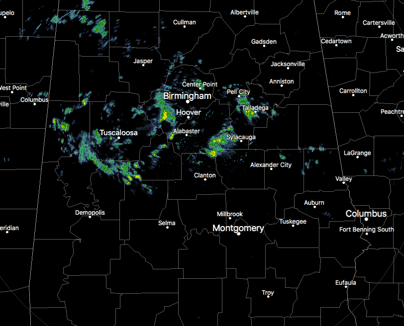
We have mainly cloudy skies across much of Central Alabama at this point, with partly cloudy to mostly clear skies in the extreme southern parts of the area. We have some widely scattered showers over the north and central parts of the area as well, mainly north of a line from Marion to Thorsby to Lineville. There are a few smaller showers south of that line, but those are very small in nature and will not last long at all. Temperatures are currently ranging from the mid-50s to the mid-70s throughout the area. Birmingham was at 59F, while Eufaula was at 75F. It was only 55F in Tuscaloosa.
Weather For The Rest Of Your Sunday
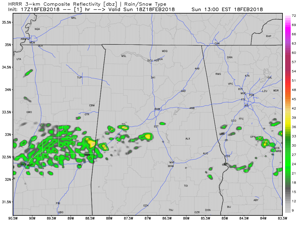
HRRR Simulated Radar valid through 5:00 AM Monday.
We’ll continue to have mostly cloudy skies throughout the remainder of the afternoon and into the early afternoon hours, with a chance of widely scattered showers. Much of the activity will be over the northern half of the area, but there is a slight chance of showers in the south as well. Afternoon highs will be in the lower 60s in the north to the mid-70s to the south. Shower chances will diminish during the late night through the overnight hours but may persist a little longer in the northeastern parts of the area. Patchy fog will start developing tonight as we get close to midnight and will linger through sunrise. Overnight lows will be in the mid-50s to the lower 60s.
Mostly cloudy on Sunday with scattered rain showers. Highs will range from the low 60s NW to the low 70s SE.
Monday’s Weather… Trending Drier and Warm
We’ll start off the day with a few lingering showers over the extreme northern parts of Central Alabama before some clearing takes place during the afternoon. The rest of the day will be dry, with afternoon highs reaching the mid-70s to the lower 80s. Skies will continue to be partly to mostly cloudy throughout the evening and into the overnight hours, with lows only dropping into the upper 50s to the lower 60s.
On This Day In Weather History
1988 – Thunderstorms soaked the Central Gulf Coast Region with heavy rain. Totals in southern Louisiana ranged up to 8.50 inches near the town of Ridge, with 6.55 inches at Plaguemine. Thunderstorms in northern Florida drenched Apalachicola with 5.41 inches of rain in 24 hours and produced wind gusts to 75 mph at Mayo.
WeatherBrains
Check out the show at www.WeatherBrains.com. You can also subscribe on iTunes. You can watch the show live at live.bigbrainsmedia.com. You will be able to see the show on the James Spann 24×7 weather channel on cable or directly over the air on the dot 2 feed.
E-Forecast
Get the AlabamaWx Weather Blog’s Seven-Day Forecast delivered directly to your inbox by email twice daily. It is the most detailed weather forecast available in Central Alabama. Subscribe here… It’s free!
Advertise With Us
Don’t miss out! We can customize a creative, flexible and affordable package that will suit your organization’s needs. Contact Bill Murray at (205) 687-0782.
Category: Alabama's Weather, ALL POSTS
About the Author (Author Profile)
Scott Martin is an operational meteorologist, professional graphic artist, musician, husband, and father. Not only is Scott a member of the National Weather Association, but he is also the Central Alabama Chapter of the NWA president. Scott is also the co-founder of Racecast Weather, which provides forecasts for many racing series across the USA. He also supplies forecasts for the BassMaster Elite Series events including the BassMaster Classic.Subscribe
If you enjoyed this article, subscribe to receive more just like it.


