Storms Have Entered Northwest Alabama
Our line of thunderstorms is into the northwestern corner of Alabama now.
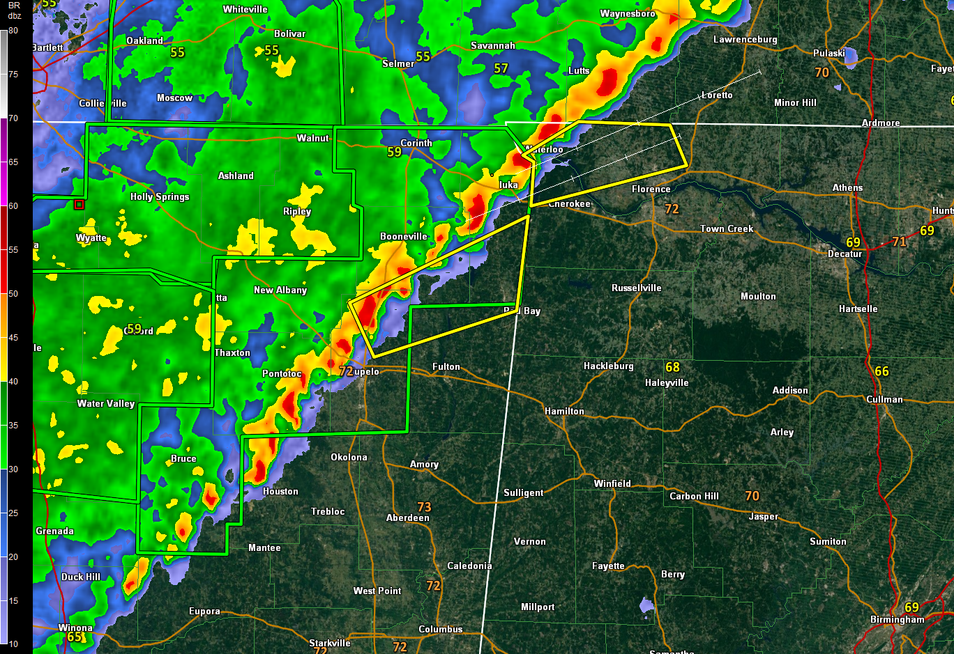
The storms along the leading edge of the line have intensified over the past hour or so, probably in response to an increasing upper level and lower level jet encroaching on the region.
New severe thunderstorm warnings are now in effect for parts of Northeast Mississippi and a new warning was just issued for parts of Colbert and Lauderdale Counties.
The UAH SWIRLL researchers did release a balloon near Lexington in Lauderdale County at 9:32 p.m. It showed a good amount of low-level instability and steep lapse rates, so the storms do still have fuel. They also saw high-level amounts of low-level wind shear, keeping the threat of tornadoes in the picture.
That low-level shear should be weakening and the severe weather threat should continue to diminish. Strong gusty winds will be the main threat along with the threat of heavy rains.
Heavy rainfall may become the main problem. A large mass of moderate to heavy rain extends behind the main line of storms and rainfall amounts could approach between 1.0 and 1.5 inches between now and 8 a.m. over portions of Northwest Alabama, including parts of Marion, Franklin, Colbert, Lauderdale, Lawrence and Limestone Counties. If 1.5-inch amounts are exceeded, flash flood warnings will likely be required.
The line of storms should slowly weaken overnight before reaching the I-59 Corridor around 3:30-4:30 a.m.
We will be up monitoring the threat throughout the night and providing frequent updates.
Category: Alabama's Weather, ALL POSTS
About the Author (Author Profile)
Bill Murray is the President of The Weather Factory. He is the site's official weather historian and a weekend forecaster. He also anchors the site's severe weather coverage. Bill Murray is the proud holder of National Weather Association Digital Seal #0001 @wxhistorianSubscribe
If you enjoyed this article, subscribe to receive more just like it.


