Isolated Severe Storm Threat Building Over NW Alabama
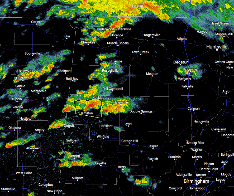
We may have a threat starting to build for the northwestern parts of Central Alabama for this afternoon and into the early evening hours as conditions are starting to become unstable.
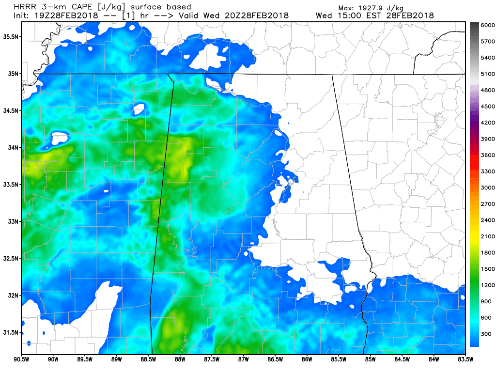
HRRR CAPE values valid at 2:00 PM.
Deep layer bulk shear values are already reaching 65-70 knots over the northeastern parts of Mississippi, along with 30-35 knots of shear up to 1km. This is indicative of good support for supercells. Storm relative helicity values up to 1km are also quite high in the 300-400 m2s2. Surfaced-based instability values are in the 1500-2000 J/kg at this point on the state line moving into Marion County, well high enough to support convective storms. We are also seeing Significant Tornado Parameter values around 2 as of now.
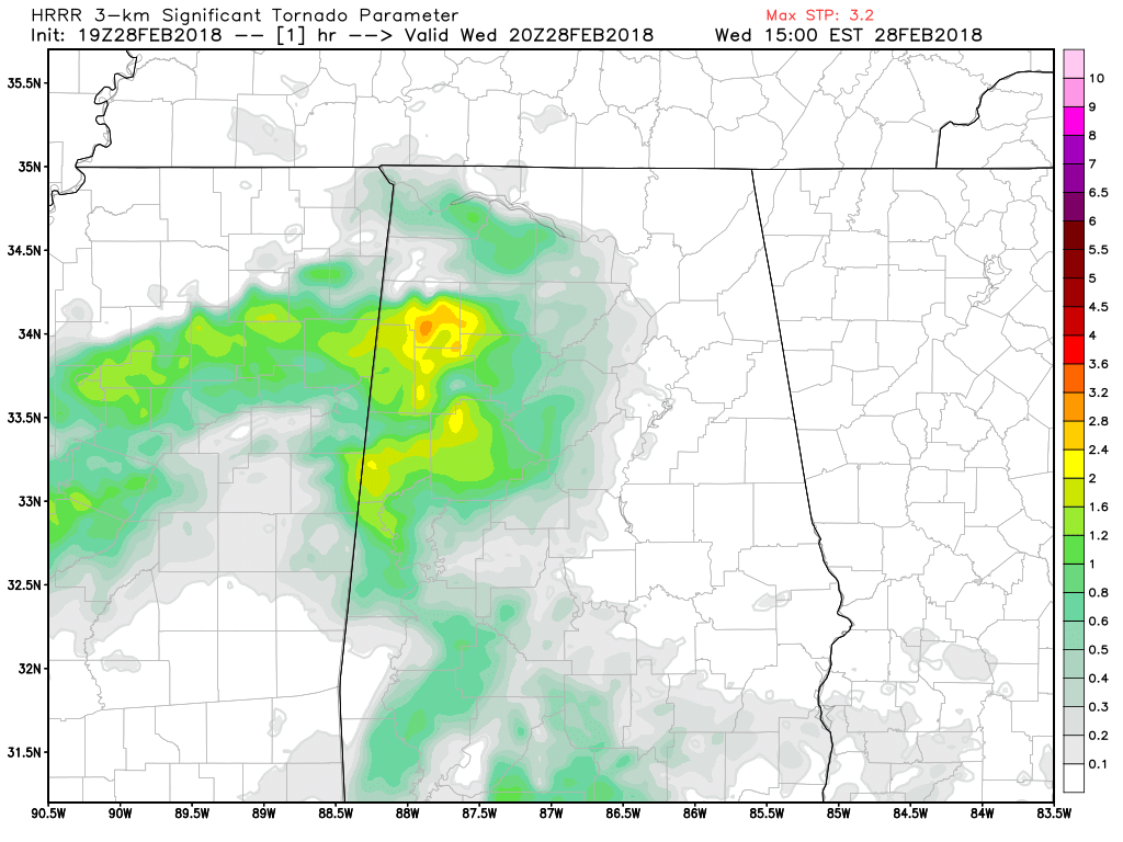
HRRR STP values valid at 2PM.
Bottom line: A few isolated strong to severe storms are possible across the northwestern parts of Central Alabama throughout the remainder of the afternoon and early evening hours. Small hail and damaging winds will be the main threats, but a few of these could rotate due to the shear values, and an isolated tornado or two are possible. Main risk area will be west of I-65 and along and north of US-278 for the next few hours.
We’ll keep you posted throughout the rest of the afternoon and evening on AlabamaWx.com.
Category: Alabama's Weather, ALL POSTS
About the Author (Author Profile)
Scott Martin is an operational meteorologist, professional graphic artist, musician, husband, and father. Not only is Scott a member of the National Weather Association, but he is also the Central Alabama Chapter of the NWA president. Scott is also the co-founder of Racecast Weather, which provides forecasts for many racing series across the USA. He also supplies forecasts for the BassMaster Elite Series events including the BassMaster Classic.Subscribe
If you enjoyed this article, subscribe to receive more just like it.


