Strong Storm Now Affecting Marion County
Special Weather Statement
National Weather Service Birmingham AL
157 PM CST WED FEB 28 2018
ALZ011-282030-
Marion AL-
157 PM CST WED FEB 28 2018
…SIGNIFICANT WEATHER ADVISORY FOR NORTHWESTERN MARION COUNTY UNTIL 230 PM CST…
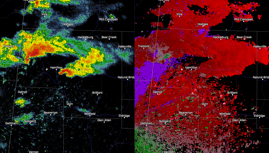
At 157 PM CST, Doppler radar was tracking a strong thunderstorm near Weston, or 8 miles northwest of Hamilton, moving east at 30 mph. Pea size hail and winds in excess of 40 mph will be possible with this storm.
Locations impacted include…
Hamilton, Weston, Pigeye, Shottsville and Bexar.
This storm may intensify, so be certain to monitor local radio stations and available television stations for additional information and possible warnings from the National Weather Service.
Category: ALL POSTS
About the Author (Author Profile)
Scott Martin is an operational meteorologist, professional graphic artist, musician, husband, and father. Not only is Scott a member of the National Weather Association, but he is also the Central Alabama Chapter of the NWA president. Scott is also the co-founder of Racecast Weather, which provides forecasts for many racing series across the USA. He also supplies forecasts for the BassMaster Elite Series events including the BassMaster Classic.Subscribe
If you enjoyed this article, subscribe to receive more just like it.


