Heads Up Fayette And Walker Counties
Special Weather Statement
National Weather Service Birmingham AL
316 PM CST WED FEB 28 2018
ALZ013-015-282145-
Fayette AL-Walker AL-
316 PM CST WED FEB 28 2018
…SIGNIFICANT WEATHER ADVISORY FOR NORTHWESTERN WALKER AND CENTRAL
FAYETTE COUNTIES UNTIL 345 PM CST…
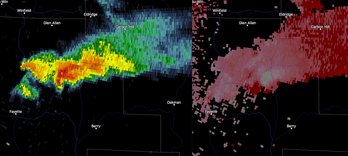
At 315 PM CST, Doppler radar was tracking a strong thunderstorm near
Bankston, or 9 miles northeast of Fayette, moving east at 30 mph.
Winds in excess of 40 mph will be possible with this storm.
Locations impacted include…
Jasper, Carbon Hill, Berry, Oakman, Hubbertville, Cedrum Area,
Fowlers Crossroads, Holly Grove, Gamble, Corona, Townley and West
Corona.
PRECAUTIONARY/PREPAREDNESS ACTIONS…
This storm may intensify, so be certain to monitor local radio
stations and available television stations for additional information
and possible warnings from the National Weather Service.
To report severe weather, contact your nearest law enforcement
agency. They will relay your report to the National Weather Service
office in Birmingham.
Category: ALL POSTS
About the Author (Author Profile)
Scott Martin is an operational meteorologist, professional graphic artist, musician, husband, and father. Not only is Scott a member of the National Weather Association, but he is also the Central Alabama Chapter of the NWA president. Scott is also the co-founder of Racecast Weather, which provides forecasts for many racing series across the USA. He also supplies forecasts for the BassMaster Elite Series events including the BassMaster Classic.Subscribe
If you enjoyed this article, subscribe to receive more just like it.


