Rain, Strong Storms Sliding Along Warm Front From Mississippi into Alabama
A large mass of rain and thunderstorms is moving across Mississippi tonight, and the leading edge has entered West Central Alabama.
There is tons of lightning all the way from Pickens, Sumter and Greene Counties through central Mississippi into southeastern Arkansas.
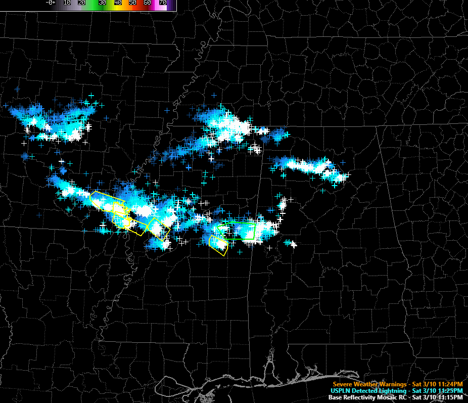
An area of rain and storms over North Central Alabama is also producing plenty of lightning across parts of Marion, Franklin, Lawrence, Winston, Morgan, Cullman and Blount Counties.
The NWS in Jackson has extended the severe thunderstorm watch into additional counties in eastern Mississippi all the way up to the Alabama border.
Here is the composite radar as of 11:30 p.m.:
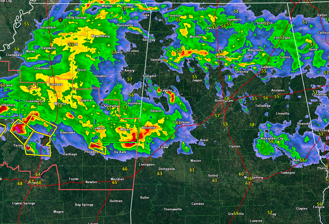
The activity is sliding east southeastward along a warm front that extends across South Central Alabama and South Central Mississippi. The temperature at Tuscaloosa has risen from 57F to 61F over the past few hours.
The large mass of rain and storms will spread across Alabama during the overnight hours. Heavy rain and lightning will be the main impacts. But along the warm front, some of the storms could be strong to severe with damaging wind gusts and some hail as well. Areas from Eutaw and Livingston to Marion, Selma and Montgomery could experience the stronger storms.
The severe weather threat will continue to diminish during the night, but we will be monitoring the situation.
Category: Alabama's Weather, ALL POSTS
About the Author (Author Profile)
Bill Murray is the President of The Weather Factory. He is the site's official weather historian and a weekend forecaster. He also anchors the site's severe weather coverage. Bill Murray is the proud holder of National Weather Association Digital Seal #0001 @wxhistorianSubscribe
If you enjoyed this article, subscribe to receive more just like it.


