Nearly Cloudless & Very Cool At Midday
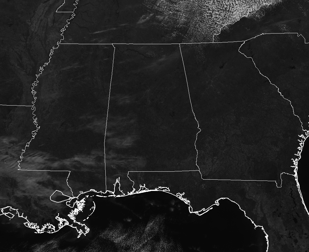
Mainly clear skies across Central Alabama at 12:20 PM, with a little bit of wind and really cool temperatures. Winds are currently averaging 5-10 MPH mainly out of the northwest. Temperatures are currently ranging from the mid-40s to the lower 50s throughout Central Alabama, with the warm spot being Eufaula at 53 degrees. Birmingham was at 50 degrees, while the cool spot in the area was Haleyville at 46 degrees.
Weather For The Rest Of Your Tuesday

High pressure located over the Minnesota/Iowa state line is continuing to pump colder and dry air down from Canada and over places that have a decent amount of snow cover into Central Alabama, keeping our temperatures well below normal for mid-March. Other than a few high and thin wispy clouds floating overhead, skies will be sunny. Temperatures will range from the lower 50s to near 60 degrees from north to south. Winds will be out of the northwest averaging less than 10 MPH. For this evening and throughout the overnight hours, clear skies and very cold temperatures can be expected as lows will dip down into the upper 20s to the mid-30s. Freeze Warnings and Frost Advisories are in effect… see below.
Freeze Watch, Freeze Warning, & Frost Advisory In Effect
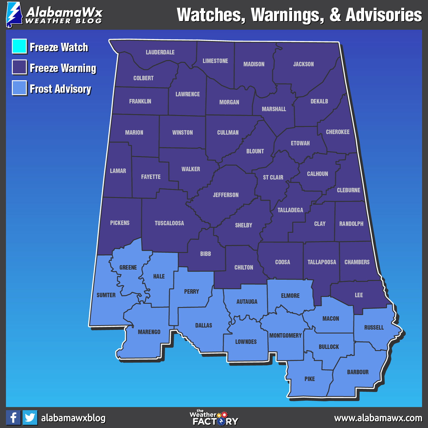
CENTRAL ALABAMA
A Freeze Warning is in effect at 12:00 AM Wednesday for Bibb, Blount, Calhoun, Chambers, Cherokee, Chilton, Clay, Cleburne, Coosa, Etowah, Fayette, Jefferson, Lamar, Lee, Marion, Pickens, Randolph, Shelby, St. Clair, Talladega, Tallapoosa, Tuscaloosa, Walker, & Winston counties until 10:00 AM Wednesday.
A Frost Advisory is in effect at 12:00 AM Wednesday for Autauga, Barbour, Bullock, Dallas, Elmore, Greene, Hale, Lowndes, Macon, Marengo, Montgomery, Perry, Pike, Russell, and Sumter counties until 10:00 AM Wednesday.
A Freeze Watch continues in effect for Autauga, Barbour, Bibb, Blount, Bullock, Calhoun, Chambers, Cherokee, Chilton, Clay, Cleburne, Coosa, Dallas, Elmore, Etowah, Fayette, Greene, Hale, Jefferson, Lamar, Lee, Lowndes, Macon, Marengo, Marion, Montgomery, Perry, Pickens, Pike, Randolph, Russell, Shelby, St. Clair, Sumter, Talladega, Tallapoosa, Tuscaloosa, Walker, and Winston counties through 9:00 AM Thursday.
NORTH ALABAMA
A Freeze Warning is in effect at 1:00 AM Wednesday for Colbert, Cullman, De Kalb, Franklin, Jackson, Lauderdale, Lawrence, Limestone, Madison, Marshall, and Morgan counties until 9:00 AM Wednesday.
Another Bright, Sunny, & Very Cool Day On Wednesday
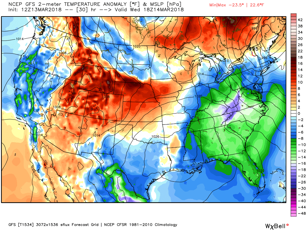
GFS Temperature Anomaly (departure from normal) valid at 1:00 PM Wednesday.
As you can see by the image above, temperatures will once again be below normal throughout the day. High pressure continues to be just off to our west allowing for more cool and dry continental air to flow over Central Alabama. We’ll have a case of severe clear throughout the day, and winds will be out of the northwest averaging less than 10 MPH. Afternoon highs will be in the upper 40s to the upper 50s from north to south. Another clear and very cold night ahead for Wednesday night, and Freeze Warnings and Frost Advisories will likely be issued once again. Lows will bottom out in the upper 20s to the lower 30s.
Beach Forecast Center
Don’t you wish you were there, already? Soaking up the rays and wiggling your toes in the sand? Get the latest forecast for the beaches from Fort Morgan to Panama City on our Beach Forecast Center page. There, you can select the forecast of the region that you are interested in.
WeatherBrains
Don’t forget you can listen to our weekly 90 minute netcast anytime on the web at WeatherBrains.com or on iTunes. This is the show all about weather featuring many familiar voices, including the meteorologists at ABC 33/40.
E-Forecast
Get the AlabamaWx Weather Blog’s Seven-Day Forecast delivered directly to your inbox by email twice daily. It is the most detailed weather forecast available in Central Alabama. Subscribe here… It’s free!
Advertise With Us
Don’t miss out! We have enjoyed nearly 3.3 MILLION page views on AlabamaWx.com since the start of 2018. We can customize a creative, flexible and affordable package that will suit your organization’s needs. Contact Bill Murray at (205) 687-0782.
On This Day In Weather History
1993 – The Superstorm of 1993 (also called the Storm of the Century) was one of the most intense mid-latitude cyclones ever observed over the Eastern United States. The storm will be remembered for its tremendous snowfall totals from Alabama through Maine, high winds all along the East coast, extreme coastal flooding along the Florida west coast, incredibly low barometric pressures across the Southeast and Mid-Atlantic, and for the unseasonably cold air that followed behind the storm. In terms of human impact the Superstorm of 1993 was more significant than most landfalling hurricanes or tornado outbreaks and ranks among the deadliest and most costly weather events of the 20th century.
Category: Alabama's Weather, ALL POSTS
About the Author (Author Profile)
Scott Martin is an operational meteorologist, professional graphic artist, musician, husband, and father. Not only is Scott a member of the National Weather Association, but he is also the Central Alabama Chapter of the NWA president. Scott is also the co-founder of Racecast Weather, which provides forecasts for many racing series across the USA. He also supplies forecasts for the BassMaster Elite Series events including the BassMaster Classic.Subscribe
If you enjoyed this article, subscribe to receive more just like it.


