PDS Tornado Warning in Louisiana; Central Alabama Remains Stable; Strong Storms Affect Southwest Alabama Later
Everything is on track with our severe weather forecast for tonight for Alabama. Severe weather is occurring to the west of Alabama tonight and some of it will work into southwestern parts of the state overnight.
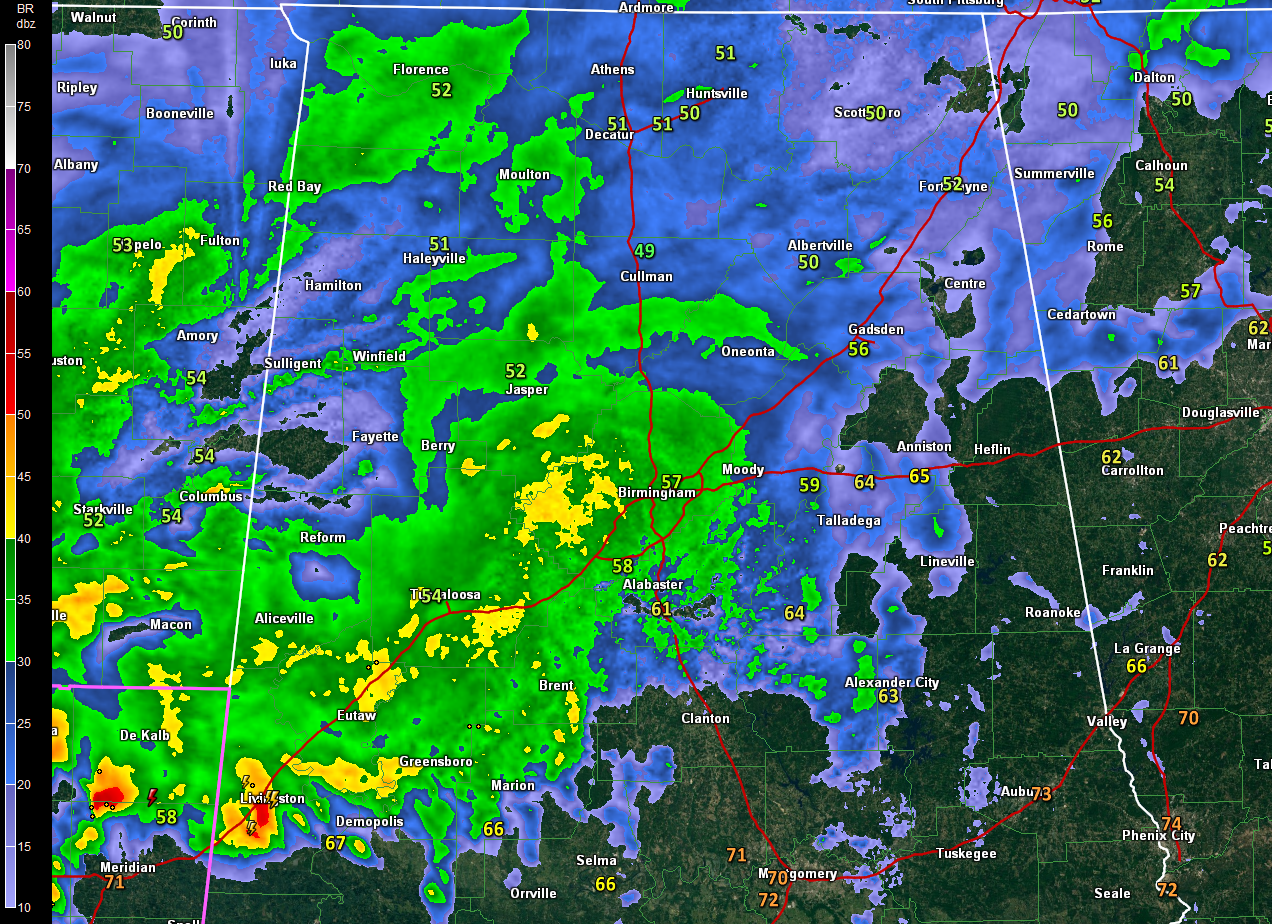
Across Alabama, it is mainly light to moderate rain across the northern half of the state with heavy rain in the I-59 Corridor between Sumter County and the Birmingham Metro.
A tornado watch extends all the way Tyler, Texas to the Alabama/Mississippi border. There is a severe thunderstorm watch over North Central Texas, including the Dallas/Fort Worth Metroplex.

Storms are lined up along I-20 tonight from northeastern Texas through northern Louisiana and central Mississippi all the way to Merdian. There are numerous severe thunderstorm warnings from Vicksburg westward all the way to Carthage, Texas. Two tornado warnings for now, including one that a radar confirmed tornado around Coushatta, LA, which is east of I-49 and southeast of Shreveport. That is for a large and extremely dangerous tornado and is a PDS or Particularly Dangerous Situation tornado warning according to the NWS Shreveport. The tornado warning is affecting northern parts of Monroe LA.
A strong thermal gradient exists along the I-20 corridor through Louisiana, Mississippi, and Alabama. The temperature at Tuscaloosa is 68F while it is 52F at Columbus MS. Very warm and moist air is crashing northward into the boundary from the southwest to the west of Alabama, feeding the storms.
These dewpoints near 60F will edge into Alabama over the next couple of hours, making it easier for storms to survive the border crossing as we go into the evening.
A strong wind max at the jet stream level along with colder air aloft is spreading southeastward across southeastern Oklahoma and southwestern Arkansas. This is enhancing the storms over those areas into northwestern Louisiana. A new tornado warning just went up northeast of Dallas around McKinney.
It will continue be an active night to the west of Alabama, with the greatest of tornadoes and damaging winds for places like Tyler, TX, Shreveport, Monroe and Alexandria in Louisiana over to Jackson, Mississippi.
The storms will push into West Central and Southwest Alabama later tonight, generally south of US-82 with the greatest threat of damaging winds and hail south of a line from Livingston to Linden to Pine Hill and Atmore. There could be a few reports of severe weather along and south of US-82 to Montgomery and over into Southeast Alabama as far east as Ozark.
For areas northeast of US-82 including Tuscaloosa, Birmingham, Hamilton, Jasper, Cullman, Clanton, Alex City, Anniston and Gadsden, there will be periods of rain and thunder overnight. The storms will likely be based well above the surface, which can make for some loud, rumbling thunder. There will be some locally heavy rain as well, but severe weather should stay to the southwest.
Category: Alabama's Weather, ALL POSTS
About the Author (Author Profile)
Bill Murray is the President of The Weather Factory. He is the site's official weather historian and a weekend forecaster. He also anchors the site's severe weather coverage. Bill Murray is the proud holder of National Weather Association Digital Seal #0001 @wxhistorianSubscribe
If you enjoyed this article, subscribe to receive more just like it.


