

Clouds Increasing Across North Alabama This Afternoon; Clouds, A Few Showers Overnight
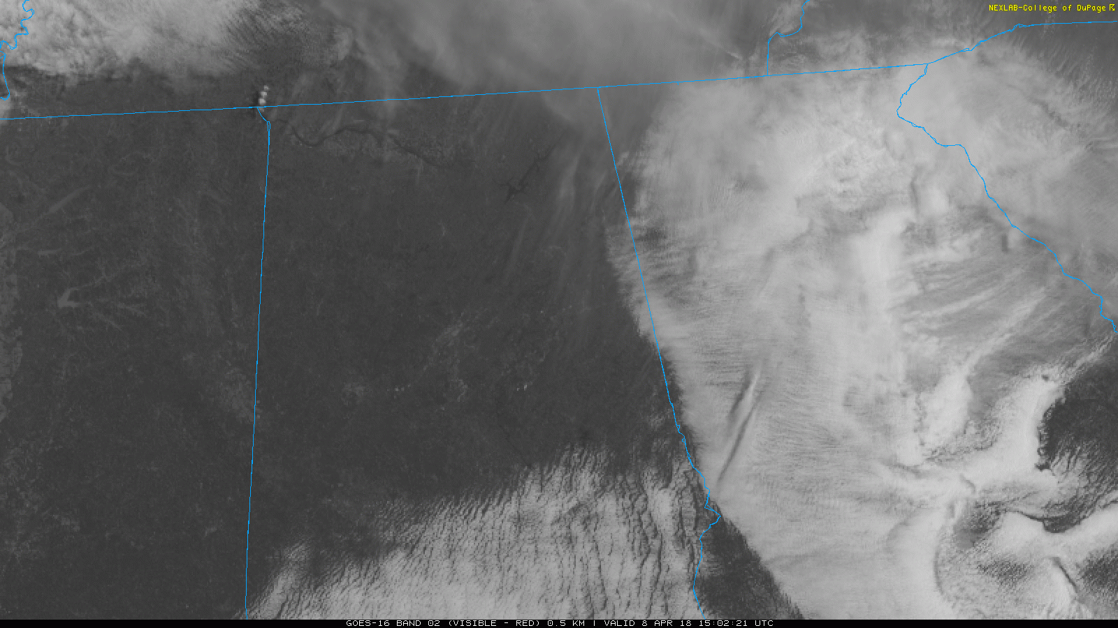
After a frankly miserable day yesterday with clouds, spits of rain, cold temperatures, and a biting north wind, today will be quite an improvement, although not back to our usual spring standards here in Alabama. On the satellite, low clouds were leaving South Alabama, pesky low clouds over Georgia were being repulsed at the Alabama border and earlier high clouds moving in from the northwest had moved on leaving mostly clear skies. This will push temperatures in into the upper 50s North to lower and middle 60s elsewhere. Some clouds near Memphis will begin to affect from the area from northwest to southeast during the afternoon and overnight hours. You can expect them into the I-59 corridor by early to mid-afternoon. Heavier clouds will move in from the southeast tonight as southeasterly winds bring back moisture and a disturbance to the northwest.
A FEW SHOWERS OVERNIGHT: A few showers will develop tonight in the in the ascending, moister air. Rainfall amounts will be light, generally less than one-tenth of an inch. Lows will be in the lower to middle 40s.
NEW WORK WEEK: After the disturbance passes early Monday, skies will become partly cloudy through the day with highs in the upper 60s. But a very deep trough will be organizing to the west of us and heading east. The front will be approaching the Northwest Corner of Alabama by Tuesday morning. A few light showers will develop late Monday night. The fast-moving showers will be gone by early Tuesday morning, and once again, rainfall amounts will be very light, less than one-tenth of an inch. Highs will again be in the upper 60s and lows Tuesday morning will be in the upper 40s.
MIDWEEK NICENESS: Spring starts looking like spring in Alabama Wednesday, Thursday and even into Friday. Highs will warm into the 70s and even lower 80s by Friday. Lows will warm from the 40s to the 50s. We will see mostly sunny skies Wednesday, Thursday and Friday.
WEEKEND STORM SYSTEM: A surface low will form across the Plains states by Friday. Showers and storms will break out Friday night across the Arklatex. As the low moves northeast and occludes, it will drag a slow-moving front our way, accompanied by a large area of rain and thunderstorms. It will take much of the day for the system to cross Alabama on Saturday. Rainfall amounts should reach one to one and ½ inches.
SEVERE WEATHER THREAT: On its current itinerary, the weekend system should pose little severe weather threat to North or Central Alabama. Instabilities will be higher over South Alabama, and there will be some threat there.
Category: Alabama's Weather, ALL POSTS
About the Author (Author Profile)
Bill Murray is the President of The Weather Factory. He is the site's official weather historian and a weekend forecaster. He also anchors the site's severe weather coverage. Bill Murray is the proud holder of National Weather Association Digital Seal #0001 @wxhistorianSubscribe
If you enjoyed this article, subscribe to receive more just like it.


