Our Own Atmospheric River; Flash Flooding Threat Increasing
California’s got nothing on our atmospheric rivers!
California recently had its greatest “atmospheric river” in its history.
Atmospheric river is a term that has fallen into favor over the past few years for feeds of moisture that travel great distances. They are like regular rivers, but in the atmosphere, that carry large amounts of water vapor long distances from the tropics.
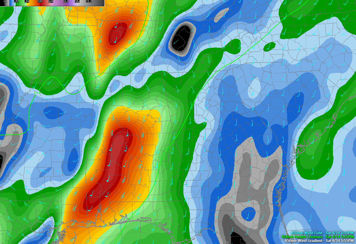
850 millibar low level jet showing strong low level winds off the Gulf of Mexico at 5,000 feet.
We have seen our own Gulf of Mexico version of it this afternoon and evening. A low-level jetstream at 5,000 feet developed on the east side of our approaching trough this afternoon and it has been transporting high amounts of moisture out of the Gulf of Mexico.
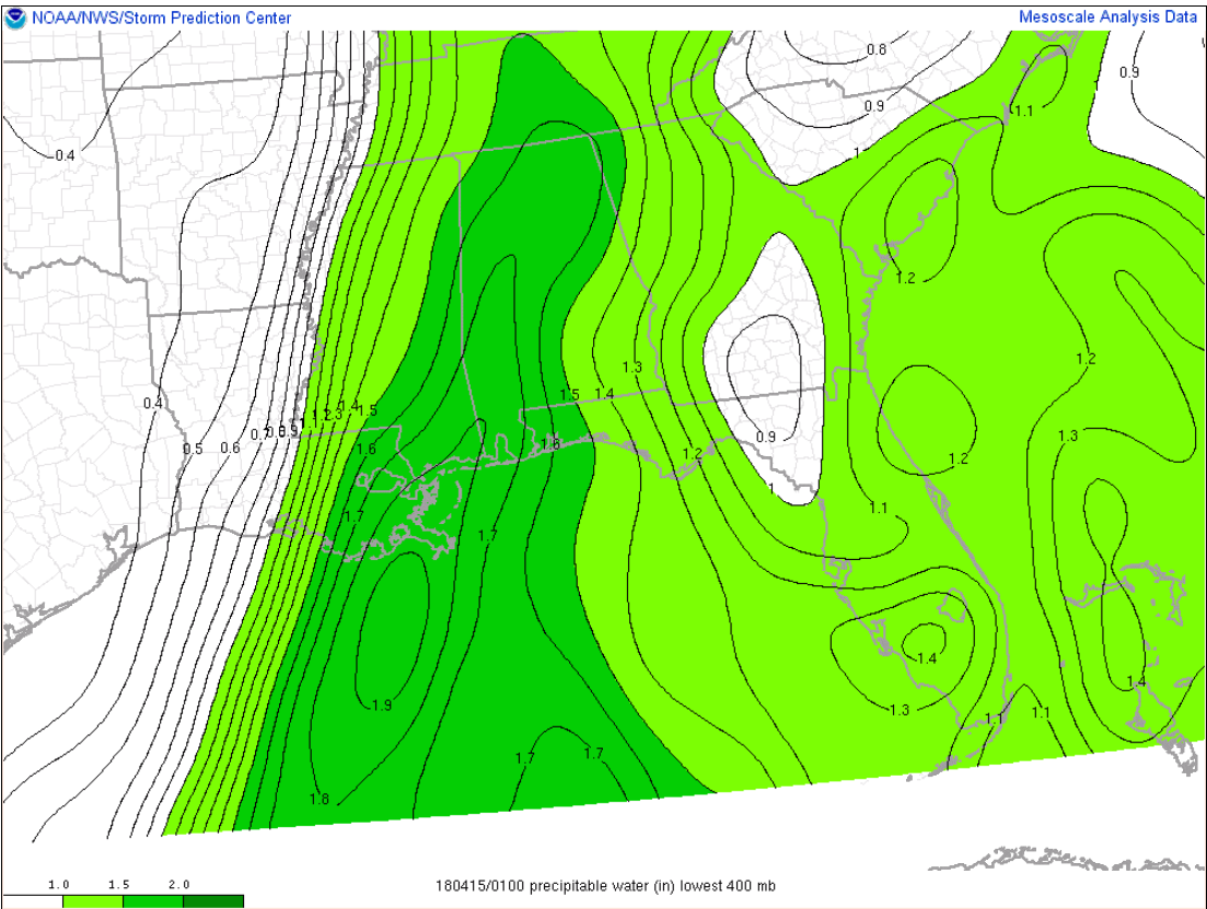
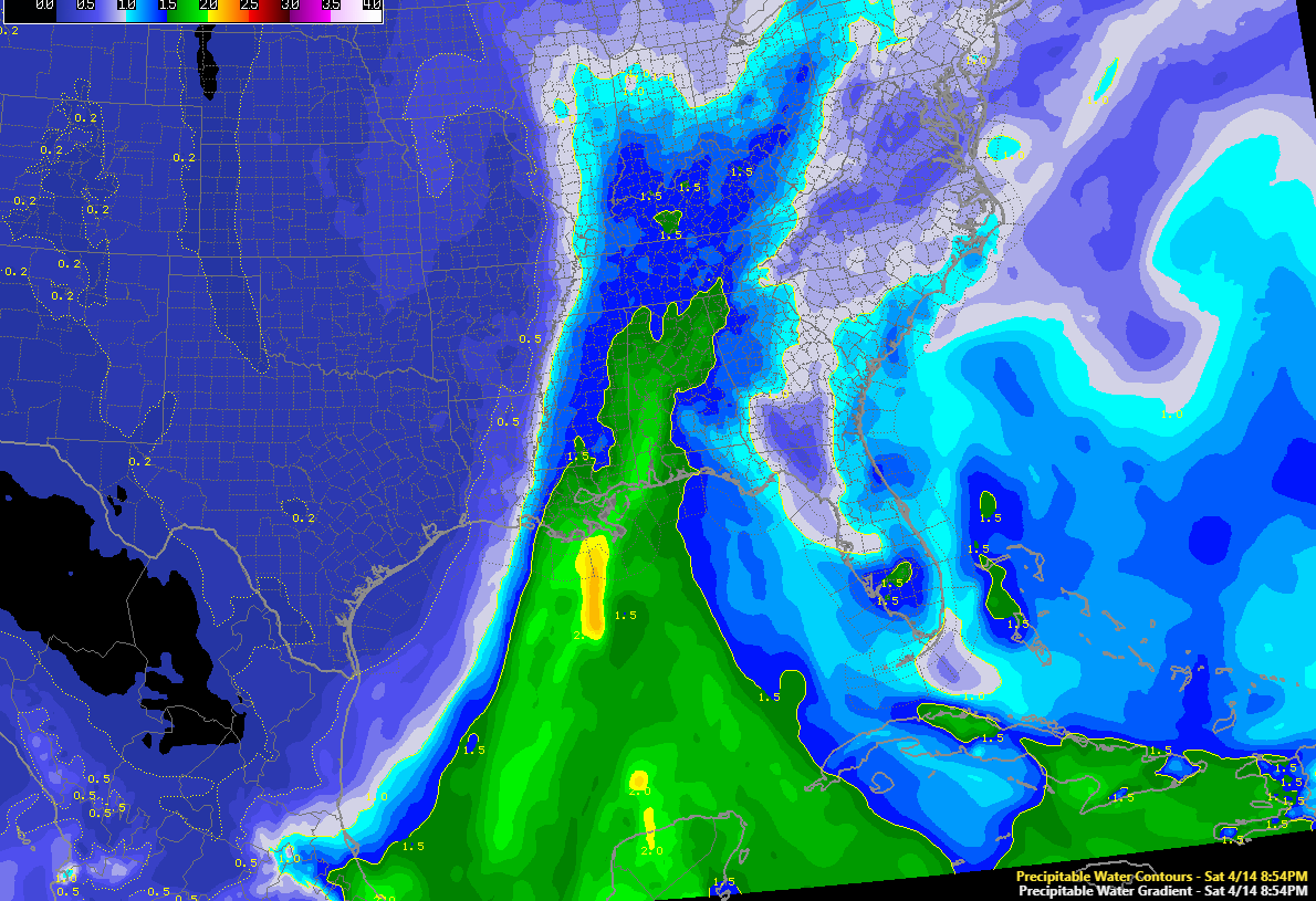
High precipitable water value showing lots of moisture over the Gulf Coast region including Alabama
Preciptable water values of 1.5 inches or greater have been transported up into the Nashville area by this feed, with 1.7 inch amounts up into West Central Alabama.
The result has of course been heavy rain.
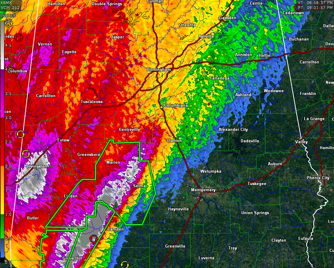
Storm total rainfall estimates off the
BMX Doppler Radar.
Widespread 2-4 inch amounts have fallen west of I-65, with a couple of swaths of 4-5 inch or great amounts over Southwest and West Central Alabama.
Three hour totals approaching 2 inches are in the fire hose of precipitation that current extends from south of Birmingham back to Mobile.
These trends are going to continue to shift slowly eastward over the next few hours, resulting in rainfall amounts that could cause flash flooding. The flash flood watch remains in effect until 1 a.m. and might have to be extended in tme and area eventually.
Flash flood warnings cover parts of Southwest and South Central Alabama and other may have to be issued up into the Birmingham area, where an areal flood advisory is already in effect.
A new flash flood warning was just posted for Dallas and Perry Counties, including Selma, where 6 inches of rain may fall.
The severe weather threat continues to the south, where a tornado watch remains in effect.
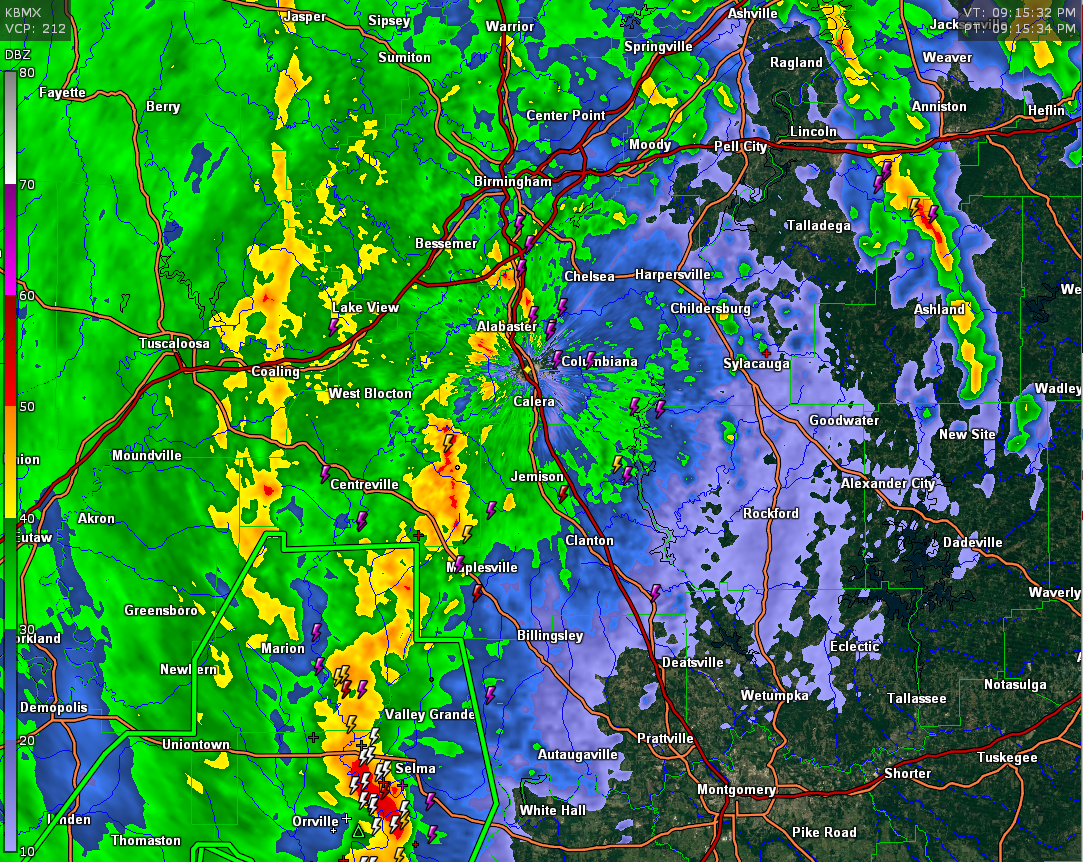
Current radar at 917 p.m.
There is 500-1,000 joules of elevated CAPE extending all the way to the Birmingham area, however, resulting in some occasional lightning and thunder. Nothing severe, just rolling thunder.
You can see the kicker that will eventually push the system eastward over the next several hours. It is approching Columbus MS south from the south-southwest. As it pushes north-northeast overnight, the line will slide eastward, putting an end to the rain and storms.
Category: Alabama's Weather, ALL POSTS
About the Author (Author Profile)
Bill Murray is the President of The Weather Factory. He is the site's official weather historian and a weekend forecaster. He also anchors the site's severe weather coverage. Bill Murray is the proud holder of National Weather Association Digital Seal #0001 @wxhistorianSubscribe
If you enjoyed this article, subscribe to receive more just like it.


