A Brief Check On Our Weather Situation At 8:30 AM
RADAR CHECK AT 8:15 AM
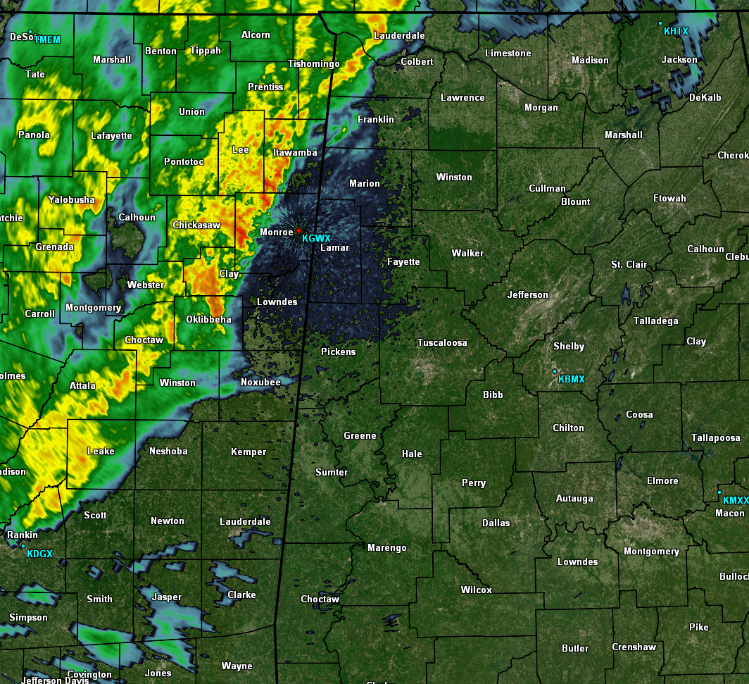
As you can see by the radar image above, not much progress eastward has been made by the line of showers and storms that stretches from north-central Lauderdale County in North Alabama down to the south-southwest through the eastern parts of Mississippi. Drier air over North/Central Alabama is continuing to win out at this time, holding the rain at bay. Eventually more moisture will be able to work into North/Central Alabama, but it will still be a while before that happens which will allow rain to spread over into the western parts of the area.

As you can see with the animated simulated radar from the HRRR model, rain will continue to move slowly into the area from the west. I believe that this run is actually overdoing the rainfall just a little bit in intensity, but I think the coverage is pretty close. If this model solution turns out to be correct, rainfall will not reach the Birmingham metropolitan area until 2:00-4:00 PM. Rainfall with be diminishing in coverage throughout the afternoon and evening hours, and just about everyone should be dry by the time we reach the late night hours.

In case you missed the update from this morning, the Storm Prediction Center shows that there is no longer a threat of organized severe storms throughout the lower 48 states, as the Marginal Risk has been removed from portions of North and West Alabama.
Category: Alabama's Weather, ALL POSTS
About the Author (Author Profile)
Scott Martin is an operational meteorologist, professional graphic artist, musician, husband, and father. Not only is Scott a member of the National Weather Association, but he is also the Central Alabama Chapter of the NWA president. Scott is also the co-founder of Racecast Weather, which provides forecasts for many racing series across the USA. He also supplies forecasts for the BassMaster Elite Series events including the BassMaster Classic.Subscribe
If you enjoyed this article, subscribe to receive more just like it.


