

Friday Midday Update: Waiting on Rain and Storms
A CASE OF THE MUGGIES: Very moist air remains in place, and we are watching the radar at midday waiting on those showers and storms to develop.
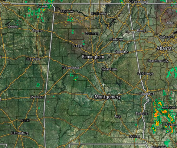
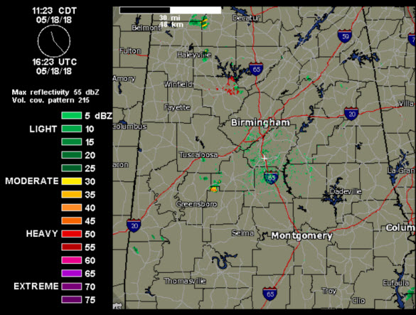
At just before noon, just a few showers were ongoing on the radar in North/Central Alabama, but we do see quite a bit of activity well off to our south across portions of the Wiregrass and Southwest Georgia.
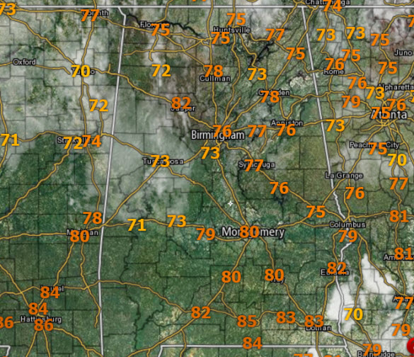
At midday, we are seeing a sky generally with more clouds than sun, but there is still enough sun making it through and temperatures have climbed into the upper 70s and lower 80s, and by the end of the day, we should all be in the lower to upper 80s.
For the rest of the afternoon and evening, we will continue to watch the radar for our latest round of showers and storms. Storms today, like every other day this week, will be random in placement, producing gusty winds, loads of lightning, small hail, and tropical downpours. Heading into the overnight hours, the rain will gradually decrease in coverage and intensity, and lows will settle down into the upper 60s.
WEEKEND WEATHER: For both Saturday and Sunday, the sun will be out at times, and highs will be in the 80s for most locations. Rain chances come down some, but we will still have the risk of showers and storms on a daily basis. The rain won’t be continuous, and we won’t have an all day “wash out”. Like we see each day, the greatest coverage of showers and storms will come during the afternoon and evening hours, generally between 1PM and 11PM, when instability is the highest. With such a moist airmass in place, we can’t totally rule out a late night or morning shower.
Within this air mass, the thunderstorms that form will tend to be rather random and scattered and there is no way of knowing exactly when and where they will develop. Organized severe thunderstorm activity is not expected, but a few “pulse” type severe storms are possible. The main threat from these will come from gusty straight line winds. Also, intense tropical downpours are expected with any storm, and these can produce tremendous amounts of rain over a short period of time and can produce isolated flash flooding. Always remember to TURN AROUND, DON’T DROWN, if you encounter flood waters. In additions, tremendous amounts of lightning are produced by these storms; if you can hear thunder you can be struck by lightning, so WHEN THUNDER ROARS, HEAD INDOORS.
IT’S TEE TIME AT GREYSTONE!: The Regions Tradition is ongoing through Sunday at the beautiful Greystone Golf & Country Club! Make plans to attend one of the majors of the PGA Champions Tour! You can see legendary golfers Bernhard Langer, John Daly, Vijay Singh, and more tee it off with Nick Saban, Gus Malzahn, Bo Jackson, and other celebrities in the NCR Pro-AM. Juniors 18 & under are admitted free with a ticketed adult, and five-day grounds tickets are $80. Single day grounds tickets are $20. GET YOUR TICKETS HERE!!! The sky will be cloudy at times, and there will be some risk of rain on a daily basis through the event at Greystone. So, take the rain gear, but on the positive side we don’t expect severe storms, there will be some nice breaks in the rain, and the sun should pop out at times. Daily highs will be in the 80-84 degree range.
SEC BASEBALL TOURNAMENT: The 2018 SEC Baseball Tournament takes place on May 22-27 at the Hoover Met. Don’t miss some of the best baseball in the country as the top-12 teams will battle it out in Hoover on the road to Omaha. Join us for the indoor FanFest which is free to the public, open each day of the tournament and fun for all ages. Single-session tickets are $18 each for adults and $9 each for kids 3-12. Bleacher seats are first-come, first-served in the General Admission sections. GET YOUR TICKETS HERE!!!
THE ALABAMAWX BEACH FORECAST CENTER: The weather will be somewhat unsettled with cloudy periods and the risk of a few passing showers or storms. But again, the rain won’t be continuous and there will be some sun. Highs in the 80s. Click here to see the AlabamaWx Beach Forecast Center page.
WORLD TEMPERATURE EXTREMES: Over the last 24 ours, the highest observation outside the U.S. was 117.3F at Chandrapur, India. The lowest observation was -98.7F at Concordia, Antarctica.
CONTIGUOUS TEMPERATURE EXTREMES: The highest observation was 110F at Rio Grande Village, TX. The lowest observation was 17F at Estcourt Station, ME.
WEATHER ON THIS DATE IN 1980: Mount Saint Helens (in Washington State) erupted spewing ash and smoke sixty-three thousand feet into the air. Heavy ash covered the ground to the immediate northwest, and small particles were carried to the Atlantic coast.
Category: Alabama's Weather, ALL POSTS
About the Author (Author Profile)
Macon, Georgia Television Chief Meteorologist, Birmingham native, and long time Contributor on AlabamaWX. Stormchaser. I did not choose Weather, it chose Me. College Football Fanatic. @Ryan_StinnetSubscribe
If you enjoyed this article, subscribe to receive more just like it.


