7:45 Update: Potentially Serious Flooding Situation Developing Across Greene, Hale, Perry, Southern Bibb, and Chilton Counties.
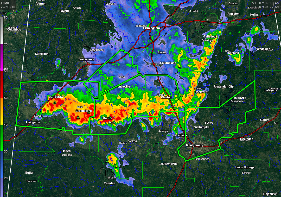
Strong thunderstorms producing intense rainfall continue at this hour across Greene, Hale, southern Chilton and Coosa Counties.
GOES satellite imagery indicates very cold cloud tops depicting the most intense convection in this area.
Flash flood warnings continue for parts of Sumter, Greene, southern Tuscaloosa, Bibb, Parry and Chilton Counties. There are shown in green here with the current radar. The warning for Montgomery, Elmore and Tallapoosa was just replaced with a new flash flood warning that will go until 1:45 p.m. Storms will move back into those counties that experienced flooding last night.
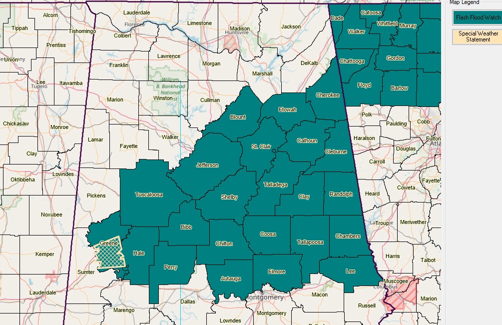
A flash flood watch has been issued for parts of Central Alabama as well.
Doppler radar estimates indicate 4-5 inches of rain has fallen across a wide area of Central Alabama over the past couple of days, shown here in white and gray.
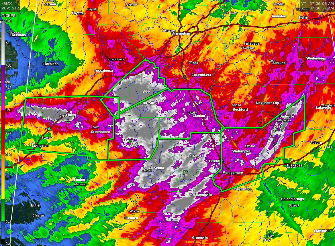
These estimates might be 0.5-1 inch under actual rainfall amounts given the tropical nature of the moisture, but it has been substantial.
One hour rainfall amounts have exceeded 2.5 inches in Perry County near Marion. That is intense rainfall.
Category: ALL POSTS
About the Author (Author Profile)
Bill Murray is the President of The Weather Factory. He is the site's official weather historian and a weekend forecaster. He also anchors the site's severe weather coverage. Bill Murray is the proud holder of National Weather Association Digital Seal #0001 @wxhistorianSubscribe
If you enjoyed this article, subscribe to receive more just like it.


