Still Rather Comfortable At Midday; Temperatures & Humidity Levels Begin To Rise Tomorrow
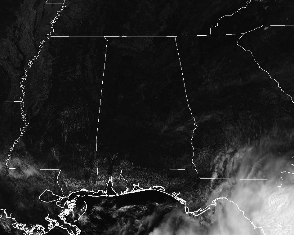
Conditions Across Central Alabama At 11:00 AM
Not that many clouds at all across the southeast at this point on this fabulous Wednesday, with the only clouds associated with a stalled boundary just off the Gulf Coast and draping over the northern Florida peninsula. Temperatures across the area are running from the upper 70s in the north to the mid-80s in the south. Birmingham is currently at 82 degrees, while Tuscaloosa is the warm spot at 84 degrees. With dewpoints in the upper 50s to the lower 60s throughout the area, that is making it feel pretty comfortable, especially for an early June day in Central Alabama.
Weather For The Rest Of Your Wednesday
We will continue to have a “Code Orange” air quality alert for Jefferson and Shelby counties throughout the remainder of the afternoon and into the early evening hours due to ground level ozone. Humidity levels continue to stay rather low for this time of the year, making today continue to be comfortable. Skies will be mostly sunny with afternoon highs in the upper 80s to the lower 90s. Unfortunately our night will not be a cool and comfortable as it was last night, but it is still not that bad. We’ll drop down into the lower to mid-60 for much of the area, with a few upper 60s in the southeastern parts of the area.
The Muggies Start To Make A Comeback On Thursday
While we will continue to stay dry across Central Alabama on Thursday, the humidity levels start to increase as high pressure moves well off to our northeast and allows for Gulf moisture to be pulled up into the southeast. Skies will be mostly clear throughout the day and afternoon highs will be in the lower to mid 90s. Dewpoints will be in the lower 60s so the heat index values will only be 1-2 degrees above the actual temperature. Winds will not help make it feel cooler as they will be out of the south at around 3-6 MPH. Skies will be mainly clear throughout the late night and overnight hours and lows will be in the mid-60s to the lower 70s.
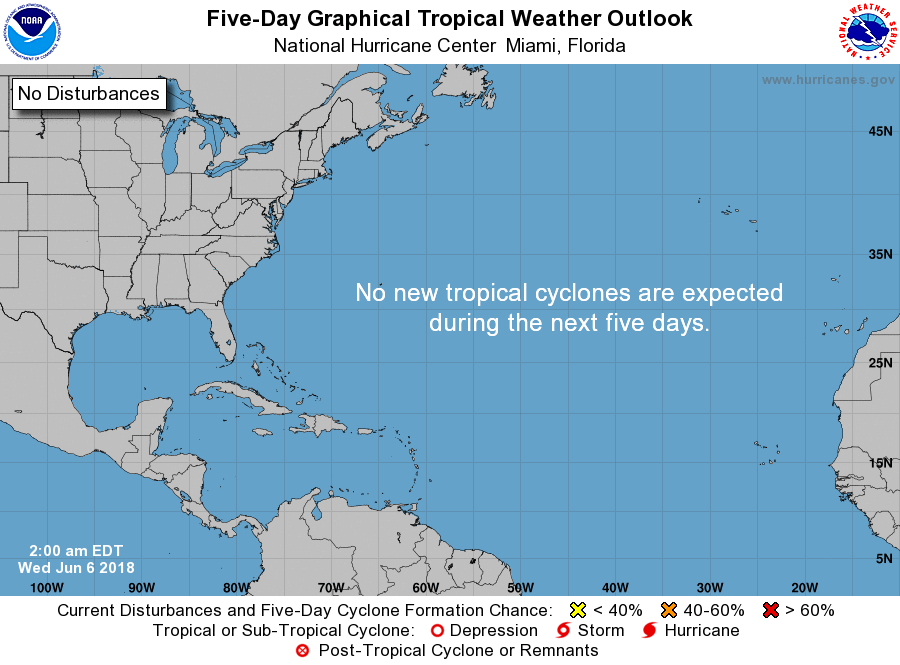
An Update On The Tropics
While the Atlantic basin is quiet at this point with no tropical cyclone development expected over the next 5 days, the eastern Pacific has its first tropical storm of their season. Tropical Storm Aletta is expected to become a hurricane tomorrow night, but it will be a fish storm and stay well enough away from land.
Just taking a look at the models, the latest run of the GFS has a tropical low forming over the northern Caribbean Sea on Wednesday of next week and it moves northward into the Gulf of Mexico while strengthening. It has landfall occurring late on Thursday evening or into the very early morning hours on Friday at 973 mb, which would make it a low-grade hurricane. Comparing this to the European and Canadian models which shows nothing in the Gulf at this point. This is not an official forecast, just telling you what is being shown at this point.
Beach Forecast Center
Get the latest weather and rip current forecasts for the beaches from Fort Morgan to Panama City on our Beach Forecast Center page. There, you can select the forecast of the region that you are interested in.
WeatherBrains
Don’t forget you can listen to our weekly 90 minute netcast anytime on the web at WeatherBrains.com or on iTunes. This is the show all about weather featuring many familiar voices, including the meteorologists at ABC 33/40.
E-Forecast
Get the AlabamaWx Weather Blog’s Seven-Day Forecast delivered directly to your inbox by email twice daily. It is the most detailed weather forecast available in Central Alabama. Subscribe here… It’s free!
We’re Having A Record-Breaking Year So Far! Advertise With Us Today!
Don’t miss out! We have enjoyed over 10.4 MILLION page views on AlabamaWx.com since the start of 2018. We can customize a creative, flexible and affordable package that will suit your organization’s needs. Contact Bill Murray at (205) 687-0782.
On This Day In Weather History
1989 – Thunderstorms developing during the late morning hours produced severe weather through the afternoon and night. Thunderstorms spawned 13 tornadoes, and there were 154 reports of large hail and damaging winds. A strong (F-3) tornado injured six persons at Lorenzo, TX, and thunderstorm winds gusting to 100 mph killed one person at Glasscock City, TX. Softball size hail was reported at Lipscomb and Glen Cove TX.
Category: ALL POSTS
About the Author (Author Profile)
Scott Martin is an operational meteorologist, professional graphic artist, musician, husband, and father. Not only is Scott a member of the National Weather Association, but he is also the Central Alabama Chapter of the NWA president. Scott is also the co-founder of Racecast Weather, which provides forecasts for many racing series across the USA. He also supplies forecasts for the BassMaster Elite Series events including the BassMaster Classic.Subscribe
If you enjoyed this article, subscribe to receive more just like it.


