

Big Storms Moving Across West & Southwestern Parts Of Central Alabama
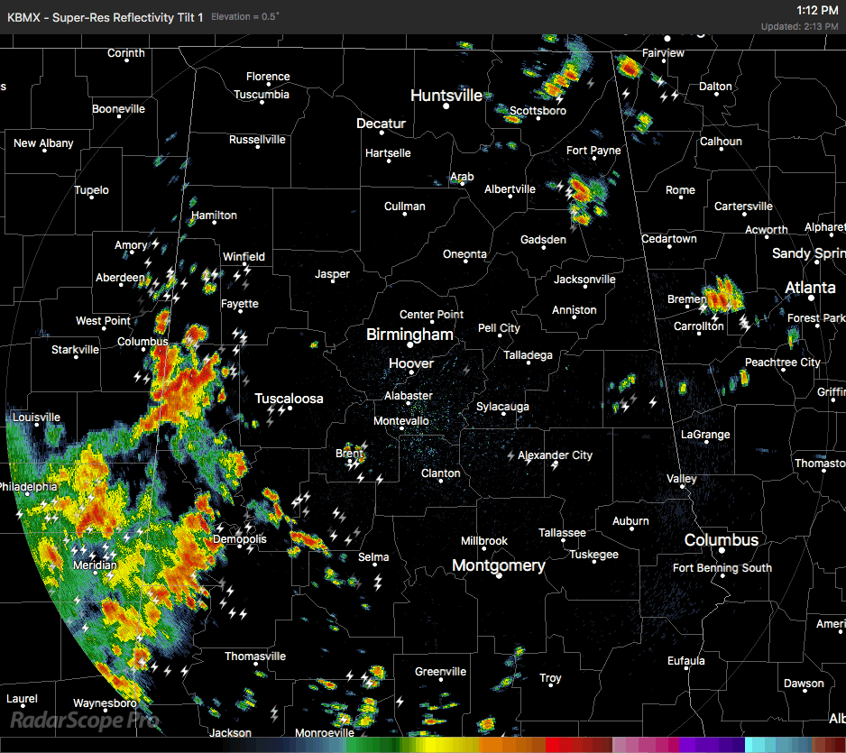
We have plenty of stronger storms moving eastward across the west and southwestern parts of Central Alabama as we approach 2:30 PM on this warm and muggy Monday afternoon. Several Significant Weather Advisories have been issued for storms over portions of Tuscaloosa, Pickens, Fayette and Lamar counties, along with parts of Perry County, and parts of Bibb County.
Gusty winds up to 40 MPH and some small hail could be possible with these storms, along with heavy rain and dangerous cloud-to-ground lightning. There is also the possibility of some localized flooding issues in the poor drainage areas with these storms.
All of the shower and storm activity is moving to the east around 20 MPH, which is slightly better than what we were seeing last night when storms were either holding station or moving less than 10 MPH.
Another strong storm is located over parts of Autauga, Lowndes, and Dallas counties that just had a Significant Weather Advisory put on it as well.
If you are in the path of any of these storms, please move indoors immediately as soon as you hear thunder. If you can hear thunder, you are close enough to the parent storm to be struck by lightning.
I’ll continue to have updates through the afternoon and evening.
Category: ALL POSTS
About the Author (Author Profile)
Scott Martin is an operational meteorologist, professional graphic artist, musician, husband, and father. Not only is Scott a member of the National Weather Association, but he is also the Central Alabama Chapter of the NWA president. Scott is also the co-founder of Racecast Weather, which provides forecasts for many racing series across the USA. He also supplies forecasts for the BassMaster Elite Series events including the BassMaster Classic.Subscribe
If you enjoyed this article, subscribe to receive more just like it.


