Stronger Storms Over Northeast Alabama
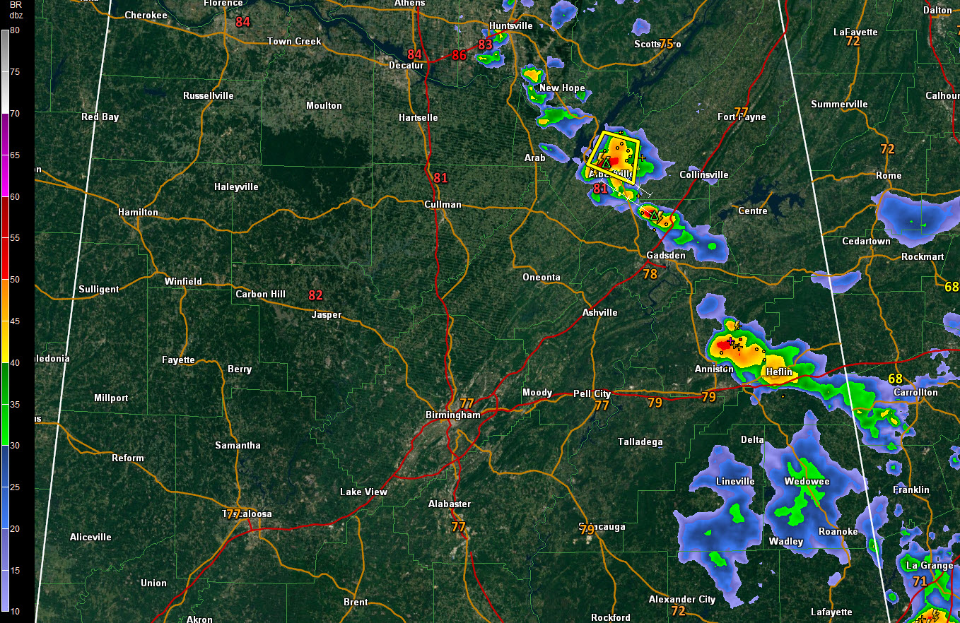
Storms have intensified this afternoon over northeastern Alabama on the western edge of a trough and weak surface low over northern Georgia. Showers and storms a lined up in an arc from Madison County in the Tennessee Valley through Marshall, Etowah, Calhoun and Cleburne Counties along a southwestward moving boundary.
A severe thunderstorm warning remains in effect until 715 p.m. for parts of Marshall County. Hail is likely with the storm and damaging wind gusts could reach 60 mph in addition to heavy rain and lightning. A new significant weather advisory has just been issued for southeastern Marshall County ahead of this storm.
Heavy storms are in the Jacksonville and Heflin areas of Calhoun and Cleburne counties. The NWS in Birmingham has just issued an areal flood advisory for parts of Calhoun and Cleburne counties. It goes until 9 p.m.
Weakening showers remain over Clay, Randolph, Tallapoosa, and Chambers counties. They are part of an eastward moving complex of storms that traversed the state earlier today.
The rest of Central Alabama is free of showers at this hour.
The storms over eastern Alabama should diminish over the next couple of hours, setting the stage for a quiet night across the central part of the state.
Category: Alabama's Weather, ALL POSTS
About the Author (Author Profile)
Bill Murray is the President of The Weather Factory. He is the site's official weather historian and a weekend forecaster. He also anchors the site's severe weather coverage. Bill Murray is the proud holder of National Weather Association Digital Seal #0001 @wxhistorianSubscribe
If you enjoyed this article, subscribe to receive more just like it.


