

Widespread Showers and Storms Over East Central, South Central Alabama
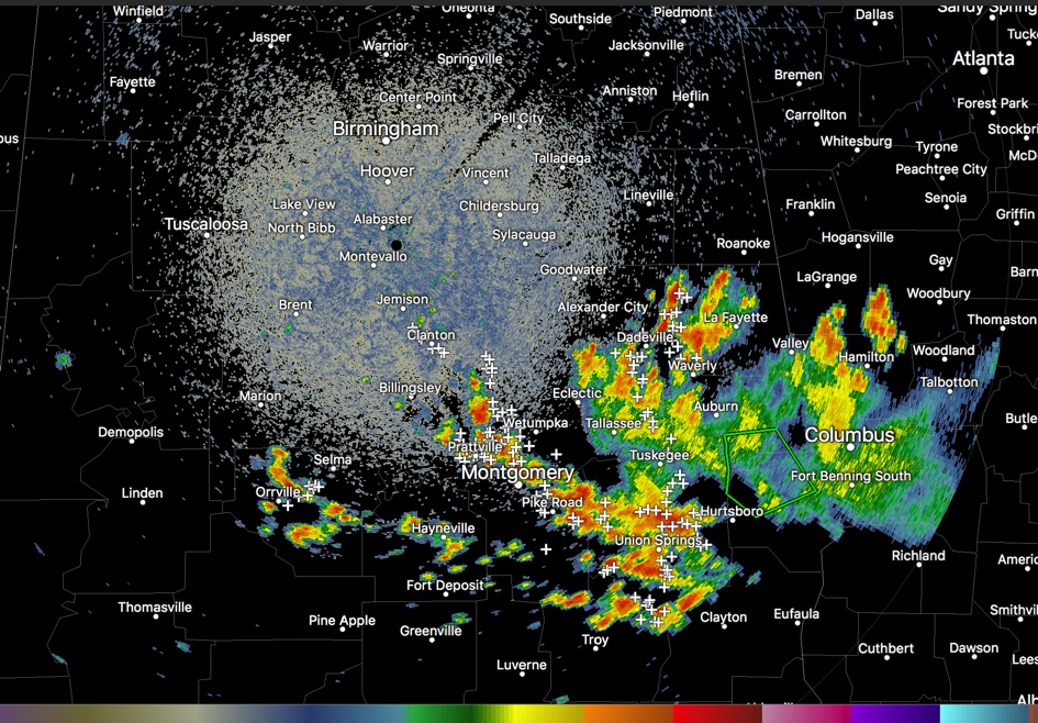
Widespread showers and storms continue early this afternoon across South Central and East Central Alabama in a low-level convergence zone on the southwest flank of an upper level low over northern Georgia.
They are extensive from north of Montgomery on I-65 through the capital city to Union Springs in Bullock County. Another arc curves back to south of Selma.
Additional showers and storms are over East Central Alabama from the Auburn area back up to Alex City and Wadley.
A slight cyclonic drift is noted in the activity, rotating from northwest to southeast around the upper low’s periphery.
Lots of lightning and heavy rain with the stronger cells.
A flash flood warning continues until 1:30 p.m. CDT for parts of Lee and Russell Counties.
Scattered storms will develop across the rest of Central and North Alabama during the afternoon, but I think the main concentration will remain over South Central Alabama.
Category: Alabama's Weather, ALL POSTS
About the Author (Author Profile)
Bill Murray is the President of The Weather Factory. He is the site's official weather historian and a weekend forecaster. He also anchors the site's severe weather coverage. Bill Murray is the proud holder of National Weather Association Digital Seal #0001 @wxhistorianSubscribe
If you enjoyed this article, subscribe to receive more just like it.


