Isolated Storms Today/Wednesday But More Numerous Thursday
* * * No Weather Xtreme Video this morning due to safety fair at Mercedes in Vance * * *
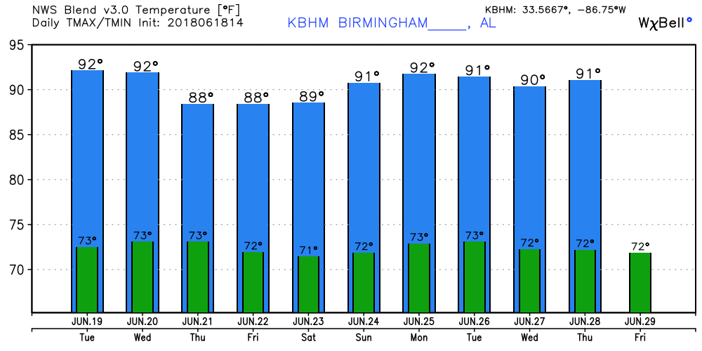
Much of the eastern half of Alabama is clear this morning, but some clouds from the disturbance on the Texas coast near Corpus Christi area affecting the western half of the state. Surface high pressure remained in place this morning with slightly drier air in place today and Wednesday, so it appears likely showers will be limited again today and Wednesday much like we saw on Monday. Highs should be in the lower half of the 90s.
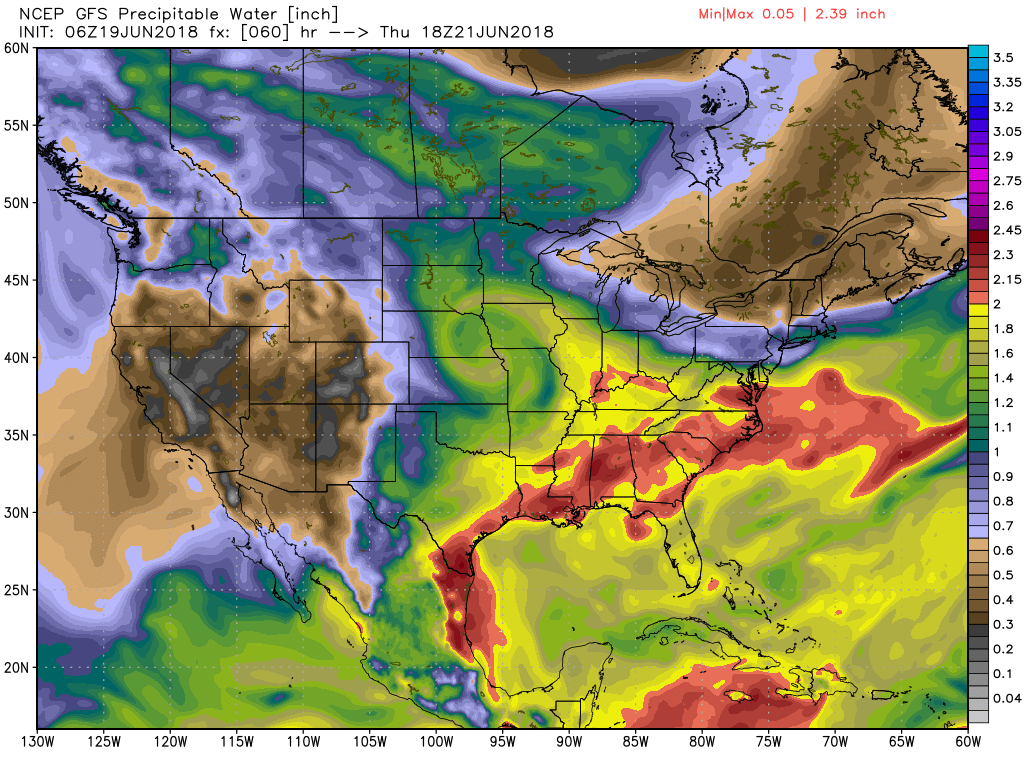
The upper ridge currently in place across the Southeast US will be weakened by the approach of a fairly strong closed low coming out of the northern Rockies late Wednesday and Thursday. The closed low marches across the Middle Mississippi River Valley on Friday before weakening as it moves northeastward on Saturday into the eastern Great Lakes Area. At the surface, a low pressure system will move beneath the upper low into the eastern Great Lakes by late Saturday. This system will bring a cold front down into the northern portion of the Southeast on Thursday and Friday. With precipitable water values surging higher late Wednesday and into Thursday (see chart), showers and thunderstorms should become numerous once again for Thursday and lingering into Friday due to the presence of the front. There is a small risk that a few storms could produce severe weather primarily in the form of damaging wind as instability values surge on Thursday and Friday.
Thanks to the additional clouds from the disturbance on the Texas coast and the presence of more storms, our highs from Wednesday through Friday should be held down a bit with highs mainly in the upper half of the 80s. We probably won’t notice the slight heat reduction due to the high humidity levels.
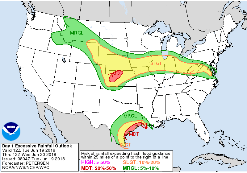
The Atlantic tropical basin is quiet with the exception of the area of disturbed weather on the Texas coast in the vicinity of Corpus Christi. This area will see lots of rain over the next several days with amounts over the next five days in the range of 7 to 10 inches. There is a slight risk for additional heavy rains along the frontal system stretching from Nebraska to the Mid-Atlantic states for today.
From Sunday into the middle of next week, the upper flow pattern goes pretty close to zonal, so the surface front will remain stalled just north of us through Tuesday. While much of Alabama will see a return to daily heat-driven showers and storms, areas closer to the weak frontal boundary may see more numerous storms. Highs over the weekend and into next week should be in the range of 89 to 92.
Looking into voodoo country, week 2 begins with weak troughiness over the eastern half of the US, but the GFS builds a substantial ridge into the eastern US by the first of July. So it’s looking pretty warm as we head into July.
BEACH FORECAST: No affects from the Gulf system or Bud on the beautfiul beaches of Alabama and Northwest Florida. Click here to see the AlabamaWx Beach Forecast Center page.
WEATHERBRAINS: Don’t forget you can listen to our weekly 90 minute netcast anytime on the web, or on iTunes. This is the show all about weather featuring many familiar voices, including our meteorologists here at ABC 33/40.
The Weather Xtreme Video will be on a one-a-day schedule this week as James takes a well earned vacation. I committed to working with the folks at Mercedes Benz plant in Vance for a two-day safety fair, yesterday and today, so the Weather Xtreme Video should return Wednesday. Enjoy the day. Godspeed.
-Brian-
.
Category: Alabama's Weather, ALL POSTS
About the Author (Author Profile)
Brian Peters is one of the television meteorologists at ABC3340 in Birmingham and a retired NWS Warning Coordination Meteorologist. He handles the weekend Weather Xtreme Videos and forecast discussion and is the Webmaster for the popular WeatherBrains podcast.Subscribe
If you enjoyed this article, subscribe to receive more just like it.


