

Strong Storms Continue To Press Eastward Across North Alabama
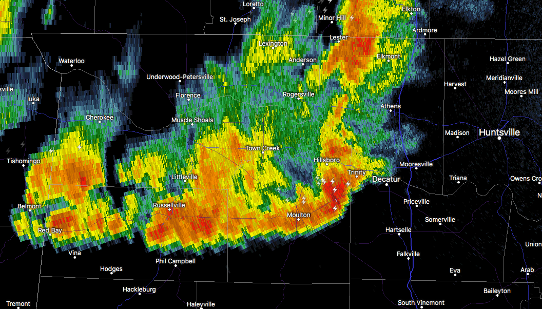
A cluster of strong storms continue to march east-southeastward across North Alabama as we have reached 9:15 PM. The good news is that there are no warnings in effect for any North Alabama counties, but a strong storm with gusty winds is currently affecting Lawrence and Limestone counties and is in the process of entering northwestern Morgan County as I type.
Strong, gusty winds, very heavy rainfall, and dangerous cloud-to-ground lightning can be expected with this storms as it begins to approach Decatur, Priceville, Hartselle, Falkville, and Somerville. This storm previously had a severe thunderstorm warning on it with a decent amount of mid-level rotation on it about an hour ago, but is has weakened since then.
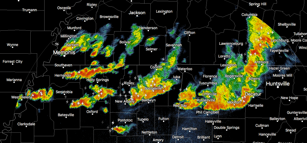
There are more strong thunderstorms back to the west over the northern parts of Mississippi, and these will eventually move into North and Central Alabama later tonight and into the overnight hours. While severe storms are not expected as the boundary layer has cooled from the daytime heating, some of these could still pack gusty winds up to 30-40 MPH, heavy rain, and dangerous cloud-to-ground lightning.
These storms should make it into the Birmingham Metropolitan Area and along the I-20 corridor around the 2:00-3:00 AM time frame, and eventually diminishing by the 7:00-8:00 AM time frame on Saturday morning.
We’ll keep you posted throughout the night if needed. Stay tuned.
Category: Alabama's Weather, ALL POSTS
About the Author (Author Profile)
Scott Martin is an operational meteorologist, professional graphic artist, musician, husband, and father. Not only is Scott a member of the National Weather Association, but he is also the Central Alabama Chapter of the NWA president. Scott is also the co-founder of Racecast Weather, which provides forecasts for many racing series across the USA. He also supplies forecasts for the BassMaster Elite Series events including the BassMaster Classic.Subscribe
If you enjoyed this article, subscribe to receive more just like it.


